SoCal and Arizona
Business/Biking Trip
Saturday, Feb 21, 2004 through Monday, Mar 1, 2004
Trip Highlights
- 13 rides throughout
SoCal and Arizona
- 300.5 miles
- 25.4 hours riding time
- 25,000+ feet climbing
- 12 distinct riding
locations: 8 trail, 4 road
- 1 night-time ride with
lights
- 4 rides encountered
snow or sleet
- Highest elevation:
8,585 feet at Mt Hopkins summit in AZ
- Biggest net gain
climb: 5,515 feet on Mt Hopkins
- Highest winds
encountered: >75 mph? on Kitt
Peak
- Wildlife
sightings: Coyotes after sundown
and without lights, very fresh bear tracks in the snow
- Pre-shipped Dean
Colonel racing mountain bike via FedEx ground to Helens Cycles in Santa Monica, CA
Saturday, 2/21/04 “The Strand”
bike path in Santa Monica, CA
36.0
miles estimated
2:00
hours
Minimal
elevation change
Flight
got in late. Picked bike up at Helens,
then headed to Santa Monica Pier to pick up rental tandem so I could show Cathy
the LA area coastline and the famous Venice
Beach. It was cold, dank and rainy, and the tandem
cruiser was a real piece of work.
Handlebars didn’t point straight when wheel was straight, captain and
stoker pedals weren’t lined up so pedals would hit rounding corners, and the
seven total speeds shifted spontaneously.
Plus, the proprietor of the rental shop would only stubbornly commit to
staying open long enough for us to return the bike. He wanted to close early because the rain
made business slow. Anyway, we got a
good ride in. Not much happening on the
beach in 50 degree rain, but there’s always curious looking people hanging out
at Venice Beach.
The bad weather did make for clear cruising on a normally crowded
boardwalk though, which was a bonus.
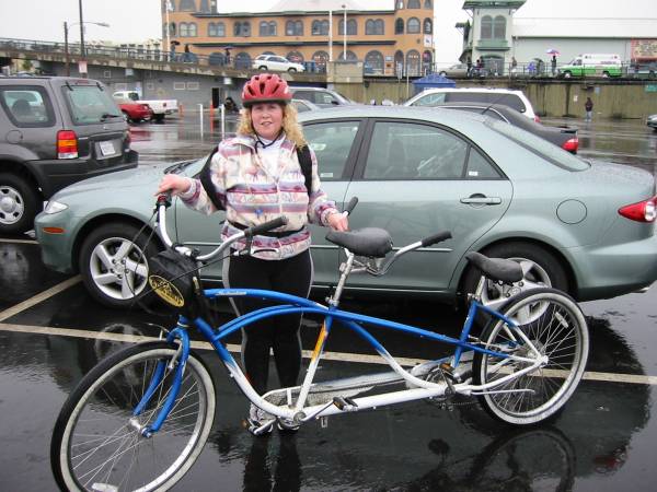
Cathy with
Schwinn cruiser. Note pedal
(mis)alignment.
Sunday, 2/22/04 Mt Wilson “Toll Road,” Pasadena, CA
24.5
miles
3:05
hours
4700
feet net gain, >5000 feet total climbing
Did this same climb last February in much nicer
weather. Cathy hiked while I biked. Saw two guys starting the ride up while we
were figuring out where to legally park.
They got at least 30 minute head start, a nice incentive to see if I
could catch them. Anyway, this dirt road
(was a toll road in early 1900’s) gains about 4700 feet in 9 miles, making it a
similar climb to Mt Washington
in NH. Only deal was, it was a rainy day. That was why we were here and not in the
soupy clay singletrack trails of the Santa
Monica mountains.
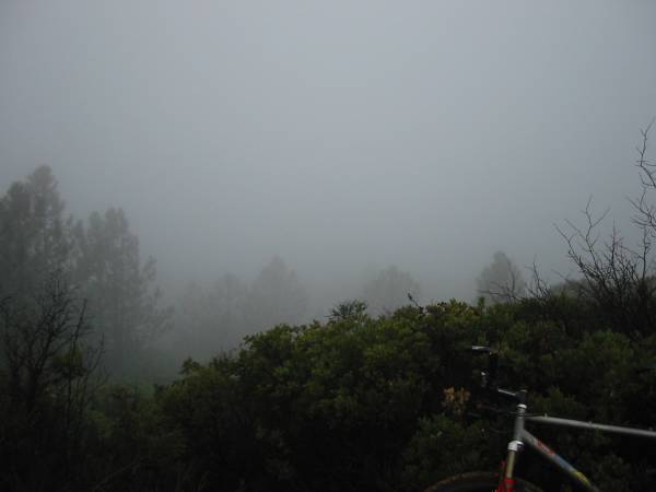
The Mt Wilson Toll Road
doesn’t get too soft in rain. The climb
started dry, but about half way up I encountered heavy rain. Started seeing snow around 4500-5000
feet. At about 5000 feet, I caught the
two guys I saw heading up earlier. Turns
out one was from France, the other from Belgium, but they both currently
reside in LA. The Belgian was tough,
picking up the pace with me on his wheel, totally dropping his buddy. From about 5000 feet to the summit at 5700
feet, we had to ride in truck tracks as the snow approached 12 inches in
depth. Very hard to do on 10-12% grade. Temps were near freezing, and the wind was
blowing a nasty sleet into my eyes. I
didn’t wear my booties, so my feet froze.
I knew it would be cold up there, so I put on my balaclava, second
thermal jersey, and a wind-proof shell I carried up. The Belgian guy did about the same, except he
was in knickers, I was in AmFibs. The
other two were going back down the same way, I chose to go down a different
way, which was also different from the way I went down last year. I took the Mt Lowe Rail Path down the nasty
weather elevations, then picked up awesome Echo Mtn and Sam Merrill singletrack
trails the rest of the way down where it was drier. These few miles of singletrack turned out to
be the bulk of singletrack riding I did this SoCal trip. Cathy hiked a couple miles up the very steep
toll road to a nice vantage point over the LA basin before going down. She also caught a period of heavy rain on the
way down.
Truck
tracks near summit. Deep ruts in places
meant your front wheel was always
sliding
out or your pedals were bashing into snow or rocks. Not what you expect in Pasadena.
Belgian rider
adding more layers.
Summit of Mt
Wilson 5000 feet above Pasadena, CA.
Soaking wet,
sleeting, in the clouds, foot of snow on the ground.
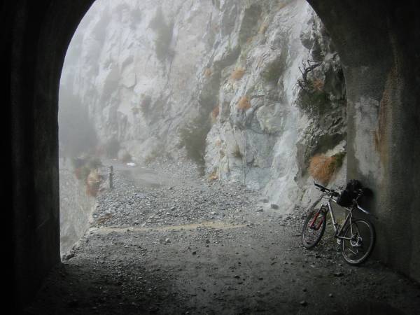
Only dry spot on
this trail was inside this rail tunnel around 5000 feet.
Camera did not
capture well the water pouring down the rocks.
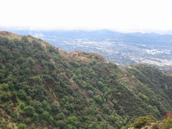
Out from under
the rain, the singletrack zigzagging down the mountain side can be seen.
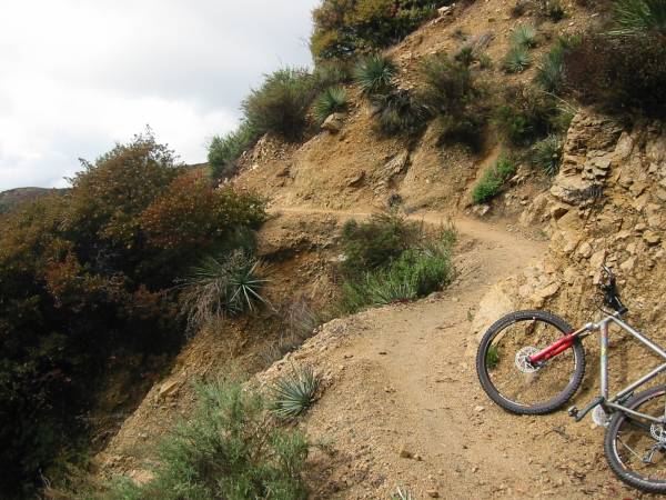
Very fine
singletrack here. Several miles of
cliff-hanging stuff like this.
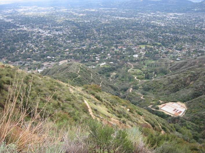
The
Sam Merrill
Trail meandered all over as it worked
it’s way down to Pasadena.
The
trail was surprisingly dry despite the periodic downpours. Soil here is like baseball diamond sand.
Some
more of SoCal hardpack singletrack. It’s
amazing how the climate can change in just a few thousand feet of elevation
difference.
Monday, 2/23/04 San Diego Zoo
Can’t visit San
Diego without visiting the world famous zoo. It rained off and on throughout the morning,
but temps were mild and sun poked through some.
No biggie. Been a while since we
visited a zoo, and we were both thoroughly impressed. In the four hours we spent there, we covered
probably 75% of the main exhibits.
Although the Panda exhibit probably draws the most attention, I liked
the Gorilla and Polar Bear exhibits the best.
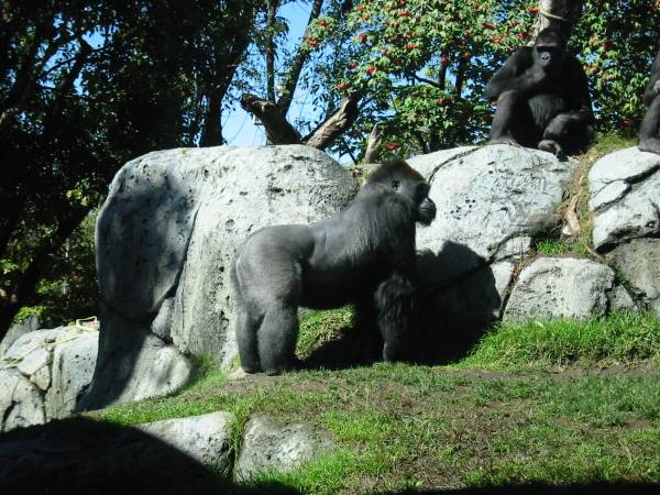
Gorillas. The male in foreground was very fast and
dominant and HUGE.
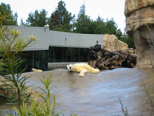
Polar
Bears. I was kind of in an area not for
tourists taking pictures, so this guy came over to sniff my scent.
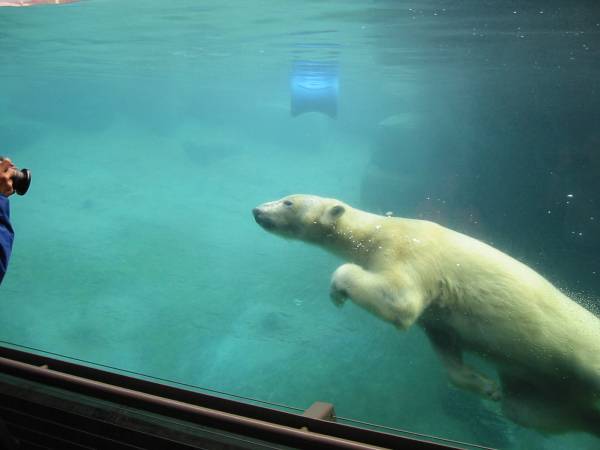
This guy (or
gal?) spent most of his time under water showing off to the visitors against
the glass.
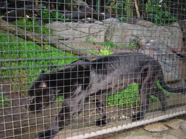
Black
Panther. Would not want to run into one
of these in the wild. Pure muscle and
huge feet.
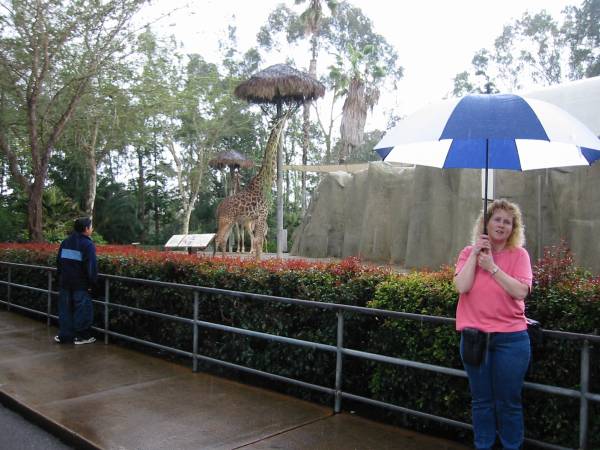
Cathy at the
Giraffe exhibit.
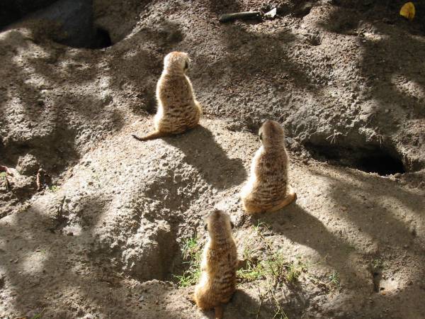
Meerkats. If you work at BAE Systems, you know about
these critters. A lot smaller than I
thought they’d be.
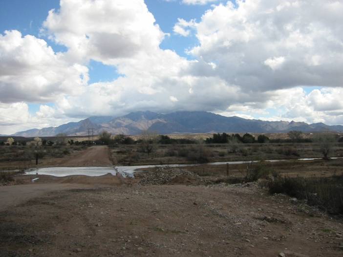
Monday Afternoon, 2/23/04 Black Mountain,
Ramona, CA
29.0
miles
2:56
hours
3020
ft vertical gain, 4010 ft summit, 4800 ft total climbing
This all fire road ride is about 45 minutes north of San Diego. Was warm and sunny in San Diego during the afternoon, but cold and
rainy here in the mountains. Parked at
the ranger station in Ramona. Began a
modest climb up Black Canyon Rd
to the saddle, then big descent into the Santa Ysabel Canyon. After crossing the Santa Ysabel Creek, modest
climbing again begins on Upper Santa Ysabel Truck Trail. Very nice view of the canyon along the way,
and no rain at this point. However, the
summit of Black Mountain was shrouded in a heavy black
cloud. Eventually Black Mountain Truck
Trail is reached which switchbacks around for several miles at a persistent
steep grade to the summit. The surface
got sloppier and sloppier the higher I got.
Eventually, I resorted to pushing my bike up sections. Granny gear did not work, and even middle
ring started chain sucking. About the
time I reach the top, it started to sleet.
I rode in heavy sleet or rain for much of the way down on slick as snot,
3” deep chili mix goo. The descent was
nearly monotonic 3000+ feet of vertical at a much steeper average pitch than
the climb, as a different route was taken back to the car. There was still one more 680 foot paved climb
hurdle to get back to the car. Nasty
steep, and both granny and middle rings did nothing but suck up the chain. Had to big-ring it out of the saddle the
whole way. At least 10% grade – my legs
were screaming.
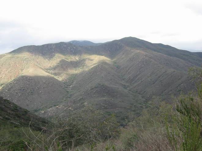
Summit
of Black Mountain in clouds. Santa Ysabel Truck Trail can be seen near
base of mountain in canyon.
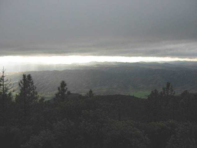
View from
summit. Hard to believe just a few
thousand feet down it was sunny.
On descent, just
below cloud line.
Tuesday, 2/24/04 Silver Strand Bike Path, Coronado, CA
24.0
miles
1:27
hours
After the meetings and taking Cathy out for dinner at
Miguel’s for some great Mexican food, I jumped on the bike with lights for a
late evening ride on the paved path that runs the length of the Coronado
peninsula, about 11 miles long. Went at
a steady moderate pace. Nice view across
the bay of lit up downtown San Diego. Cathy walked this path during the day to the
touristy area of Coronado
and back for 10+ miles of hiking.
Beautiful day and evening.
Wednesday ride #1, 2/25/04 Silver Strand Bike Path, Coronado, CA
22.1 miles
1:11
hours
Mid day I got in a quick lunch ride in between
presentations. Got to see all the things
I missed riding the night before on the Silver Strand bike path. Cathy hung out around the beach and enjoyed
another perfect day.
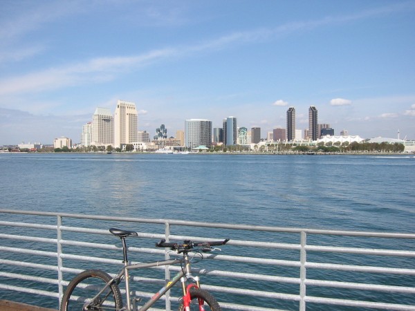
View of downtown San
Diego from Coronado.
Wednesday ride #2, 2/25/04 Mission Trails Recreation Area, San Diego, CA
9.3 miles
1:05
hours
Appox.
2000 feet of steep climbing
In the late afternoon after the last meeting finished, we
drove over to the Mission Trails. Most
of this area was closed, as it was
consumed in one of the big fires last fall.
But a nice ridgeline loop was open, which required a hefty climb to get
to it. Only had an hour of light left,
so this was going to be a quickie bonus ride.
I found it really amazing how the firefighters saved so many houses in
such a huge burn area. When I left San Diego for Tucson,
I drove 45 minutes on interstate through populated, burned out areas. Only occasionally did I see foundations
left. I thought I read San Diego county lost 2700 homes to the
fires.
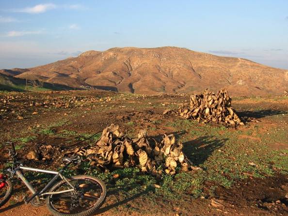
Burned Fortuna Mountain and Prickly Pear cacti.
One other story. This morning Cathy
wakes me early, says water’s coming in everywhere! I knew it was raining, but we were on second
floor, with floors above us. I get up,
and wow, water was coming in through wall switches, wall and ceiling light
fixtures, vents, you name it. Bathroom
was getting flooded, personal items got wet, and I got wet. We call front desk, they said they’ll send an
“engineer” up to look at it. 10 minutes,
nobody. Call again, say need new room
NOW, I have meeting in less than an hour to get ready for. They did address that quickly. We got a large suite, I’m guessing a
$400/night deal. Later in my busy day I
asked what happened at the front desk.
They wouldn’t spell it right out, but someone’s dirty toilet overflowed
above us. Yuk, yuk, yuk.
Thursday ride #1, 2/26/04 Mission
Beach, La Jolla, CA
37.5
miles estimated
2.5
hours
An
800 foot steep climb to summit of Mt Soledad
Cathy and I rented a tandem on the beach again. Got a much better bike this time. We waited until the morning showers stopped,
then headed over the La Jolla area. We cruised the bike path along Mission Beach
and Mission bay, some of it twice. A lot of fun, and pretty nice weather. After that, we headed north to check out the
coast line of La Jolla. Of course, that peak with a monument on top
of it kept catching my eye down at sea level.
Somehow, the roads we happened to take ended up at the summit, about 800
feet above sea level. I couldn’t fool
Cathy though, she’s been married to me too long. She did really enjoy the view up there after
the pain and suffering of climbing was over.
Could probably see 50 miles of coast north and south, as well as all of San Diego, and the
mountains to the east I rode previously.
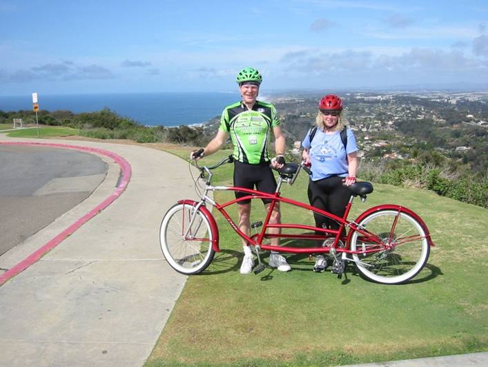
Doug and Cathy
with tandem cruiser on Mt Soledad in La Jolla.
Thursday ride #2, 2/26/04 San Clemente
Canyon, San Diego, CA
6.2
miles
0:47
hours
Approx.
400 feet of climbing
Cathy was wiped from the long tandem ride, so after we
checked into our cheap hotel (free business part was over), I went out for another
quickie bonus ride just a few minutes away.
This park is right in town, and it has several miles of moderately
scary, steep-grade-hugging singletrack.
I started from the lot heading east.
Came to a white water stream crossing after only one mile and didn’t
know what to do. Pondered it for a
minute, then a couple came from the other direction. They stopped momentarily, then since
apparently the guy knew the crossing, charged through it. He cleared it just fine, getting only wet
feet in about one foot of water. His
mate did the same. Then I went. No problem.
I keep going, coming to another crossing. I assumed they had crossed that one too, so
without hesitation, I stormed on across.
About midway across, my handlebars disappear under water and I
freaked. Strong current too. I jumped off the bike, and it’s buoyancy
automatically brought it to the surface.
I waded across to the other side.
The trail continued to switchback across the flooded stream, but I
turned around and went back, having to wade across the rushing, waste deep
stream again. I caught up to the couple
and asked if they crossed there too, and they said oh no, we came in after
that. They thought my incident was
pretty funny. Anyway, continuing west
was some very nice, very steep off camber singletrack with climbing. Kind of made up for the wheel bearing
cleansing incident.
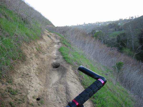
The canyon side
was very steep and the clay surface was very slimy in places. Made for some fear of death jitters in a few
places.
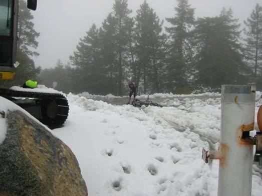
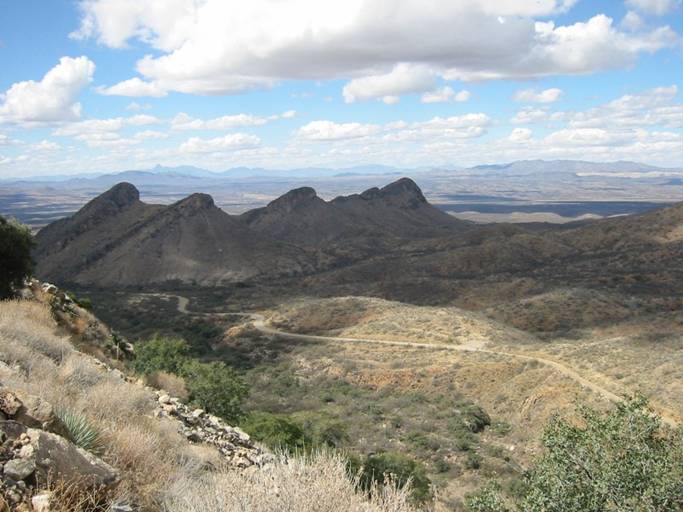
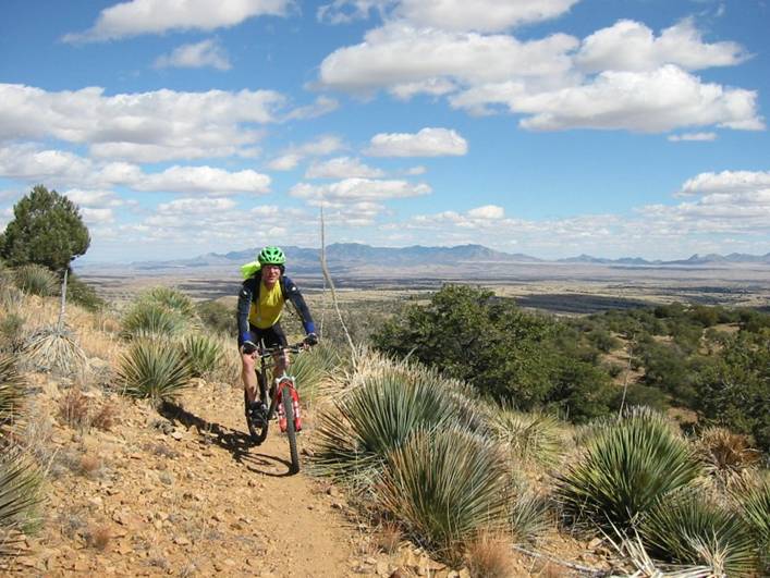
Friday, 2/27/04 Kitt
Peak, Pan Tak, AZ
24.2
miles
1:58
hours
Approx.
3630 foot monotonic climb to 6870 feet
It rained all night, so the trails around San Diego were going to be crap. I had planned to do a big mountain ride near Palm Springs, but the
snow line was down to 5000 feet, and the trails below that would be all
mud. Cathy’s part of the trip was over,
so after dropping her off at the San Diego
airport, I headed straight to Tucson
to visit my friend Chris. Weather
forecast showed less probability of rain there for Friday. Yeah, right.
Before meeting Chris and his wife Dana for dinner, I stopped at Kitt Peak,
about an hour southwest of Tucson. I had not planned on riding this mountain,
but it was on the road atlas so I could find it (barely), and Chris said guys he
knew ride it. The climb is actually a
paved state highway to the observatory complex, so nice and wide with
guardrails. I park outside the gates
(they close the road at 4pm), and it starts raining. I put warm stuff on and begin the climb. The climb heads mostly in a SW direction, the
way the wind was coming from. The higher
I got, the nastier the wind got. About
halfway up, a motorist (observatory worker?) stops and tells me, “you know,
there’s hundred mile per hour winds up there.”
I thought he was joking but said I could believe that. I had to stay on centerline to avoid getting
blown over the guardrail. The headwind
made me mad, but it also made me push all the harder. I get to the top, there’s some snow up there,
and I’m in the clouds again. Couldn’t
stand without holding onto something or taking shelter behind a building. After taking a photo, I start to head down
but stop in the open parking area to put my windbreaker on. While I’m fighting with that, my mountain
bike actually begins blowing across the asphalt!! I had to jump and catch it from blowing
away. Unbelievable. The descent was very unpleasant, rain and
wind blowing me all over the place.
Pretty much rode the brakes the whole way down.
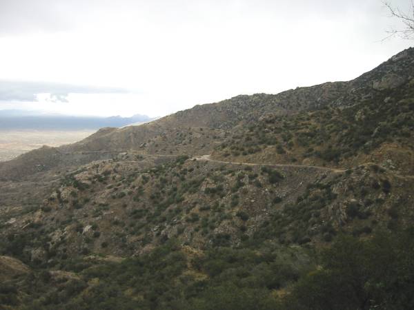
Road to Kitt
Peak, about half way up.
Near Kitt Peak
summit, just below cloud line. Why is it
I have to ride big mountains where the sun isn’t shining?
Nearly identical
shot as Black Mtn from a few days earlier and hundreds of miles away.
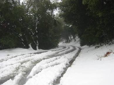
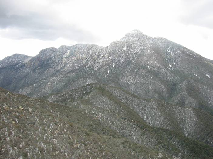
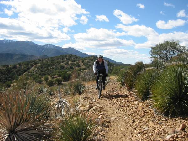
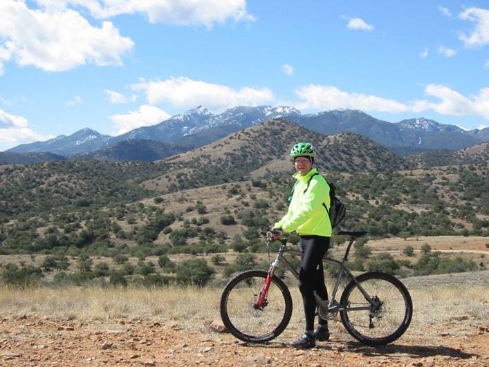
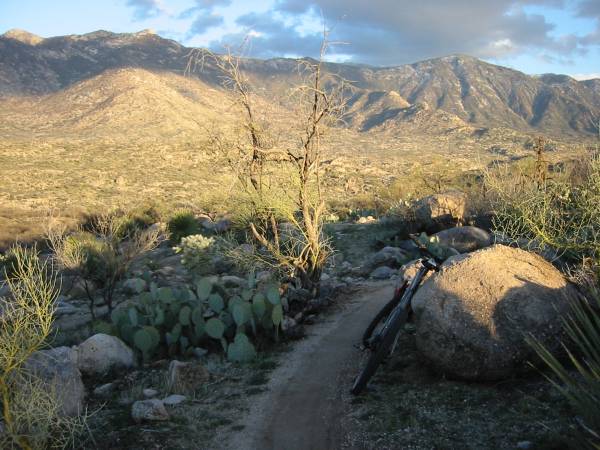
Saturday, 2/28/04 Mt Hopkins, Amado, AZ
38.6
miles
3:23
hours
Appox.
5515 foot climb to 8585 feet
This ride on an improved weather day would have to be my
capstone climb of the trip. It was my
longest hours ride, offered the most dramatic views, and the most dramatic
climate change. Mt Hopkins, another
observatory peak, is about an hour south of Tucson.
The road to the summit is mostly gravel, and very narrow in most
places. The climb began with temps in
the 50’s, with the summit in clouds. I
thought about just wearing shorts, but I saw how much snow was up top and
figured that maybe there’s snow up there because it is cold up there. I wasn’t smart enough to bring winter gloves
though. So I head up in tights, thermal
jersey, ear band, even neoprene booties over the shoes. I carried two more upper layers and balaclava
in Camelbak. The climb is quite typical
for the area, 8-10% grades, incredible views, very isolated from
civilization. At about the 6000 foot
level, there’s snow on the ground. Then
I encountered some animal tracks unlike any I’ve seen, both in shape and
size. They were black bear tracks,
freshly laid in the snow, crossing the road.
I was quite nervous stopping to catch a photo of them. Continuing, the air was getting very cold and
thin. I stayed warm climbing
though. The last quarter mile or so was
incredibly steep, probably over 20% grade, and I thought I was going to pass
out in the thin air at 8500 feet. The
summit had a good covering of snow, and anything exposed to the wind had rime ice
on it. Wind was mild today, and clouds
had cleared by now. The view was
fantastic, at least 60 miles visibility in all directions. I froze on the descent. The temp must have been around 20 degrees at
the summit, and I had thin, fingerless gloves.
In very short order I couldn’t feel the brake levers to control my
speed. Had to stop and hold my hands
against my tummy. It wasn’t until most
of the way down the 19.3 mile descent that the air was warm enough to stop
freezing my hands. The climb took 2:23,
the descent 1:00. Hundreds of bends,
switchbacks, wet/icy spots, and frozen hands prevented a faster descent.
Mt Hopkins
summit in clouds at the start of the climb.
Started with wet feet after crossing normally dry wash.
A few miles into
the climb looking back.
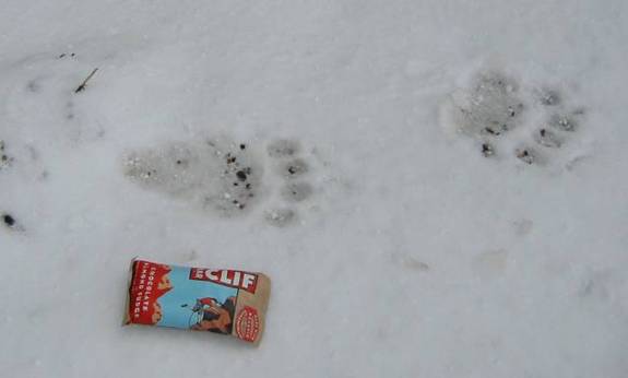
Fresh Black Bear
tracks 2/3 of the way up.
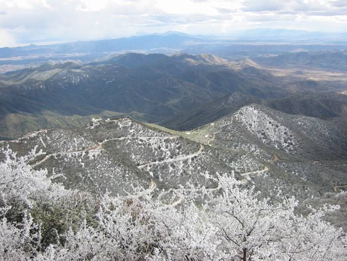
Mt Hopkins road
from 8585 foot elevation summit. Snow on
trees is actually rime ice.
Note also that
clouds have lifted to above the summit, opening up a 360 degree panoramic view.
The Mt Wrightson
Wilderness Area to the east shot from about 7000 feet. A 9400’ peak adjacent to Mt Hopkins in the Santa Rita
Mountains.
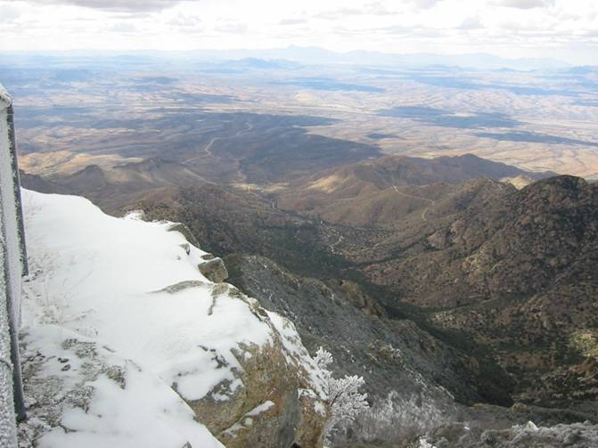
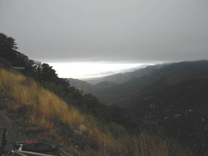
Looking west
from summit.
Looking north
from summit. The Santa Catalina
mountains that tower above Tucson’s
north side are barely visible.
Tucson lies on the flatland at the
base of those mountains.
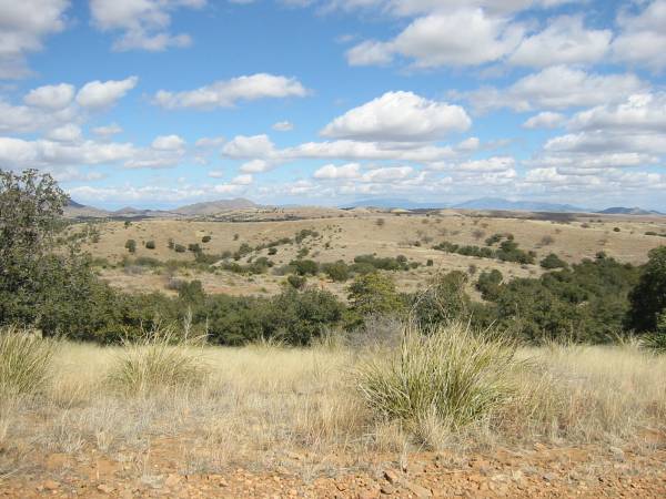
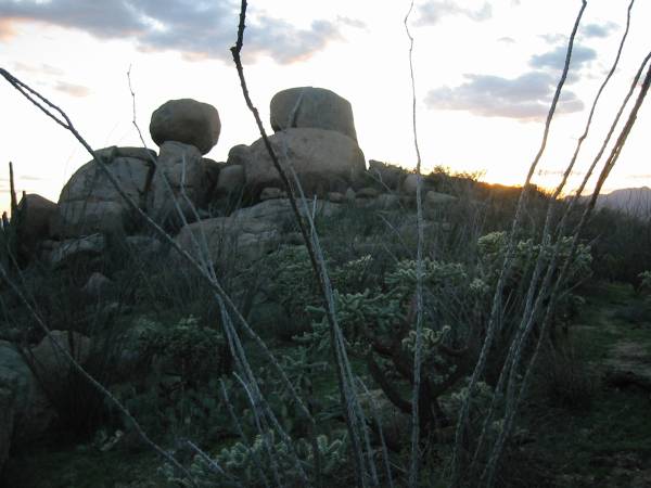
Sunday ride #1, 2/29/04 Arizona Trail, Sonoita, AZ
25.5
miles
3:00
hours
Appox.
2900 feet climbing between 5000 and 6000 feet elevation
Chris and I planned this ride many weeks back, even before
I knew for sure if I could make it out or not.
This ride was a 2000 IMBA Epic. Most of the terrain is rolling higher
elevation grasslands, open, rocky, and filled incredible scenery. Much of the loop we did followed various
forest service roads or ATV trails. However,
there was several miles of technical singletrack descent from the high point of the
ride. Chris had a crash on this section,
and I pinch flatted my front tire. Tons
of loose rocks, steep grades, ledgy sections, tight switchbacks, and cacti to
dodge. Weather was very nice, starting
out around 40, warming to 50’s, and mostly sunny.
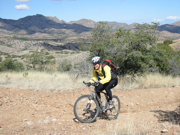
Chris climbing
near the beginning of the ride.
Typical view of
the grasslands around 5500 feet elevation.
Chris on Arizona
Trail singletrack at highest point of the ride.
Mt Wrightson in
background, area I was up in day before.
Mt Hopkins is just behind Mt Wrightson from this view.
Arizona Trail
singletrack. The long singletrack
descent began here.
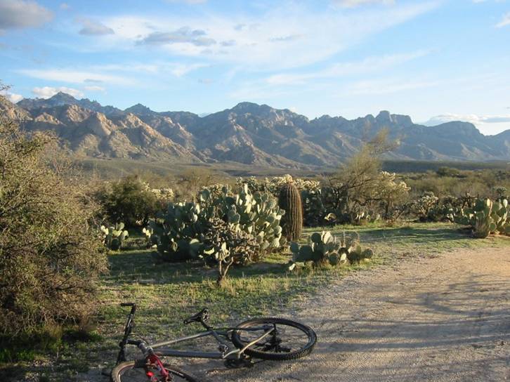
Sunday ride #2, 2/29/04 50 Year Trail, Oro Valley, AZ
11.6
miles
1:02
hours
Appox.
500 feet climbing
Kind of another unplanned ride. Chris and I headed to his house after the
IMBA Epic ride with an hour plus good light left. I had ridden the 50 Year Trail several years
earlier and remembered it as my favorite trail of that trip. It was only 15 minutes from Chris’ house, I
was already in biking gear, so I just had to ride a piece of it. I headed to the trailhead off Golder Ranch Road,
and was on the trail in about a minute.
Didn’t notice that my computer wasn’t working at first. From where you park, you take some feeder
trail to jump on the lengthy 50 Year singletrack trail. I had to remember where to get back off to my
car, as there is quite a maze of side trails from the 50 Year Trail. My plan was to go 5 miles out or to sundown,
whichever came first. Since my computer
didn’t register for a good portion of the ride out, I turned around as the sun
set, assuming I’d get to the car just as it got too dark to see. I had no lights. As I’m heading back, the coyotes were yipping
and howling all around me, as they do every night at sunset. Even had one run right in front of me. Got my heart beating pretty good. I flew back, not realizing I overshot were I
was supposed to get off. It got too dark
to see on the trail, so I popped out on a dirt road that I crossed earlier,
assuming it could take me back to my car.
Problem was, the two-track roads out there go to all these dead-end
shacks basically. Now it was almost
black out, and I couldn’t even see on the two-track. I was about to randomly stop at a place with
lights on to ask where I was when I decided to try one more path I hadn’t tried
yet. It went to my car. Moral here is bring lights when you know you
will be cutting daylight close.
Santa Catalina
Mountains near sunset, looking southeast.
50 Year Trail
singletrack. Many miles of this
here. Rock formations to go over and
around in some places,
roller
coaster-like chutes (called “The Chutes” locally) in other places.
Sunset on the 50
Year Trail.
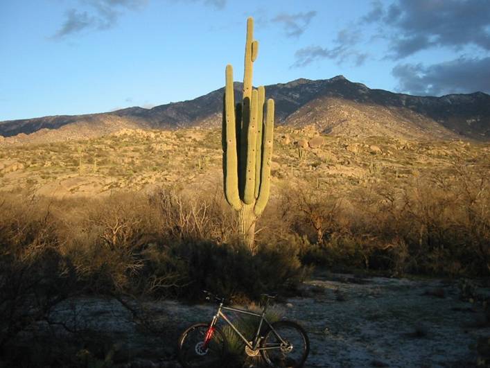
A giant Saguaro
Cactus, which Tucson
is famous for. Stands maybe 30 feet
tall. Holes are bird nest burros.
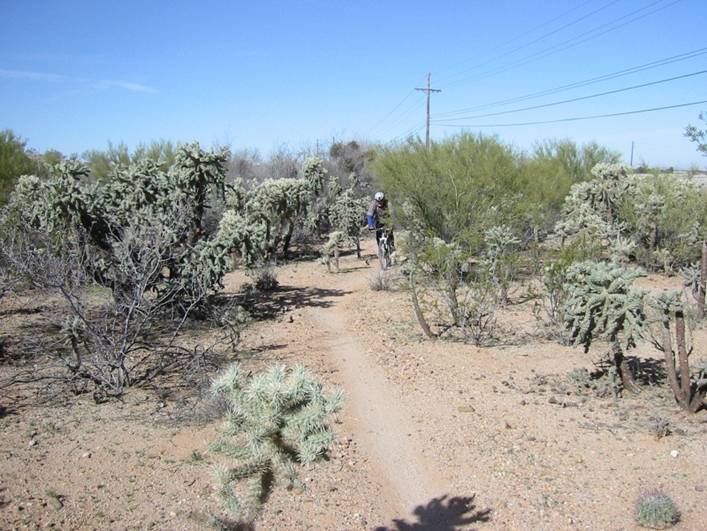
Monday, 3/1/04 Fantasy
Island, Tucson, AZ
12.0
miles
1:00
hours
Appox.
300 feet climbing
This area shares some common issues with the area
affectionately know by Boston area mountain
bikers called Vietnam. Fantasy
Island has mountain biker
built and maintained trails on public land, but it is at risk of being
developed. It’s pretty flat here, mostly
small roller coaster style hills, some of which you could get crazy air off of,
and it’s chocked full of every kind of cactus.
Wicked fast, wicked fun to ride.
Pretty much rode all of the singletrack.
Missed doing one out and back piece due to time constraints. Had to be to airport by noon. Perfect day for last ride of trip.
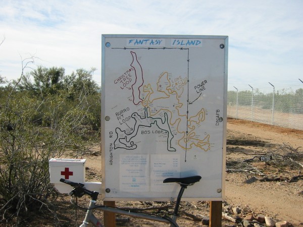
Sign at the
trail head. Note the first aid kit. Nasty cacti everywhere here,
sometimes barely
squeezing through them at 20 mph.
A Cholla
cactus. A mountain biker’s worse
nightmare. From a distance they look fuzzy.
But it’s a mass
of thorns as stout as 8-penny finishing nails.
Chris rounding a
bend on Bo’s loop I think.
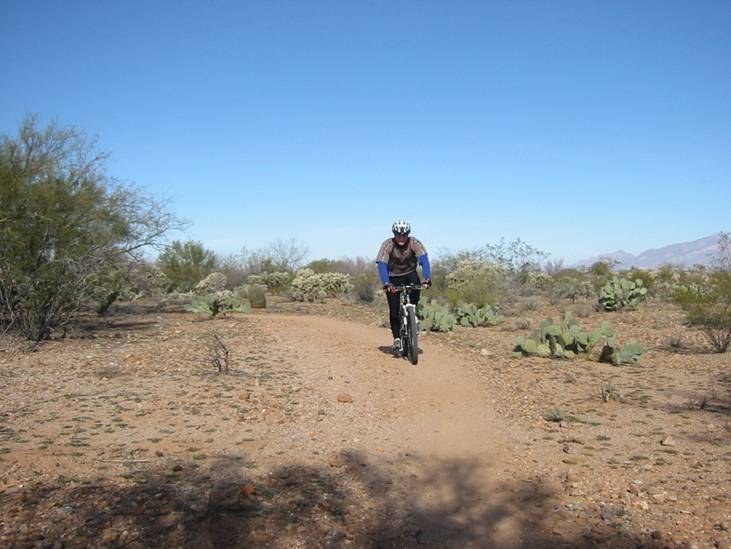
Chris on Lone
Cactus Loop.
The way I remember Tucson
from two previous trips.
Not a cloud in
sight, desert, but definitely not dead.
Trip Summary
Despite foul weather (both indoors and out) much of the
time, Cathy and I had a good time. This
was my third trip to southern California,
and each time I ran into trail closure issues.
Just part of life there I guess.
The tandem rides with Cathy along the coast more than made up for
it. This was Cathy’s first visit to the
southwest. I think she feels California is a little
less evil now than before the trip. But
she didn’t encounter any earthquakes, brush fires, rattlesnakes, or riots while
we were there either. She did see huge
burned areas, including remaining home foundations, and what heavy rain can do
there. Not as bad as what heavy snow
does here every winter though.
Fortunately, Tucson
came through with nice weather and no closed trails.