Oregon/Washington Vacation
Friday, August 27, 2004 through Saturday, September 4,
2004
Trip Highlights
- 11 rides in Oregon and Washington,
totaling 291.1 miles
- 186.9 miles trail MTB
riding
- 70.0 miles road tandem
riding
- 34.2 miles road MTB
riding
- 22 hours total riding
time
- 32,200 feet climbing
- Min elevation near sea
level, max near 8,000 feet
- Zero crashes,
mechanicals, and flats
- 1 significant hike, 4
short hikes, totaling 8.9 miles
- Rain on only one of the
eight days
- Visited Mt Hood, Crater
Lake, and the coast in Oregon, visited Mt
Saint Helens in Washington
- Number of images
captured: over 300, with 69 included here
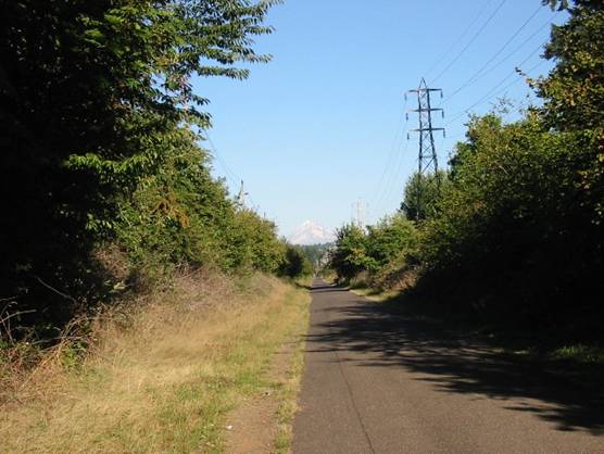
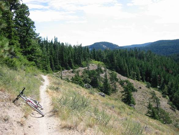
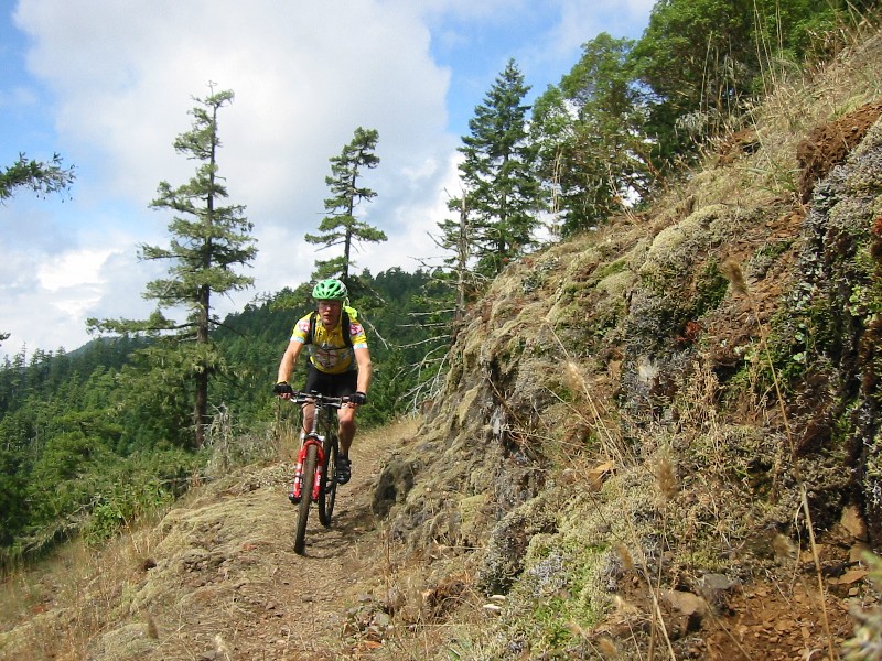
Friday, 8/27/04 Larch Mountain,
Portland, OR
50.3
miles
3:18
hours
5000
feet total climbing
After
a minor screw up tracking my bike down (FedEx said they were holding it at a
warehouse when in fact it was delivered to the bikeshop near the airport), we
checked into the Comfort Inn in Troutdale, just east of Portland.
Troutdale is at the mouth of the Columbia River Gorge and the famous
historic highway that runs through it.
There was also a manufacturer’s outlet mall across the street. Cathy was all set to shop for a while, while
I got a ride in. The intent was to bike
from the hotel to the summit of Larch
Mountain, a paved 4000
foot climb used in time-trials, then bike the singletrack up top. The climb was beautiful, near zero
traffic. The hotel sits near sea level,
and the summit of Larch Mtn is at 4056 feet.
I did not anticipate how much cooler it is at 4000 feet. It was maybe 65-70 at the hotel, but cold
enough to see your breath at 4000 feet.
I later learned it can snow on Larch Mtn in June, and there are only 2-3
months where there is no snow up top.
Due to a late start, I did not get to do the full MTB loop. Plus the trails were very soggy from a whole
week of torrential rain just before we arrived.
Only a couple miles of trail were explored. There were clouds in the area blocking the
view up top. I had no idea of how
spectacular this view was until I came back with Cathy a couple days
later. The 24 mile, mostly monotonic
descent was a blast, but I froze without any extra layers to put on.
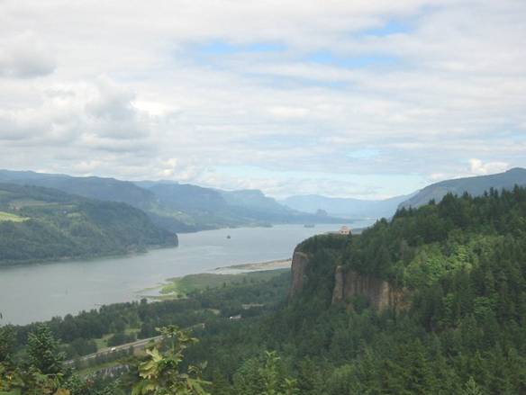
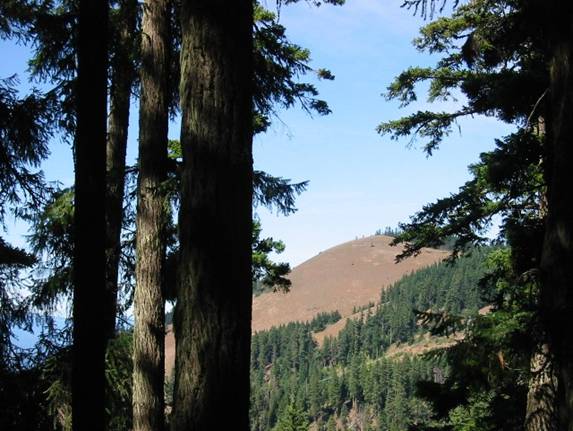
View from the Women’s Forum
Lookout, approx. 700 feet above the Columbia River.
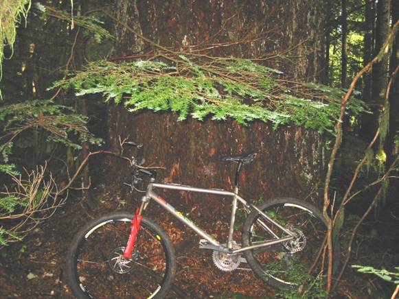
This tree was at least 7
feet in diameter. Trees like this were
everywhere I went.
Saturday, 8/28/04 Lewis River
Trail, Cougar, WA
22.4
miles
2:35
hours
1800
feet total climbing
Saturday
was to be a big biking day for me, a big shopping day for Cathy. Our plan was to do the coast on Sunday. I decided to do the Lewis River ride first in
hopes that the heavy morning fog and cloud cover would burn off so views would
open up for the afternoon Saint Helens ride.
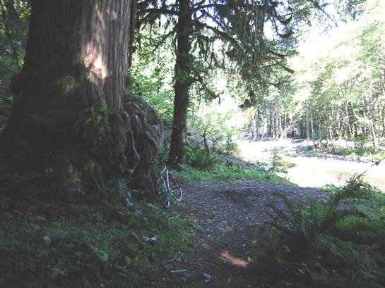
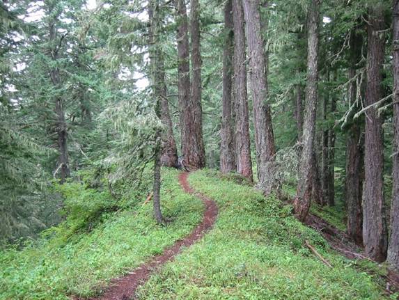
The Lewis River Trail follows the Lewis
River in Washington,
near Mount Saint Helens. This trail gets national attention in the
magazines. It is 100% singletrack
through old growth forest, and the scenery is unbeatable. Plus the trail is really buff stuff. Think Return of the Jedi buff as you’re
carving a smooth, narrow brown ribbon around unbelievably large trees. I rode the trail from the lower trailhead
upstream to Lower
Falls, and back. There were steep pitches along the way, and
several scenic water crossings too.
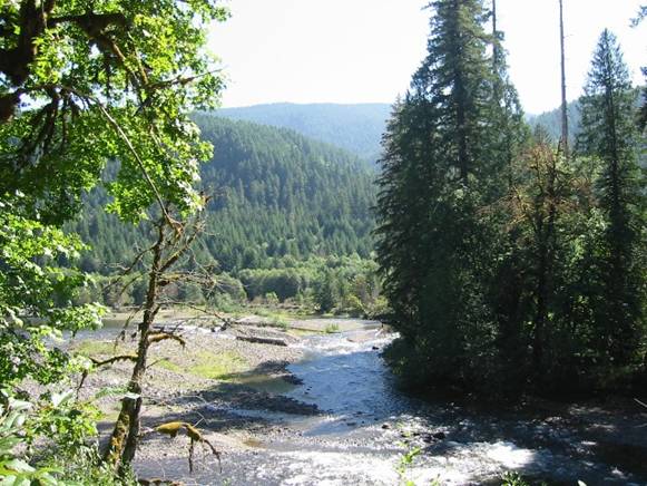
One of many vistas along the
Lewis River.
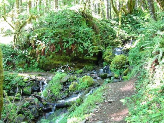
Much of the trail
was bench cut into steep grades along the river. Here is a water crossing of a small stream
feeding into the Lewis
River.
Just one specimen
of old growth. The diameter of this one
was probably around 8-10 feet at 8 feet above the ground. These trees are still 4 feet in diameter at
200 feet above the ground. Simply
unbelievable. I’ve read they can be over
600 years old.
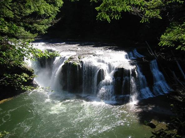
Lower Falls
on the Lewis River.
Vertical drop was maybe 60 feet.
Dozens of sightseers here as parking is nearby.
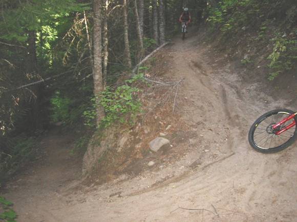
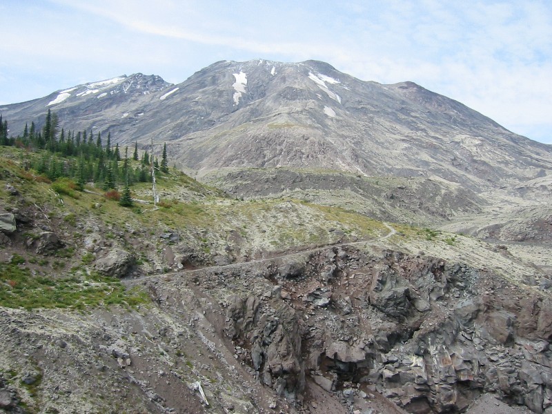
Mount Saint Helens,
WA
16.4
miles
2:12
hours
2500
feet total climbing
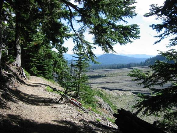
After finishing the out-and-back along the Lewis River,
I zipped up to the Ape
Canyon trailhead on Mt
Saint Helens, less than an hour away.
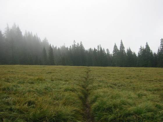
Ape Canyon Trail #234 gains about 1600 feet in 5.5 miles, where it meets
up with Loowit Trail #216 above tree line.
The trail is supremely buff, chocked full of old growth that somehow
escaped the 1980 eruption blast, and switchbacks many times on the way up. I saw a lot of bikers on this one. Once reaching Loowit Trail, the ride becomes
much flatter through a surreal Mars-like landscape. This area is called the Plains
of Abraham. There is very
little vegetation here, just white pumice rock with a nice random distribution
of large black boulders. Very tricky to
ride on in places, like riding in 6” deep marbles. The Loowit Trail runs into the Truman Trail
#207, which passes over Windy Ridge.
This was one of the coolest things to ride across, if not a bit
unnerving, as the pitch on both sides of the ridgeline was very steep. Maximum elevation reached on this ride was
about 4700 feet. Bicycles are not
allowed above 4800 feet, and in fact you even need a permit to hike above this
elevation on Saint Helens. Only 100 hikers per day are allowed to the
summit, and nobody is allowed in the crater.
Riding Saint Helens was so satisfying I
had to figure out a way to come back for another ride before flying back home.
The Ape Canyon
Trail and the Lahar Mud Flow in the background.
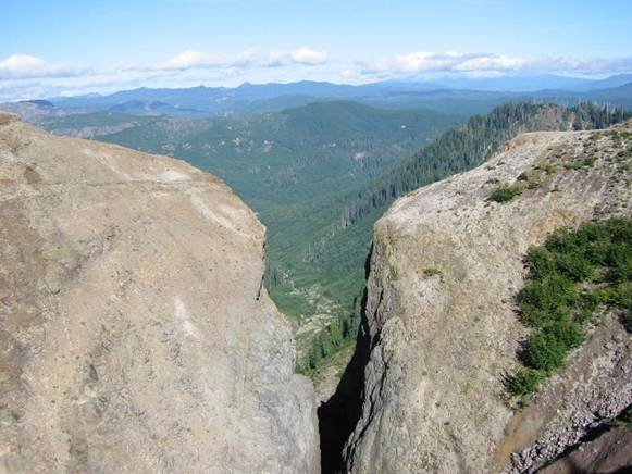
Ape Canyon.
The trail where I was standing was very narrow and dropped vertically about 300
feet into the narrow crevice. A no-fall
zone I walked on this ride.
The snow-capped
summit of Mt Adams (another volcano) just poking through the clouds.
The Mars-like landscape
around Mt Saint Helens. This is on the Plains of Abraham.
Trail on the Plains of Abraham.
You could rip 20+ mph on portions of this. Only problem was the views were so
distracting.
The
Truman Trail along windy ridge. It really was windy here too. Thought for sure the strong cross wind would
blow me over the east side of the ridgeline.
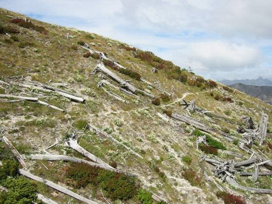
This area was cleared of everything during the 1980 eruption. All the trees blown down point the same way –
away from the volcano. There is parking
at this trailhead, and I got the impression that a lot of folks shuttle this
ride, riding Ape Canyon down only. By road it is an hour plus between trail
heads.
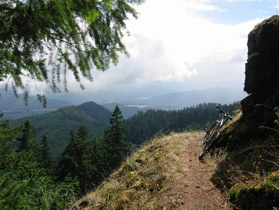
Sunday, 8/29/04 Oregon Coast,
Neahkahnie Mtn
3.6
miles
0:41
hours
1500
feet total climbing
We had planned to spend most of this day together visiting
the coastal area. We drove out to Seaside, OR
with the intention of hiking and riding on Tillamook Head, a 1000ft cliff
shoreline. The problem was the overlook
was buried in fog. Clear and sunny everywhere
else though. The sign also said no bikes
allowed, and I really wanted to sample some cliff-hugging singletrack. So with no view and no bikes allowed, we
headed south along the coast. We stopped
at Ecola State Park – no bikes. Oswald West state park – no bikes. However, the drive along coastal Rt 101
offered spectacular views. Pretty much
anything above 1000 feet was socked in with fog. Finally we see a trailhead sign that headed
inland from the coast. There was no
additional info. Looked like fair
game. There was a mountain peak there
with a communication tower on it. There
was both a hiking trail and a service road that both looked like they went to
the top. Cathy chose to hike while I
biked up with the intention of a summit rendezvous. The service road was unbelievably steep in
spots. I later learned after buying an
Oregon MTB guide book what this mountain was called and that it gains over 1200
feet in about 2 miles, for an average grade of 12%. Cathy and I did meet up near the summit after
I did a little exploring around up there.
The view was spectacular, in and out of the clouds whizzing by. I decided to take the singletrack down, which
was mostly buff, with a zillion switchbacks in it, and several root
outcroppings. It was all bench cut into
the steep mountain side. A short ride,
but I got my fix for the day in. A very
lucky find.
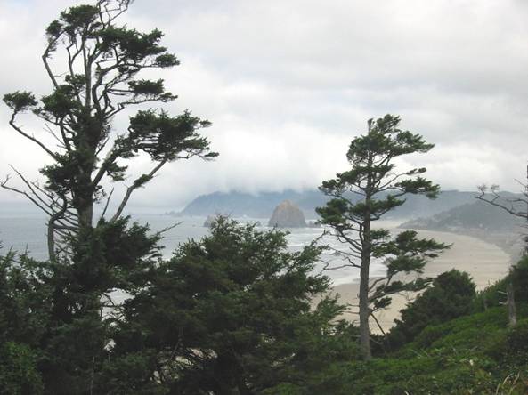
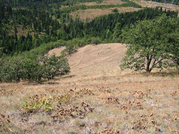
Tillamook Head
socked in with clouds. Famous Haystack
Rock just off Cannon
Beach in center.
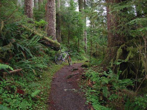
Singletrack on the
back side of Neahkahnie
Mtn. The area here was very lush and full of old
growth trees.
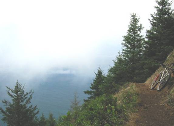
The ocean side of
Neahkahnie. Very narrow benchcut
singletrack with the Pacific Ocean 1600 feet
below.
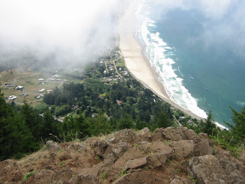
Manzanita Beach
1600 feet below the summit of Neahkahnie
Mtn. It is more down than out. It’s hard to believe a trail can be cut down
the front side of this mountain. Had to
wait for just the right instant to snap this picture, as the clouds were
whipping by and views were fleeting glimpses.
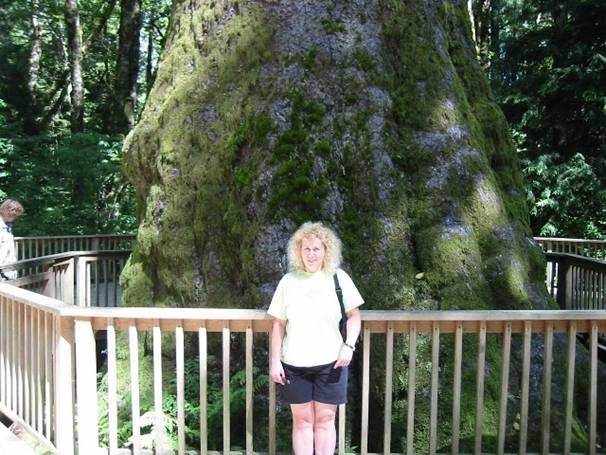
On the way back to Portland, we saw a sign for the largest Sitka Spruce in North America. We
had some time, and it was right off the highway, so we checked it out. Not particularly tall, but it sure was big at
the bottom. Stayed fat all the way up
too, with a kind of spindly top.
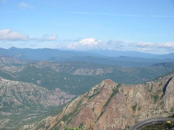
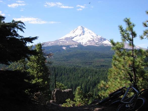
Larch Mountain
Loop, Portland, OR
6.4
miles
0:54
hours
1400
feet total climbing
Since we had a couple hours of daylight left and the skies
were crystal clear to the east, I wanted to take Cathy to Larch Mountain
to see the view. It’s less than a 40
minute drive from the hotel. We parked
in the summit parking lot then hiked the quarter mile to Sherard Point, a rocky
outcropping with a 360 degree view of many great volcanoes, including St.
Helens, Rainier, Adams, Hood, and Jefferson. I brought the tripod with the hopes of
capturing a multi-exposure panoramic photo.
Cathy and I were both totally amazed at the view. There were other serious photographers up
there too. After taking a bunch of
pictures, I went for what I thought would be a quick sub-30 minute loop around
the summit while Cathy hiked one of the trails.
The trail descended way more than I anticipated, and it was unbelievably
rocky and washed out. I had to climb
1200 feet back to the summit in quickly diminishing light. Cathy and I both were worried I wouldn’t make
it before sundown. Even in full sunlight
these forests are dark. At sundown, you
can hardly see. I made it back with very
little margin. I surprised myself in
what I was riding over. Loosing light
gives you a good incentive to hurry.
Glad I didn’t crash, but my legs were toast and we had a 100+ mile
tandem ride planned for the next day.
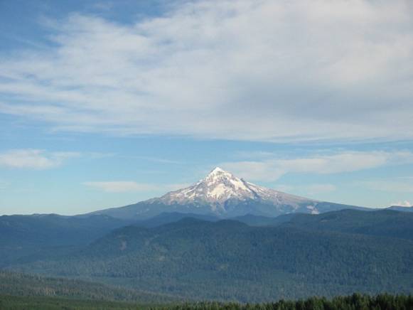
Mount Hood, about
22 miles away. A break in the clouds was
nicely illuminating the summit.
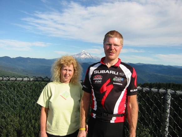
The two of us with
Mt Hood in background.
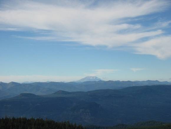
Mount Saint Helens
from Larch Mtn.
Before 1980, it was 1300 feet taller with a pointy top. It blew its top during the famous 1980
eruption.
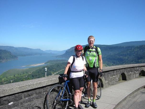
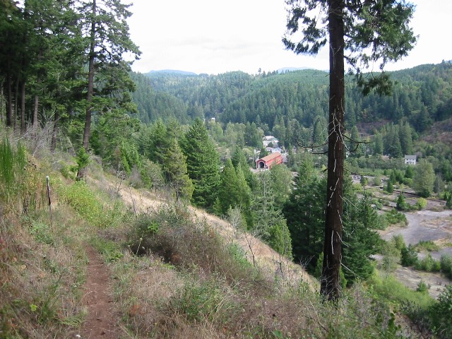
Monday, 8/30/04 Columbia
River Gorge, OR
70
miles
4:22
hours riding time
~3000
feet total climbing
Riding the Historic
Columbia River Highway on a rented tandem was to
be our capstone ride. Sunday afternoon
between visiting the coast and Larch Mtn, we picked up the tandem rental so we
could embark on a 100+ mile ride first thing Monday. It was quite cold when we left, shortly after
8am I think. Was supposed to be a
beautiful day. The first few miles are
fairly flat, then we hit a 700 ft climb to the Women’s Forum Lookout. Very modest grade however, probably not
exceeding 5%, and much less most of the time.
The descent from Crown Point
was incredibly fun. Many miles of swoopy
switchbacks. This portion of the
historic highway had very little traffic.
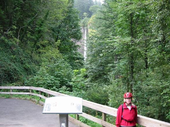
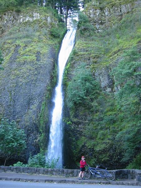
After the descent, we’re back to sea level and hit waterfall row. Just one amazing waterfall after
another. The most famous, Multnomah Falls, drops over 500 feet. With a week of heavy rain just before we got
there, everything was flowing very strong.
We stopped at each fall for pictures, skipping Oneonta Gorge for on the
way back. We soon ran out of historic highway
and bike path, so we had to pop out on the nasty busy Interstate 84. This was chocked full of 70mph double and
triple bottom semi rigs. Even though the
shoulder was wide and signs were up making motorists aware of bikes on the
interstate, these two miles were extremely unnerving. After this bit, we get back on bike path
which terminates at the town of Cascade
Locks. We were
now about 35 miles out, and the next points of interest were more than 10 miles
away, which meant a 10 mile stretch of interstate before picking up bike path
again. We decided against it. This ride wasn’t turning out nearly as
romantic as the online info made it out to be.
The first 22 miles were very nice.
So we headed back, knowing we’ll only log about 70 miles for the ride. But we stop at the Oneonta Gorge. We really didn’t know what this was. We knew you could hike into it and there was
a waterfall back in there somewhere.
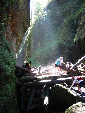
This turned out to be about a 1 hour endeavor. First there’s this huge log jam to scale,
hundreds of old growth logs piled 20 feet deep.
Very treacherous in cleated cycling shoes as everything was slimy. The gorge gets very narrow and deep as we
progress, hundreds of feet deep and only a few feet wide in places. Then there’s the deep water part. Chest deep in ice, and I mean wicked cold
water. Take your breath away cold. Finally we reach the falls at the end of the
gorge, maybe a 200-300 footer. While we
were hanging out at the falls, a cascade of fist sized rocks came down. One smacked Cathy in the hand hard, causing
her hand to swell up. We still had our
helmets on as I didn’t want to leave them unattended at the bike. We may have well needed them. We finished the ride early and were able to
return the tandem yet that day. We both
thoroughly enjoyed the ride, probably the most adventurous thing we did with
the hike into Oneonta Gorge. Cathy was
completely wiped out from the ride. It
was way more climbing than both of us thought.
I had a little left in my legs, and while Cathy recovered at the hotel,
I drove over to a small nearby Portland
park that allowed mountain biking.
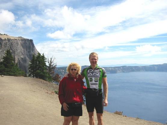
From Crown Point on the
Historic Columbia River Highway. Interstate I-80 can just be seen behind Cathy
700 feet below.
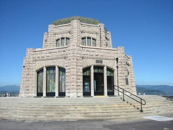
Crown
Point Vista House. It’s being renovated, so we couldn’t go
inside.
Latourell Falls.
Horsetail Falls.
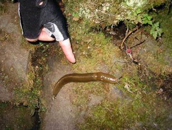
These slugs were
everywhere, some as big as ballpark franks!
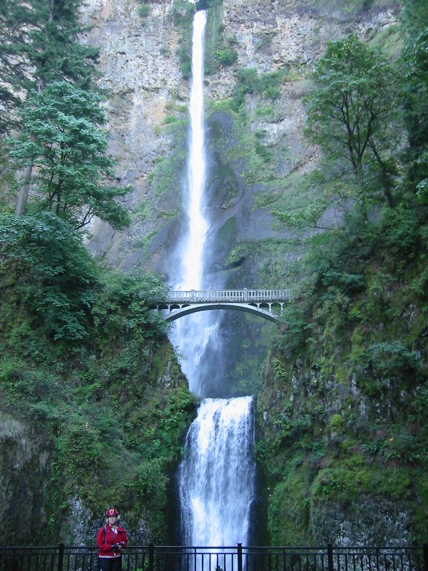
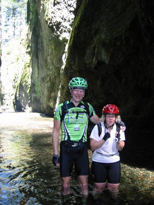
Multnomah Falls.
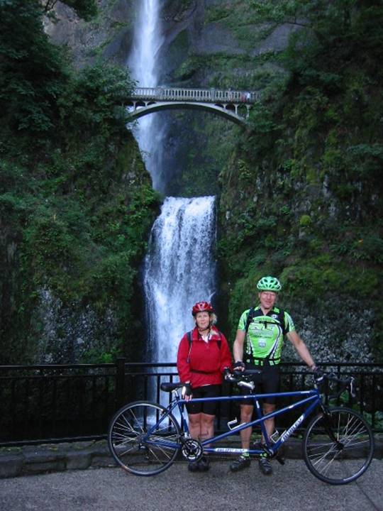
The two of us with
the Burley Rumba tandem at Multnomah Falls.
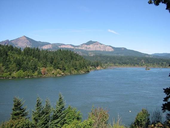
View across the Columbia from the town of Cascade Locks.
Cathy (in pink)
negotiating the log jam in Oneonta Gorge.
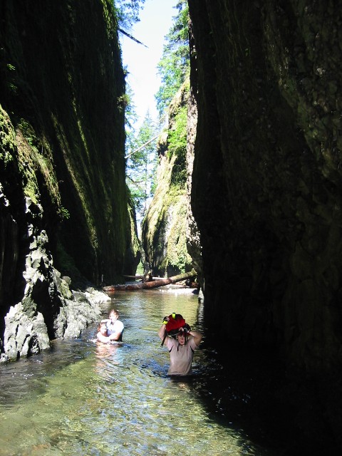
Cathy wading the
deep section in Oneonta Gorge.
You can almost feel
how cold the water is by looking at Cathy shiver.
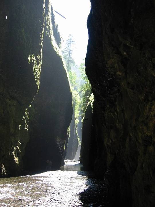
Oneonta Gorge,
looking inward toward the falls. You
could here it, but not see it.
Finally, we reach Oneonta Falls at the end of the gorge. It was extremely difficult walking on those
rocks in cycling shoes.
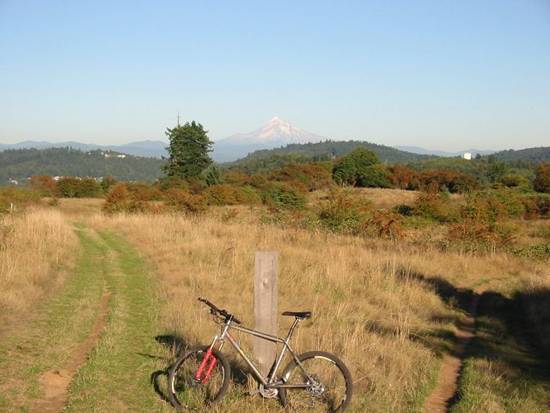
Powell Butte Park, Portland, OR
10.1
miles
0:50
hours riding time
~1000
feet climbing
Powell Butte is an urban park that has a few singletrack
trails open to mountain biking. The
summit, over 600 feet above sea level, is open and grassy and offers
spectacular views of Mt Hood and Mt Saint Helens. I went out to get a Starbucks after our long
tandem ride while Cathy rested back at the hotel. This place was just a few miles further down
the road from Starbucks. I went up the
front side on doubletrack, down the back side on sweet singletrack, then rode
several miles on the popular paved Springwater bike path. Then I pretty much backtracked to the car,
doing a loop up top first.
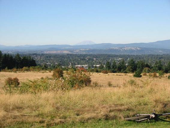
Mt Saint Helens
from Powell Butte. It must have been really scary for Portland residents (in
foreground) to see this thing blow its top in 1980.
Mt Hood from Powell
Butte.
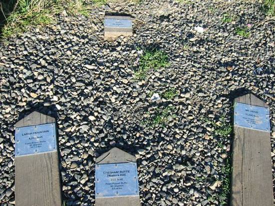
Markers on Powell
Butte indicating direction, distance, and elevation of every significant peak
that can be seen from this butte. Shown
here are Larch Mountain (4065 feet at 19.7 miles on left,
and Mt Hood (11,235 feet at 39.4 miles on right).
The Springwater
Corridor bike path. Notice Mt Hood on
the horizon.
The Pioneer Orchard
Trail on the south side of Powell Butte.
Coming down this buff singletrack was like being on rollercoaster rails.
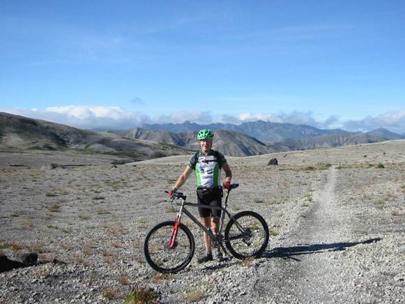
Tuesday, 8/31/04 Surveyors Ridge
near Mt Hood, OR
28.8
miles
3:28
hours riding time
~4000
feet total climbing
Had planned to drive out to Crator Lake
today. But, rain was moving into Portland Wednesday and Thursday, so we decided to push
back Crater Lake one day since it is behind
the coastal mountains and stays dryer.
So Thursday’s activities got moved up to Tuesday. After driving a little over an hour out to
the Hood River Valley
ranger station to learn about conditions and pick up more detailed maps, Cathy
and I decided what to do. She would hike
up a direct route to Bald Butte, which is almost across the street from the
ranger station. I would bike several
miles south on Rt 35 and pick up the Dog River Trail, climbing to Surveyors
Ridge, then head back north to Powell Butte for a potential rendezvous. Surveyors Ridge is opposite the Hood River
from Mount Hood, offering spectacular views of
Mt Hood across the valley. So we each
head off. The highway was a steady
climb, maybe only 2% grade. Then I pick
up Dog River Trail, where a guided group was just finishing a ride – several
40-something year old women coming down on dualies! The guy in the group was walking his bike out
– a stick shredded the sidewall of his tire.
This climb was persistently steep with some impossible (for me) to
negotiate switchbacks. Pure buff
singletrack though. After reaching what
I thought was the top, the trail begins descending. And descending, and
descending. I thought I made a wrong
turn. There were unmarked trail
junctions out there. But eventually I
run into Surveyors Ridge Trail and begin making up a ton of lost vertical. I finally figured out where I am on the map
when I reach the logging road at the top.
Surveyors Ridge from south to north is wicked fun. Has a nice downhill bias to it, but still a
lot of climbs along the way. I then met
a couple on full suspension mountain bikes and loaded panniers going the
opposite way. They must have been in
their 60’s. Just to get to where they
were was impressive. I was humbled. The views of Mt Hood and the valley below
were frequent and very distracting. You
just had to keep stopping and look.
Eventually, much later than planned, I reach the junction of the trail
Cathy came up to take to Bald Butte, a 2 mile out and back. I wasn’t sure if she came back down yet or
not, so I rode out to Bald Butte. The
last mile or so of this had some nasty loose rock hike-a-bike sections, but the
view was worth it. In one shot, I could
get Helens, Rainier, and Adams. Then the other direction was Hood. Just awesome.
I had to hike-a-bike down this thing too, it was so scary. Then I pick up Oak Ridge Trail, the one Cathy
hiked. Starts our really nice. But then it becomes so steep with at least
forty 180-degree switchbacks on loose rocks.
I was unable to negotiate several of them. Cathy was back to the car when I got there
and could not believe I would attempt to ride down something like that. The whole ride was truly an epic.
Mt Hood from Rt 35
Highway.
One of many
switchbacks climbing the Dog River Trail.
I didn’t know a rider was coming down when I snapped this photo and she
scared the crap out of me.
Surveyors Ridge
Trail. Views were abundant from this
trail, reaching 4280’ elevation.
One of many views
of Mount Hood from Surveyors Ridge.
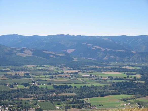
The Hood River Valley from Bald Butte.
Mt Saint Helens, Mt
Rainier, and Mt Adams from Bald Butte.
Bald Butte from top of Oak
Ridge Trail.
Oak Ridge Trail
switchbacks. Very steep and very loose.
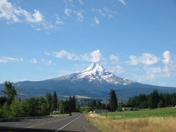
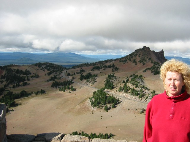
Wednesday, 9/1/04 Crater Lake, OR
34.2
miles MTB on pavement
2:33
hours riding time
~4500
feet total climbing
Tuesday evening, after finishing our Mt Hood area visit,
Cathy and I headed over to Eugene,
OR. We stayed two nights there. It divides the 5 hour drive from Portland to Crater Lake
in half, plus it’s close to another great trail riding location. Today we head off early to Crater
Lake. It’s raining in Portland by now, and it was raining through the Cascades
en route to Crater Lake. But after we crest 5000 feet, the skies clear
up. The weather was quite good once we
got to the national park. Partly sunny,
windy, and chilly. The drive out to Crater Lake is fairly desolate, just scrubby pines,
sandy, semi-arid environment. Quite high
elevation too, maybe hovering above 5000 feet.
We pay the entrance fee at the north gate and begin the drive up to the
rim. Cresting the rim and having the
view of the crater open up just takes your breath away. We park right there and walk up to the edge
for pictures and to soak up the view. I
really wanted to bike all the way around Crater Lake on Rim Drive, so Cathy and
I decided she would shadow me with the car half way around (by driving ahead to
the next vista and wait for me). The she
would do a hike up Mt Scott while I “suffered” through the climbing part of the
loop, meeting again where we first parked.
The loop is incredible, offering many vistas that ranged from about 6000
to 8000 feet above sea level. There were
three significant climbs, ranging from 600 to 1200 feet, plus numerous smaller
climbs. All paved. Bikes are not allowed on side trails. After Cathy hiked, we crossed paths again
about 5 miles before my ride ended.
After packing the bike back up, we decided to do a short hike together
to the peak called The Watchman, an active fire lookout. The total hike was about 1.6 miles and
climbed 663 feet to an elevation of 8,013 feet.
The birds-eye view of Crater Lake was
stunning from this vantage point. I
could really feel the elevation on this ride, averaging above 7000 feet
elevation. The 5% grades felt like 10%.
Initial view from
north entrance.
Different angle of
initial view.
Vista point on east
side of Crater Lake.
Vista along
southeast side of Crater Lake. Cloudtop Overlook in upper right was the high point of the ride,
at 7960 feet.
The Watchman peak
with foot path leading to summit. We
hiked this, and it was extremely windy and cold up top, intermittently in and
out of clouds.
Cathy heading back
down The Watchman.
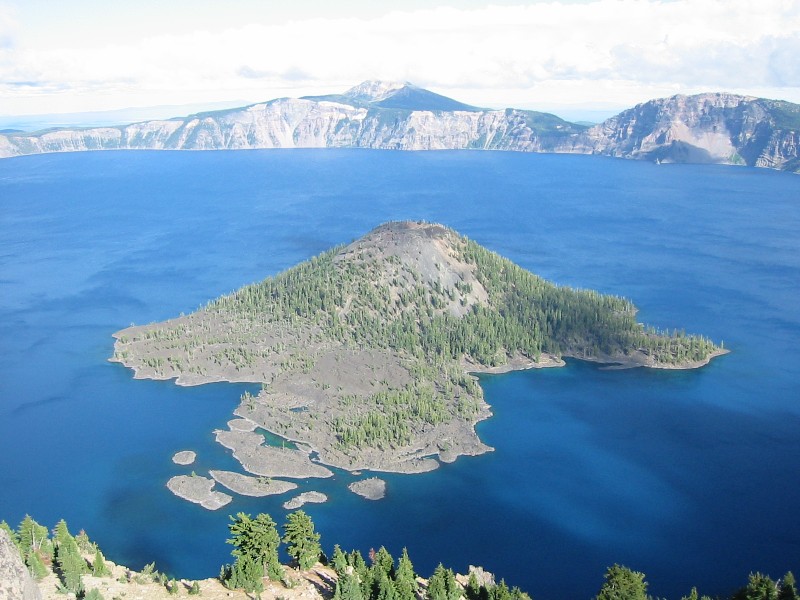
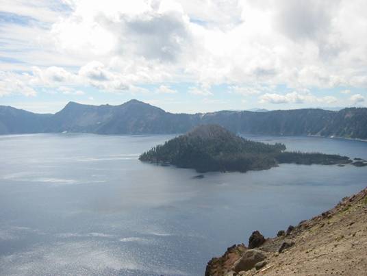
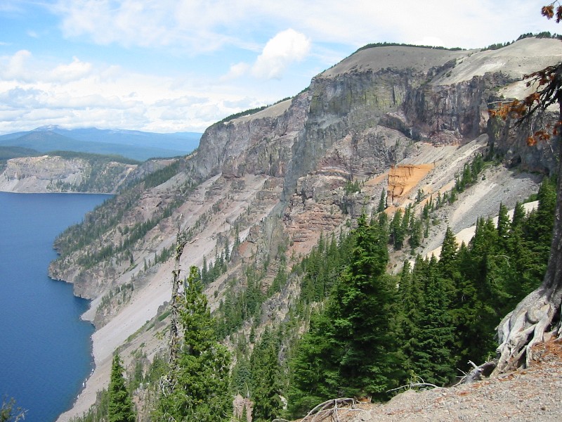
View of Crater Lake from The Watchman at 8013 feet
elevation. The bluest parts are where
the sun illuminates the water. Mt Scott,
where Cathy hiked, is in center background.
This is the deepest lake in the world at nearly 2000 feet.
View to the north from The Watchman. Rim Drive also shown.
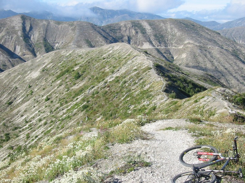
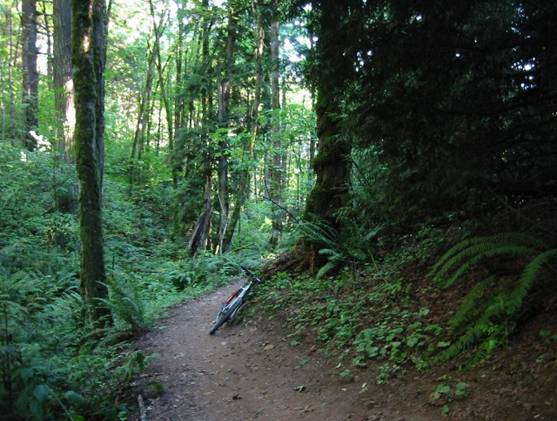
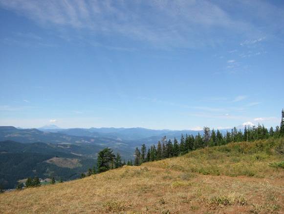
Wednesday, 9/2/04 Alpine Trail
#3450, Westfir, OR
32.5
miles
3:35
hours riding time
~6000
feet total climbing
It was still raining in Portland
and threatening to rain in Eugene
where we were staying. The plan for
today was I would drop Cathy off at the nearby mall and I would ride while she
shopped. Cathy is into shopping as much
as I’m into mountain biking. After
dropping Cathy off, I headed over to the village of Westfir,
location of the famous annual Cream Puff 100 mountain bike race. It is anything but a “Cream Puff.” The race does three 33 mile laps, each with
about 6000 feet of climbing. That’s 100
miles and 18,000 feet of climbing, and it’s touted as the toughest 100 mile MTB
race in the world. After stopping at the
ranger station just a mile from the trailhead to pick up a good map (a
lifesaver!), I park at the famous covered bridge in Westfir. It briefly poured out while driving to the
trailhead, and I was becoming very bummed. Plus, it was very cold here and I only had a
long shell along, no thermal layers. My
plan was to follow the Cream Puff 100 course.
The climb, 17 miles long and gaining 3600 feet, begins on 3 miles of
pavement, then 14 miles of forest service roads in good shape. Not steep at all, with one significant
downhill on the way up. In fact,
single-speeders place in the top five on this course. The roads were poorly marked up top. I was in the clouds, it started raining
again, and I was freezing. Couldn’t feel
my feet or fingers, and my bare knees ached.
I went purely by intuition a couple of times on which turns to take or
ignore. Even though I had a good topo
map, the unmarked road junctions and dense fog precluded reading the terrain or
gaining a sense of direction. I did
eventually find the Alpine Trail trailhead without taking any wrong turns. It nearly stopped raining at this point, and
the trail looked to be a very narrow, smooth, brown ribbon of singletrack. It first climbs a couple hundred feet over a
small peak through magnificent old growth forest before descending a
little. Then a more aggressive several
hundred foot climb ensues to the summit of Sourgrass Mountain. The mountain is covered in a unique grass,
presumably sourgrass, but no view due to cloud cover. The trail then rolls up and down around 4000
feet elevation for several miles. Wicked
fun stuff. Finally the descent begins in
earnest, at times very steep with switchbacks.
When I think I must be about to the bottom, another view opens up, now
on the sunny side of the mountain, and I’m still way above Westfir. Some more rolling benchcut singletrack is
followed before steep descending resumes.
Portions of the final descent were extremely fast and smooth. Couldn’t help but wear ear to ear grin coming
down this stuff. Finally the covered
bridge in Westfir pops into view and I knew the ride was about over. I finished the ride in partly sunny skies,
but I no more than started heading back with the car when I ran into torrential
downpours. Really lucked out. I encountered only 30 minutes of light rain
in a 3.5 hour epic ride. Cleaned up and
changed in the new trailhead facilities.
Made it back to the mall to pick Cathy up almost right on schedule. Feasted at Hometown Buffet at the Mall. Had to pretty much eat until I was stuffed
twice a day to maintain this much activity.
The hotels had decent breakfast buffets, and we hit a variety of places
for dinner, from Taco Bells to buffets to Shari’s
(like a supper Denny’s) to a nice Mexican restaurant in Troutdale.
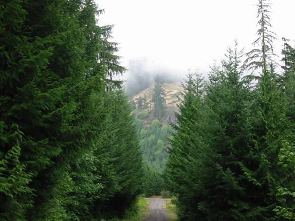
The road up to
Alpine Trail. Approaching cloud line.
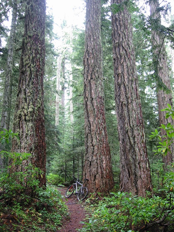
Old growth forest
on Alpine Trail. Just couldn’t get over
how big trees can get.
Much of Alpine
Trail follows a spline down Sourgrass
Mountain. Non-technical, totally peaceful descent. Never saw another person on the trail.
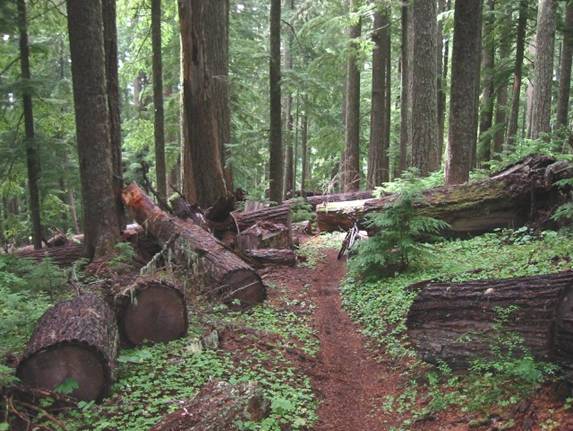
Blowdowns on Alpine
Trail. You wouldn’t be able to bunny hop
these big boys! Some were so big you had
to reach up to touch top side of log.
Summit
area of Sourgrass
Mountain. The grass was deep and wet. It hung over the trail which contained hidden
large embedded rocks.
Dry side of the
descent. There were some very steep
drop-off areas, but not quite fear of death kind of stuff.
Self portrait. Got good at setting the camera up for delayed
shots. Had ten seconds to run to my
bike, hop on, clip in, and look like I was just riding along. Had just shed yellow shell prior to taking
this shot, as the sunny side of the mountain was much more pleasant than the
see-your-breath rainy side.
Red covered bride
in center, car parked just other side.
Middle Fork of the Willamette
River visible on right,
singletrack on left.
Thursday, 9/3/04 Mount Saint Helens visit #2, WA
16.4
miles
1:57
hours riding time
~2500
feet total climbing
Just had to come back here again on an even nicer day with
Cathy. Cathy was very apprehensive about
visiting a volcano that recent blew its top, especially when our plans for the
day included a hike into Ape
Cave, an ancient lava
tube deep into Mt Saint Helens. There
was heavy overcast driving out to St. Helens. We decide to do the cave first. I wore my LED headlamp, and we rented a gas
lantern (two sources of light are required for entry. The cave entrance looks very scary, descending
vertically first on stairs. Once inside
the lava tube, it descends gently. It’s
also very cold, supposedly 42 degrees year round. Very eerie walking inside this thing. The ceiling on this portion was 10-20 feet
high, and the cave sidewalls have unique scouring marks presumably left by lava
flowing through the tube. I wanted to
shut the lights off once deep inside, but Cathy would have nothing to do with
it. Maybe a quarter of a mile in or so,
we decided to turn back. The tube is 2.4
miles long.
After visiting Ape
Cave, we drive a few minutes over to
the Ape Canyon trailhead. Cathy was going to hike to the tree line,
while I biked the same route as 6 days earlier out to Windy Ridge and
back. Numerous mountain bikers out on
this Friday morning, and Cathy was the only hiker. A group of five took off just before I
did. One snapped a chain not 200 feet
into the woods. I passed them, but soon
after one of the more racer looking guys passed me when I dabbed in a loose
section. I stayed on his wheel almost
the whole way up at a very hard pace. He
eventually stopped and we talked for a bit.
They were doing a big loop that took the Smith Creek trail back down. I thought about this on my first visit to the
volcano, but it is a very long ride, more than I had time for. Maybe on our next visit to the NW. I took a few more photos on this ride, but
mostly I just wanted to ride it uninterrupted.
The Ape Canyon/Loowit/Truman/Windy Ridge ride quite possibly makes my
top three rides ever list. I have to think
hard which top three ride to push off the list:
Porcupine Rim trail in Moab,
UT? 50-year Trail in Tucson, AZ? Pratt-Gridley loop in Ojai, CA? The riding just doesn’t get any better than
this.
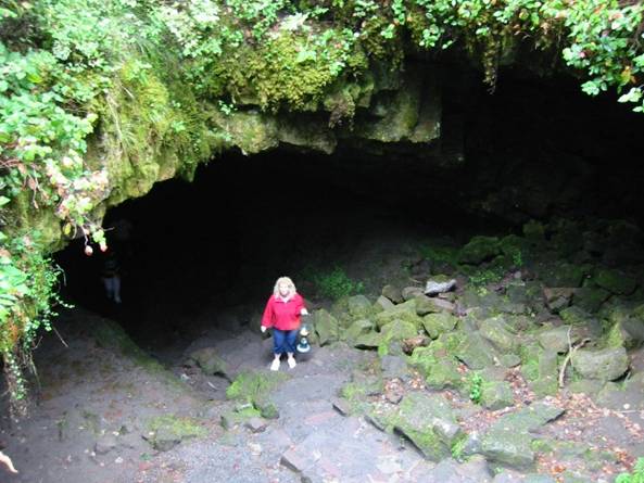
Entrance to Ape Cave
lava tube at the base of Mt Saint Helens.
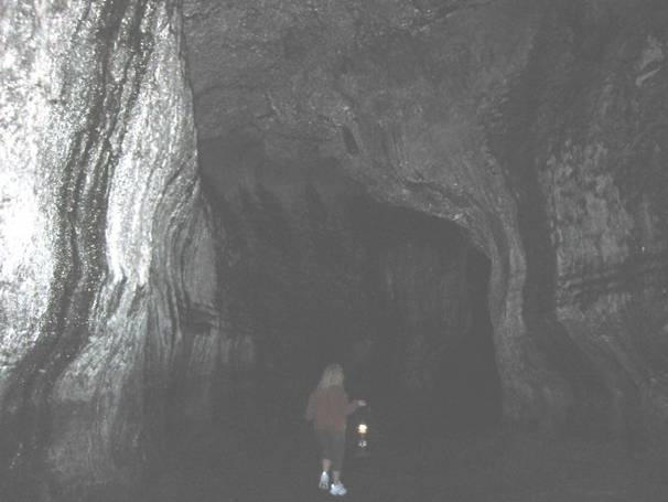
Most of the
pictures I shot in Ape
Cave were completely
black. This one barely shows Cathy with
lantern after significant brightening.
Artifacts from the
1980 eruption on Loowit Trail.
Mount Saint Helens east slope with Ape Canyon Trail in
foreground. The scary no-fall zone is in
center of image. I work up the nerve to
ride it in both directions this time.
Just had to look ahead, not at the 300 foot drop.
Self portrait on
Windy Ridge.
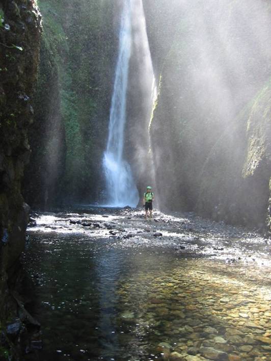
Angels Rest Hiking Trail, Columbia River
Gorge, OR
4.8
miles
1:40
hours hiking time
~1600
feet net gain
We still had a couple hours daylight left before we had to
pack our bags for the trip home the next morning. We decided to do a short, “easy” hike that
was close by. The trail called Angels
Rest fit the bill nicely. We drive over,
only 15 minutes from hotel, and begin hike with no water or food. The trail was wide and smooth for the most
part, but very gnarly in a few spots, especially near the overlook up top. Not having enough to eat since my hard St. Helens ride, I bonked horribly half way up. Almost bagged the rest of the climb. We slowed way down and eventually reached the
top, but we were both soaked in sweat.
The view from up top, 1600 feet above the river, was spectacular. Well worth the hike.
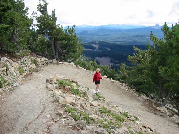
Cathy approaching
the summit of Angels Rest lookout. Most
of trail was smooth, easy hiking, unlike what is shown here.
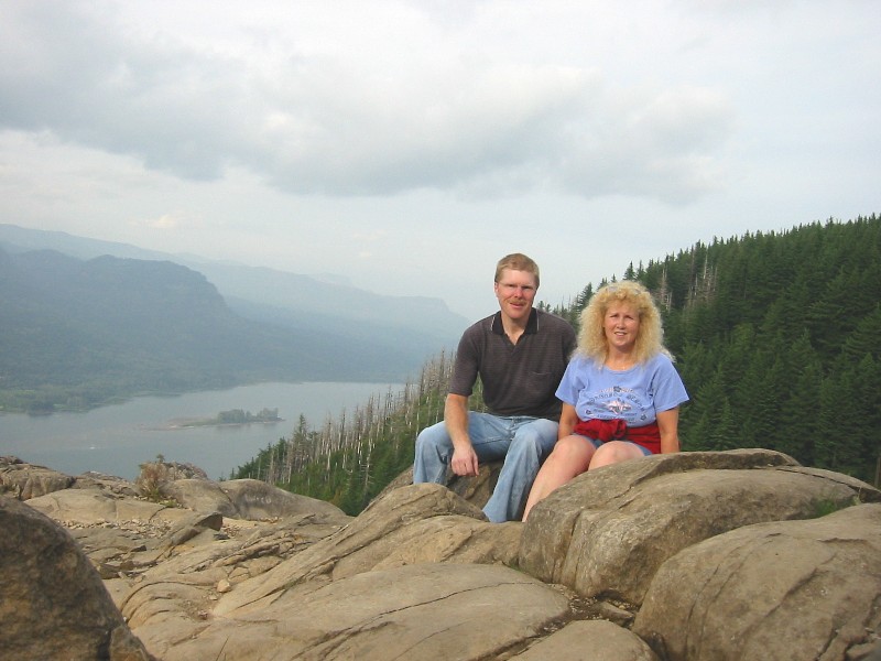
Last picture of the
trip. Set camera on rock and did the 10
second thing as nobody else was up here.
The Angels Rest vista provided fantastic views both east and west of the
Columbia River Gorge from 1600 feet.
Summary
This trip was my best to date. A pure vacation, not a few days added to a
business trip deal. Plus Cathy was
along, unlike most business trips, and she enjoyed the shopping, cycling, and
hiking. We couldn’t have asked for
better weather from the typically rainy NW – dry and just right temps. It rained 5 days straight just before we
arrived. We got to see everything we
wanted. I biked and hiked a combined 300
miles in 7 ½ days. I was impressed
enough that we’ll have to come back again, maybe take on one of the very
challenging volcano summit hikes and visit Mt Rainier in central Washington as
well.
Compiled by Doug Jansen, September 6, 2004.