Sunday, August 17, 2003 through Tuesday, August 26,
2003
Trip Highlights
- 12 trail rides
throughout MT, ID, and WA
- 267.6 miles
- 26.9 hours
- 34,100 feet climbing
- 9 distinct riding
locations
- 1 night-time ride with
lights
- 1 day-time ride with
lights
- 1 hike in
- 5 miles
- 1.3 hours
- 600 feet climbing
- Highest elevation:
7,500 feet on Alpine Trail in
- Deepest under ground:
1000 feet on Hiawatha Path rail trail
- Biggest net gain
climb: 4,500 feet from
- Wildlife
sightings: Many mountain goats and
deer, but no bear
- Pre-shipped Dean
Colonel racing mountain bike via FedEx ground to Glacier Cyclery in
Whitefish, MT
Monday, 8/18/03 Big Mountain,
Whitefish, MT
27.0
miles
2:17
hours
3000
feet
Just
getting over being extremely sick night before.
Business meeting ends mid afternoon, leaving just enough time to ride
nearby
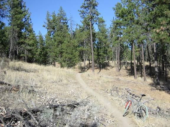
Summit Trail #1
An outside turn you wouldn’t
want to blow.

Big Mountain from
Tuesday, 8/19/03 Lion Mountain
5.2
miles
40
minutes
1200
feet climbing
Finished business banquet around 8pm, just in time to
catch the last of the sunset. Strapped
on HID light, headed to
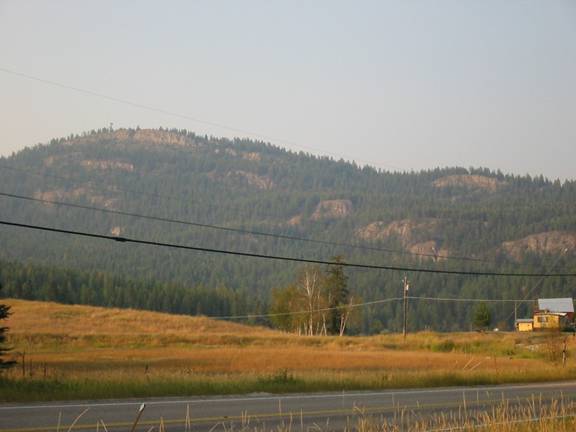
From the southwest on Rt 93, taken on Wednesday evening.
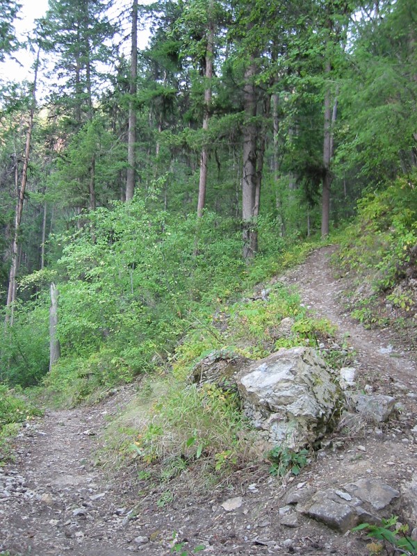
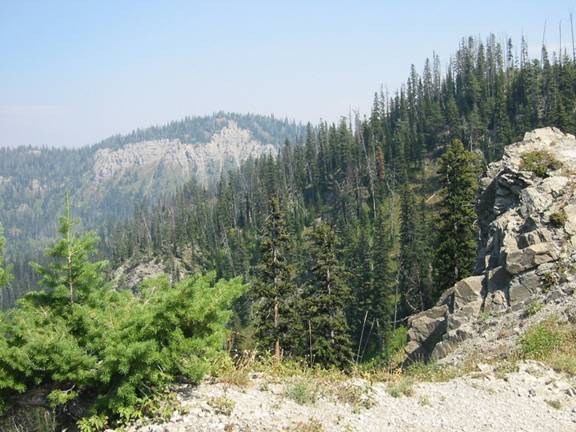
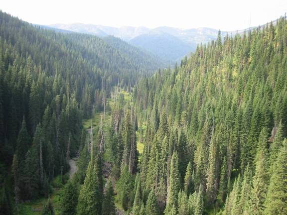
Wednesday, 8/20/03 Reid Divide
Trail, Flathead NF, Talley Lake
District , MT
27.0
miles
2:54
hours
3500
feet climbing
Meetings were finished around 2pm, so just enough daylight
left to get a good ride in. Starting to
feel much better from being sick too.
Headed out towards
Reid Divide
Trail #800
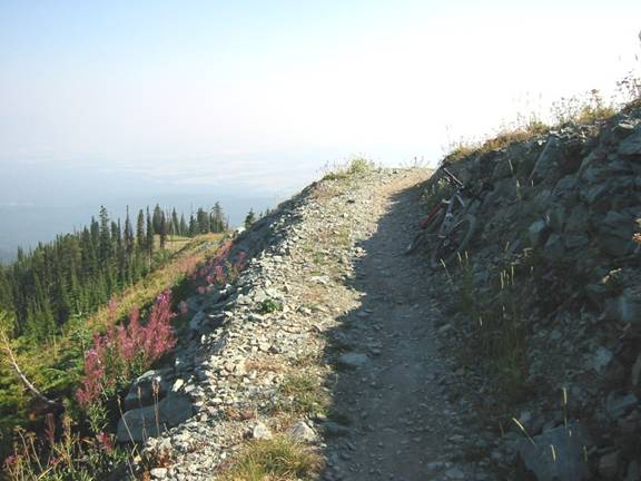
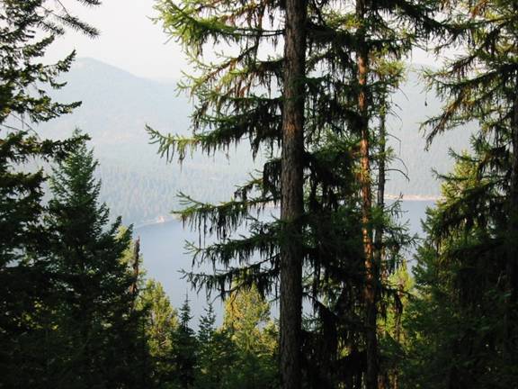
High up on ridge line. Haze in sky is forest fire smoke.
Reid Divide
Trail
Doesn’t look very dry here, but it is. Trees grow very tall and skinny.
Reid Divide
Trail
One of many very
steep, very tight switchbacks on descent to
Reid Divide
Trail
Beginning descent
to
Thursday, 8/21/03 Alpine Trail,
Flathead NF, Swan Lake District ,
MT
44.4
miles
4:31
hours
5500
feet climbing
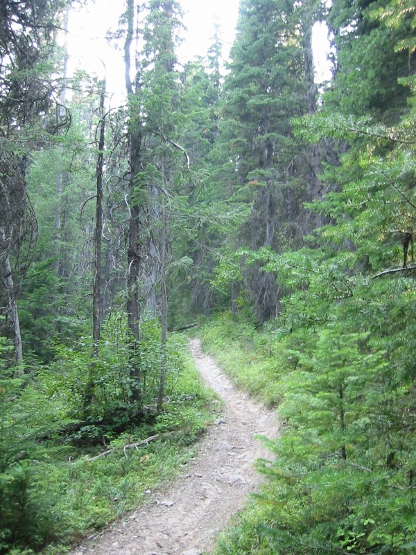
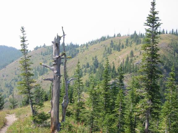
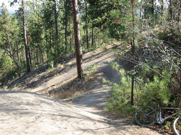
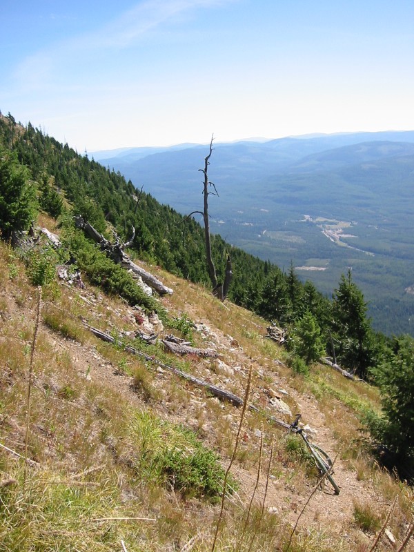
First full day of mountain biking nirvana. Planned this to be my capstone ride day, but where I wanted to ride was on fire and closed due to Tuesday’s lightning storm. This is the same trail in the same Swan Mountain Range, but about 40 miles south of the fires. This was the only piece of Alpine Trail that was not closed, but in fact the trail was on the border of the closure area. Ride started with mostly flat forest road, some heavily overgrown. Once reaching the Soup Campground, serious climbing began to Napa Point. A 10% grade was maintained for about 7 miles. At Napa Point, trail #31 is taken to Alpine Trail #7. Trail 31 had some very steep hike-a-bike sections, but most of it was ridable, and the views were stunning. Upon reaching Alpine Trail, increasing amounts of hike-a-bike grades were encountered. It was warm, 22.3 miles registered on odometer, and water was very low. I reached about 7,500 foot elevation on Warrior Mtn before deciding to turn back. Even though it was less miles to keep going, the ridge line was chocked full of numerous 200 to 500 foot hike-a-bike ups and downs. Estimate to complete was 4-6 hours, and I had only 1 hr of water left. I left with 128 ounces. After hiking and riding back to Napa Point, the 4500 foot descent was fully satisfying. The ride to Trail #31 alone was worth it. Truly unique singletrack with views and exposure (near cliff steepness edge riding) to go with it.
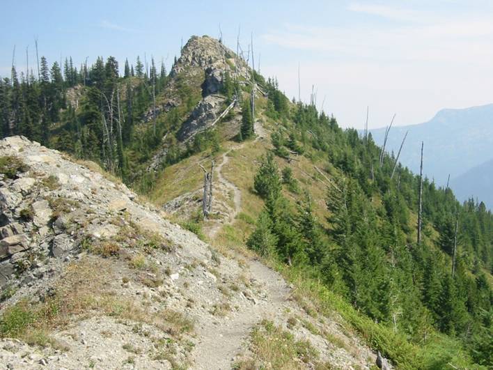
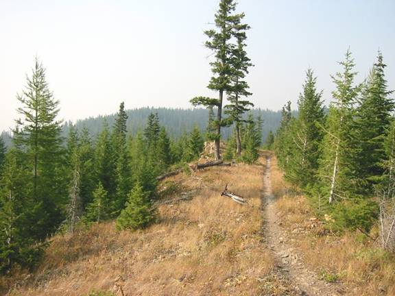
Trail #31
Hard to watch where you are going with scenery like this. Grades to side were so steep in places that you would almost certainly go for a slide or very long tumble if you slipped off trail. At these higher elevations, air was much clearer and the sky started to look blue.
Trail #31
Trail meanders around above timberline at 7000+ feet elevation.

Trail #31
A particularly steep section. Wildflowers as far down as you could see. Smoky.
Trail #31
Friday, 8/22/03
Ride #1: Lone Pine State Park ,
Kalispell , MT
19.0
miles
1:49
hours
1500
feet climbing
Semi-recovery day.
44 miles day before wiped me out good.
Ride #2: Big Mountain Ski Area,
Whitefish, MT
15.3
miles
1:40
hours
2500
feet climbing
The short, mostly pavement ride didn’t quite hit the spot in the morning, so I headed back to Whitefish (only 15 miles away) to do the easy 7.6 mile singletrack to top and back. Easy climb, but wicked fast bomb back down for good adrenaline buzz.
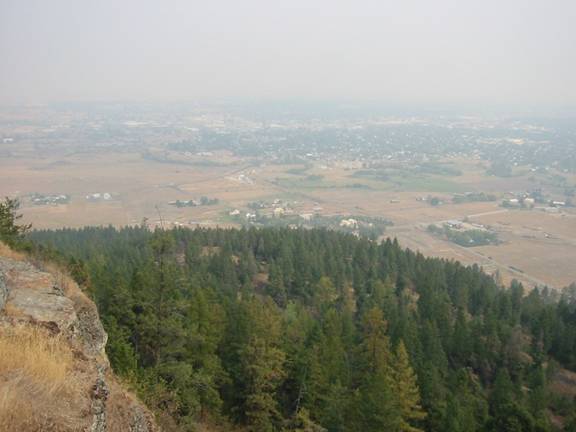
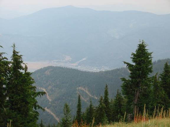
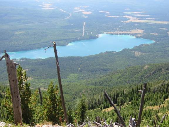
Kalispell from
Lone Pine SP Summit
A very smoky day,
perhaps worst of trip.
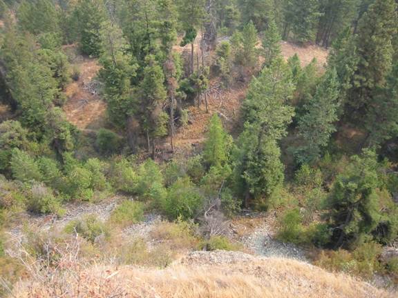
Singletrack 200
Feet Straight Below
Saturday, 8/23/03
Ride #1: Silver
Mountain Ski Area, Kellogg , ID
25.4
miles
2:31
hours
4200
feet climbing
Did not plan to ride here.
Was planning on riding Canfield in
Ride #2: Beacon Hill, Spokane , WA
15.1
miles
1:49
hours
1800
feet climbing
Didn’t plan on riding here until Sunday morning, but had
many hours light left and legs weren’t trashed yet. So I squeezed second ride of the day in. If you’ve ever been to the trails at a place
called
Gradual Climb Up
Air here was more hazy than smoky. Mostly overcast skies. Was raining in Kalispell.
Kellogg and I-90
Below from Near
Was very windy and cold up here.
Doug at
Was a blast to bomb back down this to town in background.
Beacon Hill,
Zero smoke and clear skies here. Only ride with these conditions.
Lots of this stuff here, often on bare rock, making it extremely fast.
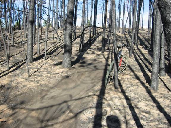
Huge area, was hot fire, soil was like talcum power.
Sunday, 8/24/03
Ride: Route of the Hiawatha Rail
Trail, Taft , MT /Pearson , ID
36.2
miles
3:00
hours
2600
feet climbing
Did not plan to ride here either. When I drove out to
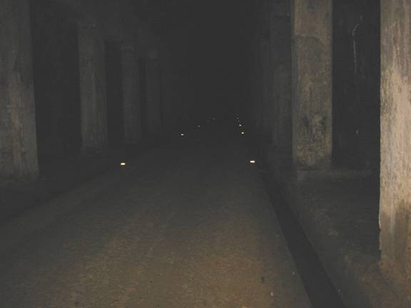
Reflectors kept you out of gutters which carried rushing water to entrances.
Valley View from
One of the Trestles
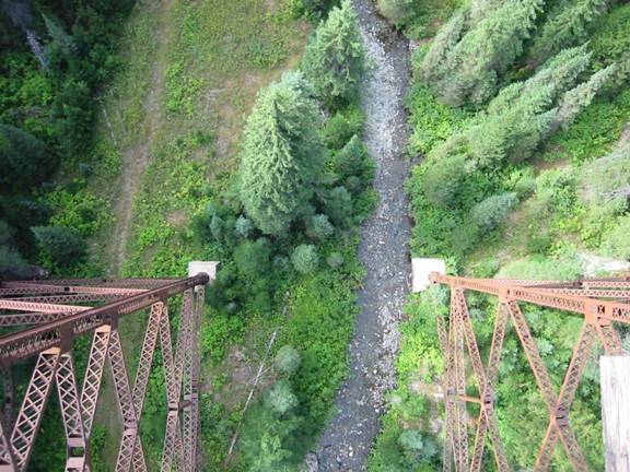
Looking Down at
Stream from Trestle
Trees are probably >100’ tall. Made me queasy.

Roland Summit
ATV Trail
Follows MT/ID State Line on Ridgeline at 5000 to 6000 Feet Elevation.
Sunday, 8/24/03
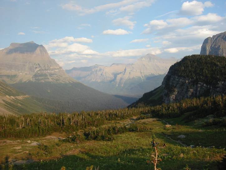
Hike: Glacier National Park , MT
5
miles
1:15
hours
600
feet climbing
Was able to get into Glacier
National Park Flathead Valley Logan Pass Grand Canyon national parks. I parked at Logan Pass Hidden Lake
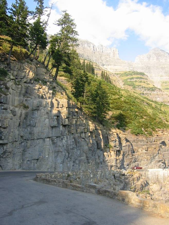
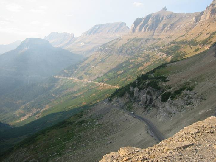
Going to the Sun
Road
Very tight, little guardrail protection with shear drop-offs.
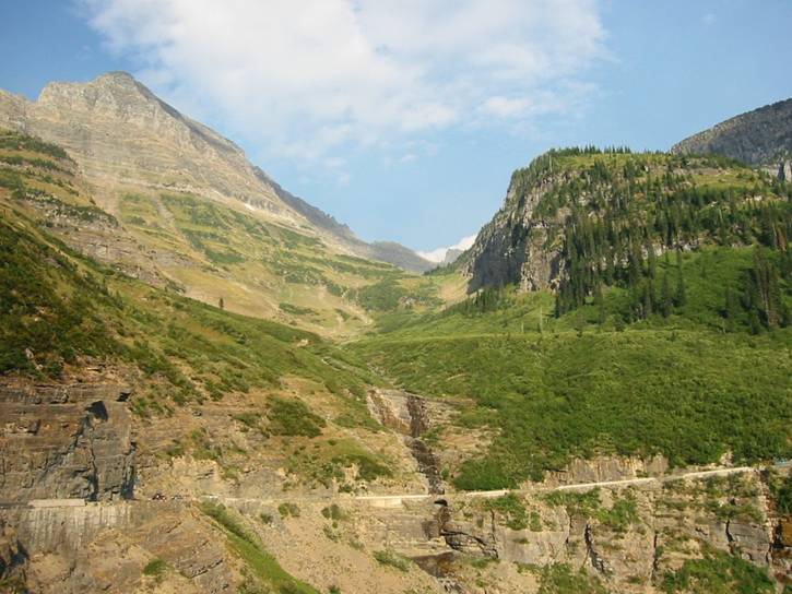
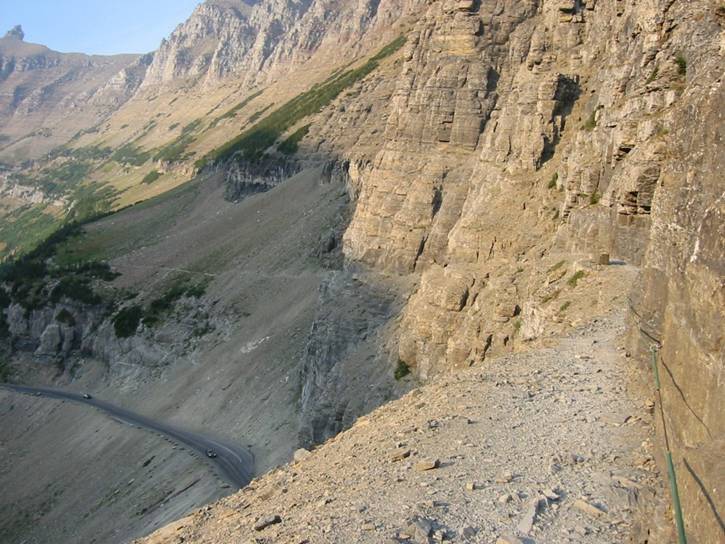
Weeping Wall
along the Garden Wall from Going to the Sun Road
Garden Wall
Trail
Going to the Sun Road 100-200 feet straight down from narrow hiking ledge.
Garden Wall
Trail
Zoom-in showing narrowness of trail and cable to hold on to. The wind blows with considerable force here, and I had to lean against the rock to be steady enough to take photo.
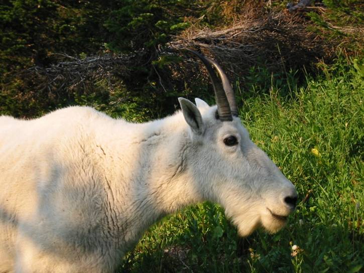
Mountain Goat
along the Garden Wall Trail
Didn’t quite like the way she was looking at me. The young’n was nearby, and these things are quite big with sharp horns. Quite tolerant of tourists though.
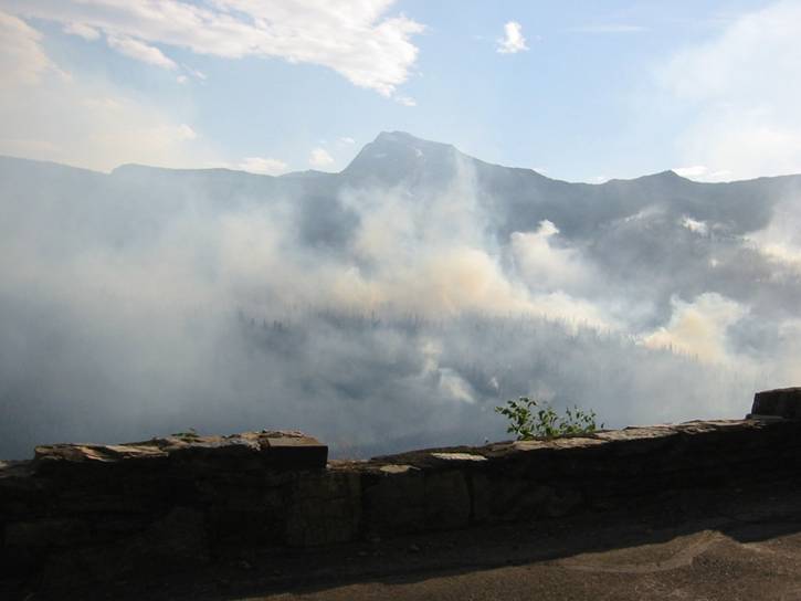
The Robert Fire,
from Going to the Sun Road
On ride back down, saw huge flare-ups of big trees going like blow torches. Would shoot a narrow column of flame 100-200 feet into air for several seconds, then tree would be spent. Was some of the most impressive natural phenomena I’ve seen.
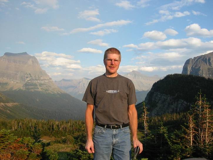
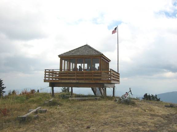
Had to get a shot of me framed by the pass.
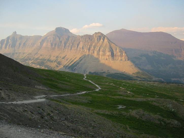
Hidden Lake
Trail Looking Down from the Continental Divide Above Hidden
Monday, 8/25/03
Ride #1: Mt.
Marston , near Eureka
25.6
miles
3:27
hours
5200
feet climbing
Rode here on recommendation of the good folks at Glacier
Cyclery in Whitefish. Since my planned big ride in the
From parking
area. Looked a lot like
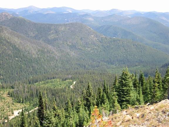
Road Up to
Followed stream in valley bottom until last few miles.
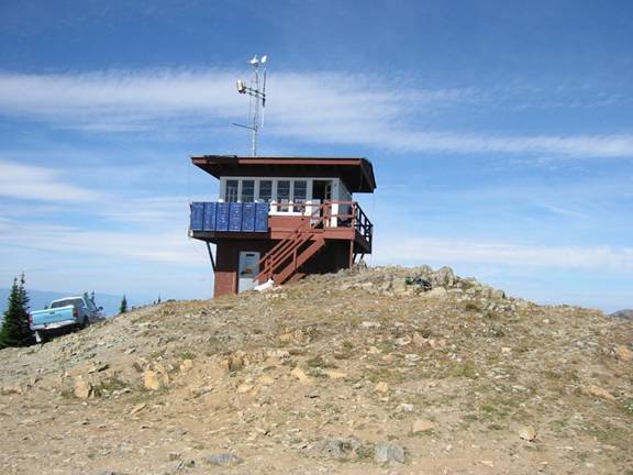
Ranger lives up here for whole season. Her dog really wanted my Clifbar.
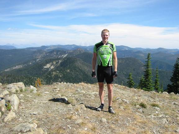
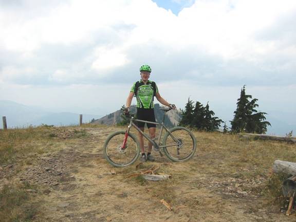
Myself, Shot
Towards the North
Canadian Rockies forest fire plum visible off my right shoulder.
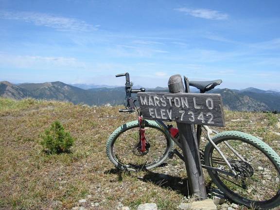
Proof
TopoUSA digital maps never agree with these things.
It is way more radiant turquoise than photo captures.
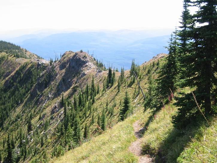
Patrick Ridge
Trail #860
Some scary steep stuff here. Views every way you looked were just incredible.
Patrick Ridge
Trail on Steep Descent
These switchbacks were impossibly steep for me to navigate. Slope at steepest part of switchback had to be 100% (45 degrees). I couldn’t even walk on slope-side to take this picture without using my hands. If you started sliding, you might never stop.
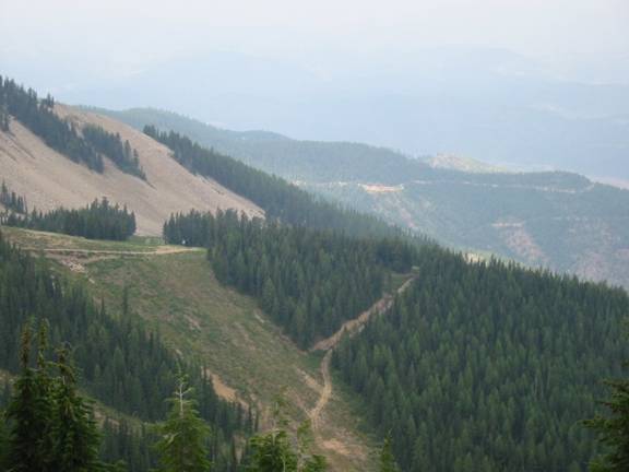
Ride #2: Big Mountain Ski Area,
Whitefish, MT
15.3
miles
1:33
hours
2500
feet climbing
With visibility so good, I just had to swing by
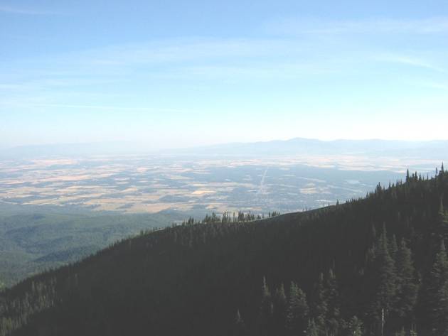
The
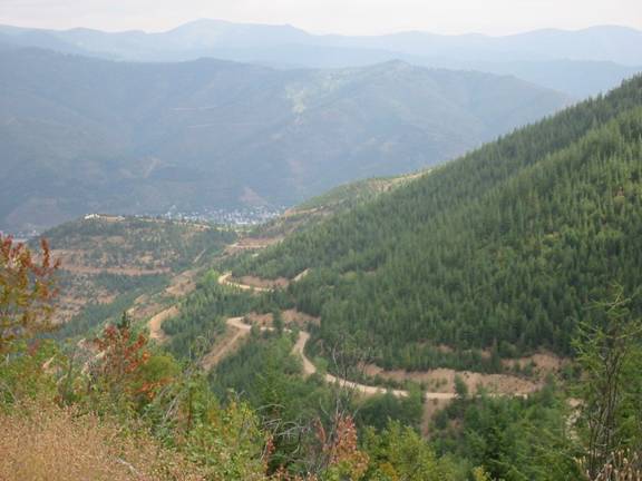
Whitefish is at base of mountain in foreground, Kalispell is at base of mountains off in distance down Rt. 93 heading straight away. Much of the valley was and still is ranch land.
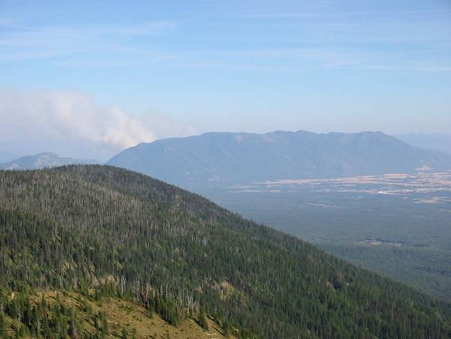
The
The plume of smoke
going up is from the Beta/Doris forest fire complex. My planned capstone ride for the trip was to
ride up Strawberry Mountain on the right side of image, ride the length of the
ridgeline shown in photo (about 20 miles), then come down Columbia Mountain
where the smoke is going up. Would have
been about a 45 mile ride, including road back to car. Unfortunately, a dry lightning storm moved up
the length of the range, starting over a dozen new fires on Tuesday evening. By Wednesday morning, the forest service had
closed the whole area to all use. Not a
big deal.
Tuesday, 8/26/03
Lone Pine State
Park , Kalispell ,
MT
12.1
miles
1:03
hours
900
feet climbing
My final ride of trip. Smoke was back after a near perfect day on Monday. Went back to Lone Pine for a short, time-wise safe ride before having to box up bike and head to airport. Hit some different bits of singletrack this time. Small park, but just fine for short ride right from town.
Trip Summary
Despite heading out while still sick and riding
opportunities being limited by fire closures, the trip was as good as any of
the others I’ve been on such as Moab, Tucson, SoCal, and the Badlands. There’s a chance I might get out there again
(company business, of course), so what couldn’t be ridden this time will get
ridden next time. This happened in
SoCal. When I went out in November, the
entire