Maah
Daah Hey MTB Trip Report
May 29-June 3, 2003
Trail Riding
MDH
Day 1:
MDH
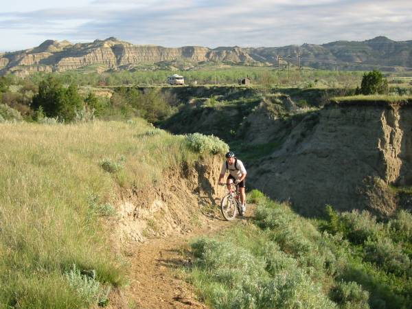
Day 1, May 30, starts off with very nice weather. Little chilly in morning. Dry trail conditions. All five of us start off after carbo-loading
on bagels, Wheaties, and fruit. Scenery here reminds me of scaled-down
Riders: Randy Bailey, Brandt Bailey, Jerry Horne, Dan
Mills, and Doug Jansen
RV
Support: Richard Bailey (Randy’s dad)
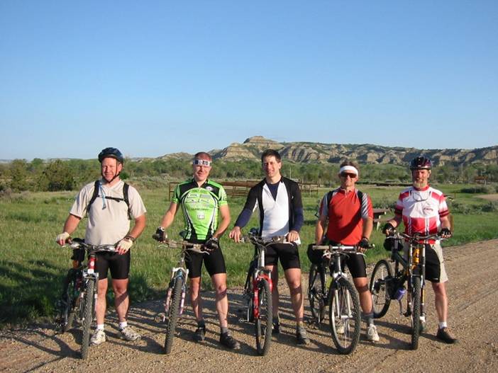
MDH Team
From Left: Brandt, Doug, Randy, Jerry, and Danny. Just after sunrise.
Brandt on first
climb of the ride. RV on
overnight CCC campsite at
north
trailhead in background.
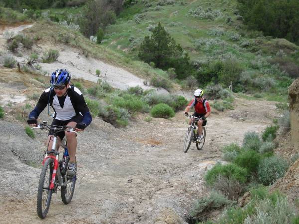
Randy and Jerry
on very steep section.
Jerry sheared derailleur shortly after this.
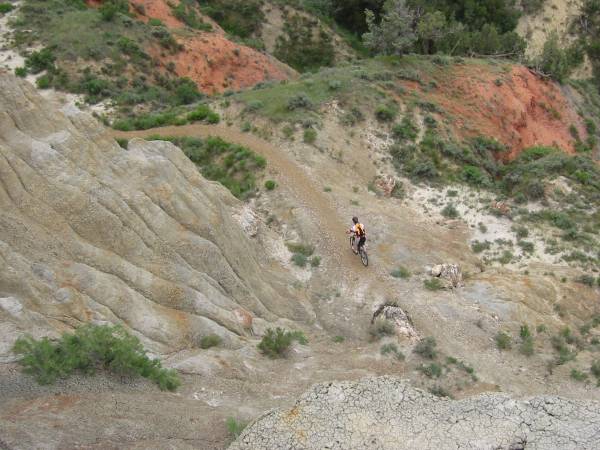
Danny straight below after
switch-backing around and down.
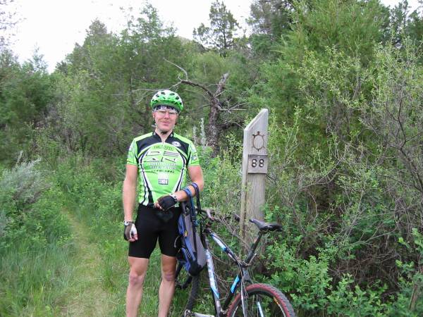
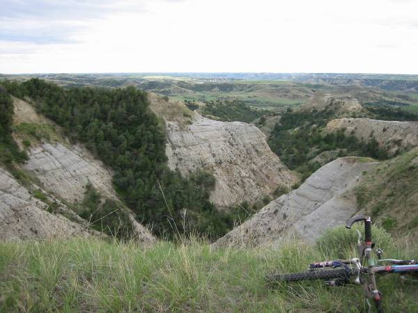
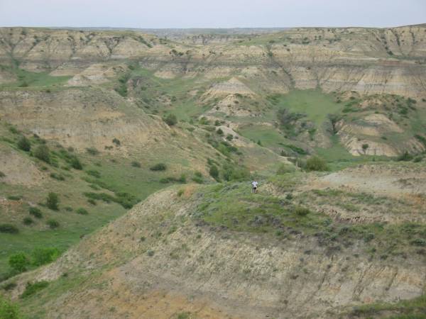
Mile marker post 88 was at border of Northern Unit of Wilderness Area.
Had to pay rancher off to
cross his land adjacent to wilderness. Bikes are not allowed on the 1.5 miles of MDH
in the wilderness area.
Jerry on Devil’s Pass.
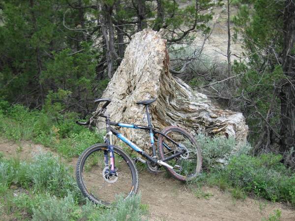
One of several petrified
stumps along the MDH.
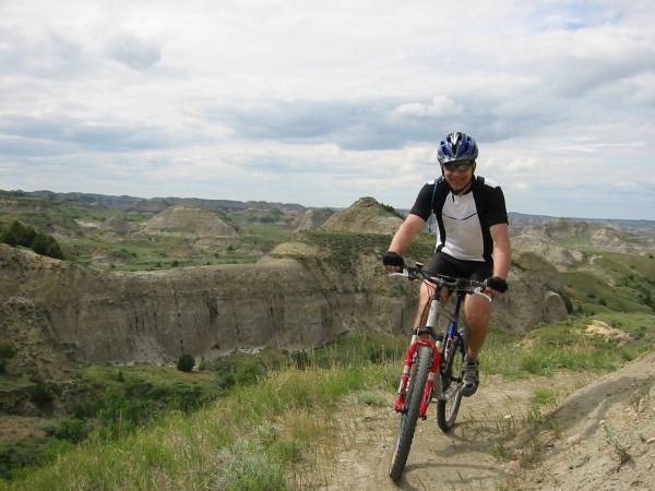
Randy cruising along high up
on a rim.
View near half-way mile post
49.
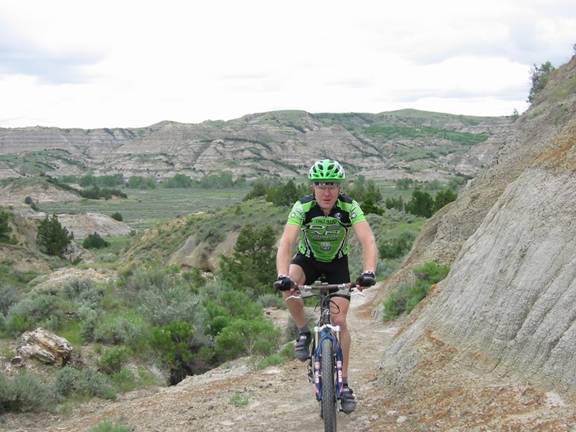
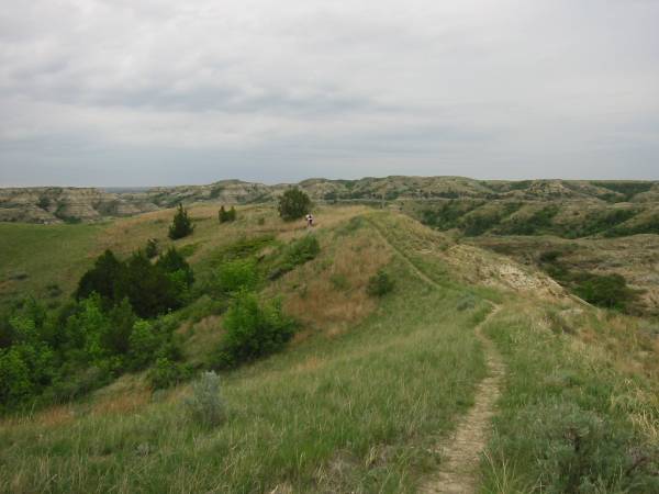
Doug on bench-cut
singletrack.
Randy “power spraying”
Summary
of MDH Day 1:
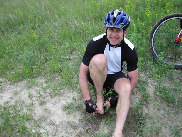
There was one (confessed) crash, where Danny caught tire
in washout. Some pretty nice road rash
to show for it. Jerry caught rear
derailleur on side of cut-in cow trail, bumping it into spokes, completely
sucking it in and wrapping it around wheel.
Had to pick up loose pieces off ground. We converted bike to single speed. Fortunately, we were only 1.5 miles from
RV. Unfortunately, it was all uphill,
and this mishap dashed Jerry’s attempt to ride the entire MDH in two days. Jerry was back online after running into
Medora for repairs and was able to get in another 20 or so miles later in the
day. Danny “hit the wall” pretty hard 35
miles or so into the ride and decided to hole up in Grassy Butte for later pick-up. I think he met the whole “town” while he was
there. Doug, Randy, and Brandt finished
the day unscathed. Doug and Randy
completed the first 60 miles of the MDH, with Brandt cutting out early with a
little less mileage. Just after crossing
the Little Missouri, we spent the night in the RV at
MDH
Day 2:
MDH Day 2, May 31, starts off chilly, with heavy
overcast. This was supposed to be the
nicer of the two days according to forecasts, but it turned out to be a wet
one. I’ve read the stories of what
riding on Bentonite clay is like and thought they
were exaggerated. Not anymore. Doug, Randy, Jerry, and Danny started the day
from the
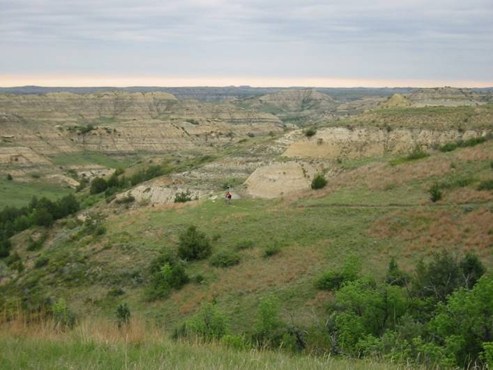
Bombing down ribbon of
singletrack. Day 2 was characterized by long
sustained climbs followed by long flowing descents. Lots of fun and very fast. Note the clear skies are receding on the
horizon.
Danny coming up one of the
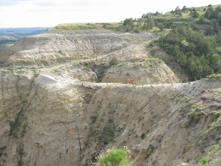
very scenic climbs. The canyon
below is at least a couple miles across.
Singletrack along high ridge
line. Very hard to
stay on the trail because you just have to look around. Overcast is building. Light drizzle started at this point.
Summary
of MDH Day 2:
The
day started off dry and chilly. Used
insulated long sleeve jersey. Saw first
rattler ever in the wild too. Was riding 20 feet or so behind Randy, when Randy hit or nearly hit
the rattler coiled up in trail.
He never saw it, but he startled it, it moved into defensive position,
and I barely missed it myself. Was
pretty good size, maybe a 3 footer.
Stopped taking photos once the rain started. Didn’t want to get the
digital camera wet. A few miles
before the next RV checkpoint, the Bentonite was
getting slick. I came very fast down one
of the descents, grade began to taper off and trail straightened out, so I let
go of brakes. Only thing was, the trail
was slipperier than ice. I went down
hard at high speed driving knee into the rock hard clay (only top few
millimeters were softening up). Took a while to get back on bike. After several more minutes of steady light
rain, the trail became completely unridable. Jerry’s brakes were packing up so thick, his
wheels wouldn’t even turn. With my disk
brakes with greater brake-arch clearance, the clay was extruded to exactly the
shape of the fork brake arch, or about 3” wide and maybe 4” around rim into
spokes. Each wheel had to weigh at least
10 lbs! Even when we could ride on the
more gravelly spots, the clay packed into drive trains would cause immediate
chain suck. We pushed/carried our bikes
to the next road, and fortunately the RV was waiting there instead of 3 miles
further up like they were supposed to be.
The wrong turn worked out in our favor.
With about 20 miles for the day, we came up about 20 miles short from
finishing the MDH. We loaded up the RV
and headed back to Bismark.
While
driving up out of the
Despite
the disappointment of not completing the trail, the MDH was a very fun
ride. The North Dakota Badlands are now
on a short list of totally unique places I have ridden, ranked with Saguaro
cactus desert in
MDH
Two-day Ride Stats:
92.7
miles
11
hours, 56 minutes
4500-5000
feet climbing
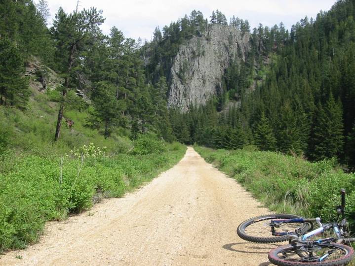
Mickelson
Rail Trail, Deadwood,
Sunday, June 1: After spending the
night at Randy’s (and chowing down on some more of
Randy’s Mom’s great cookin’), I head off to the Black
Hills of South Dakota in a Chrysler PT Cruiser rental. Forecast was bleak, calling for rain and
T-storms throughout the day. So I played
things conservatively and stuck to the Mickelson Rail Trail. This 107 mile long trail runs the length of
the Black Hills in SD and has a groomed,
gravel surface. I picked up a room at a
Super 8 Motel, right on the trail. Headed off on my bike, first stopping to pick up a $2 pass at the
bike shop one block away. Weather
was partly sunny at first, then quickly clouded over, then poured for 40
minutes when I was 8 miles out. It got
so cold out I could see my breath, and I had no warm clothes. I froze.
Once the rain stopped, it became partly sunny again. I went 32 miles out, cresting at about 6250
feet at the high point
Since I spent way more time out on the trail than I anticipated, I ran out of food and water. I never bonked so bad before. Even the 16 mile descent, mostly coasting, was difficult. All I could think about was the Little Debbie snack Randy’s mom put in a snack bag for me. It was in the car. As I approached the motel, the sky grew dark again. I no more than packed the bike and jumped in to eat the snack, the sky opened up again. This time I didn’t care. Had a nice room there, right above a white water stream. Opened the window, and the rushing water drowned out all other noise. Slept very well that night.
Ride
stats:
65.3
miles
4:33
ride time (14.35 mph avg)
Approx.
3100 feet climbing
6250
feet peak elevation
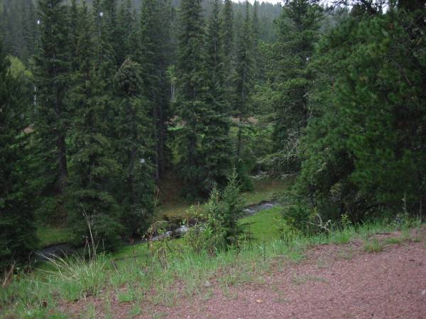
Standing under fir tree
during first heavy down pour.
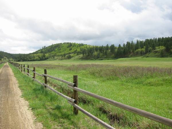
After first down pour, on 18 mile descent, same area I got caught in second storm on way back.
Many views like this on the
Mickelson. There were also a couple of
short tunnels through solid rock that I rode through. Trail follows a white water stream most of
the way down, not quite visible on right-hand side of photo.
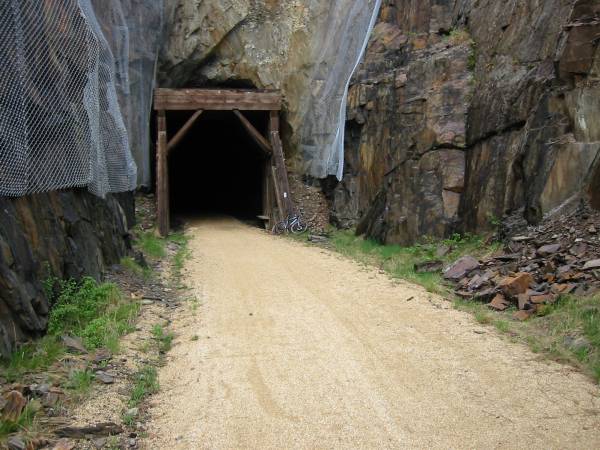
Tunnel “D” on the
Mickelson. Too bad they have to drape
the chain-link fence all over to catch potential falling rocks.
Sundance
Trail System,
Monday,
June 2: After a good night’s sleep in Deadwood (and all-you-can eat diner at
China Buffet in Sturgis), I headed off to
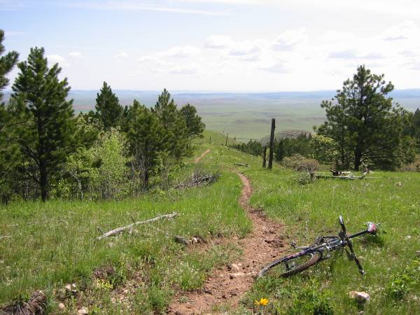
Singletrack part way up. The area was cleared by a forest fire several decades ago, so many of the trails offer open, panoramic views.
The
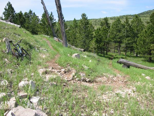
Lots of switchbacks here, and it can be quite rocky in places.
From the summit of
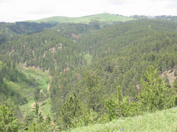
Looking back at
|
From ranger tower at top. |
Snow near summit. |


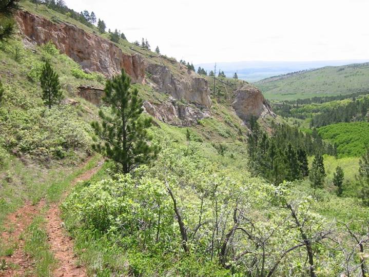
Looking down Ogden Creek Trail. Grueling climb, at times going only 2.9 mph. Had antelope run right in front of me, run up to cliff above, then stand and stare down at me from above. But before I could take a picture, he split. This trail, combined with a little bit of road up top, gains about 1800 feet.
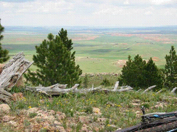
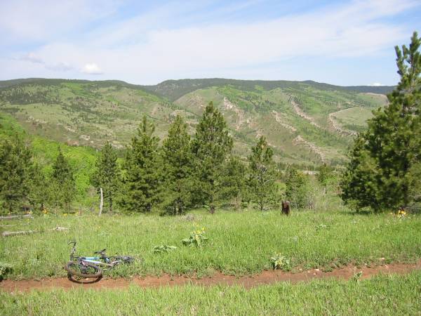
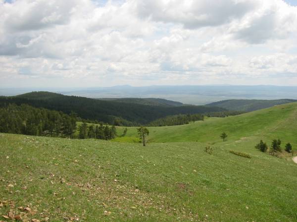
Grasslands of
Ride
Summary:
Thoroughly enjoyed riding here. Never once encountered another trail user. Only saw rangers a couple of times. The
I
finished the ride with a 1600 foot descent back to the car. Started as fire road
bombing, then “expert” singletrack.
Way too much fun. Had the parking lot to myself (as far as I
know, not one other car parked there while I was riding), so I washed up right
there and packed the bike. Shortly after
leaving for
Ride
stats:
31.4
miles
3:52
ride time
Approx.
6000 feet climbing, most of it above 5000 feet
6656
feet peak elevation