Hawaiian Trip
April 15 – 29, 2005
by
Doug Jansen
Trip
Highlights:
- Doug and Cathy from New
Hampshire and Mom Jansen from Michigan
visited Oahu (2 days), Maui (7 days), and Hawaii (The Big Island, 4 days)
- Biked, Hiked, and Snorkeled
- Visited Pearl Harbor, Polynesian Cultural
Center, Maui
Ocean Center,
active lava flow, numerous waterfalls, lava tube caves, Pacific Tsunami
Museum, Road to Hana, Haleakala
National Park, Volcanoes National
Park, and more
- Doug’s cycling summary
- 447.4 miles
- 31 hours, 42 minutes
- 45,080 feet of climbing
- Images captured: 470 with Canon cameras Digital
Rebel SLR and S110
- Traveled with Dean Torreys
Ti cyclocross bike with
disk brakes. This bike can accommodate
wider tires for dirt road climbing.
Not very light, but very comfortable touring.
Oahu
April 16, Saturday Morning Ride on Tantalus Drive/Round
Top
30.3 miles
2:09 hours
3480 feet climbing per S725 HRM
After about 16
hrs total travel time, we arrived in Honolulu
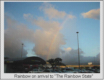
at dusk Friday evening. Walking out of
the airport, we see rainbow over the rental car lot. Fitting for arrival to the
“Rainbow State.” Got up early (6am Hawaiian Time is noon
Eastern Daylight Time) to build bike and get a ride in before driving over to
the Polynesian Cultural Center
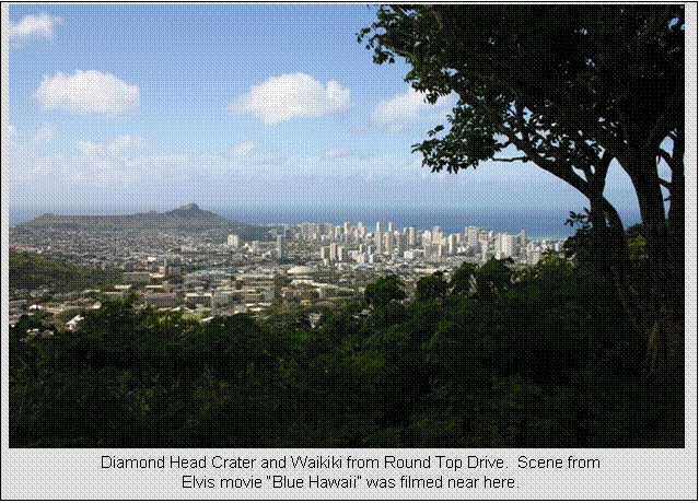
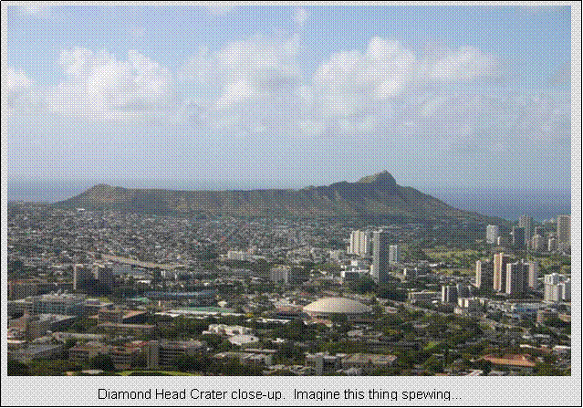
on the other side of the island. Tantalus Drive
rises from the outskirts of the Honolulu
metro area through lush rain forest. It
turns into Round Top Drive
near the high point
around 1600 feet. Round Top offers
spectacular views of Waikiki and Diamond Head
crater. Tantalus Drive is also used in USCF
hillclimb time trials. I did not time
myself on it as I didn’t know exactly where the start and finish lines are, but
I did do two climbs at near race pace. I
felt this might be the only chance in two weeks to get any anaerobic intensity
in, as intensity during the monster climbs I had planned needed to be very
carefully controlled with long recovery periods before and after them. The first time I came down via Round Top and
shot many pictures. The second time I
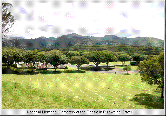
came back down Tantalus to shoot photos from that side. On my way back to Waikiki,
I side tracked over to the “punchbowl,” or Pu’owaina
Crater. The National Memorial Cemetary of the Pacific is located there, and it is
reminiscent of Arlington. Many December 7, 1941 war dead are buried
there. Grounds were meticulously tended. Mom and Cathy toured Waikiki
beach and outlets.
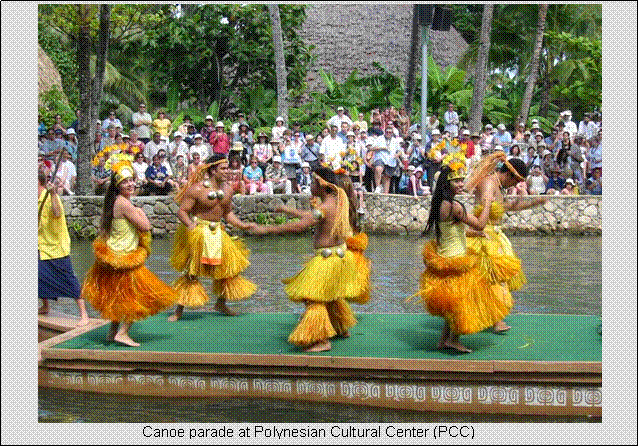
After morning
activities, we drove over to the Polynesian
Cultural Center. It is a touristy thing run mostly by Brigham Young
University students from the Polynesian Islands.
Proceeds help fund students earning degrees. It is claimed to be the number one paid
visitor attraction in Hawaii. Authentic cultural displays from each of the
island nations are represented, such as Fiji,
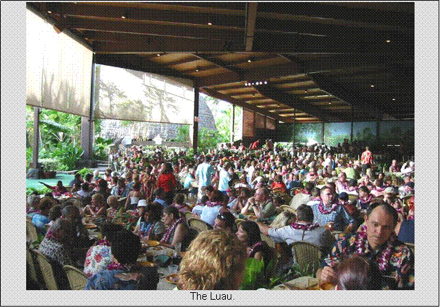
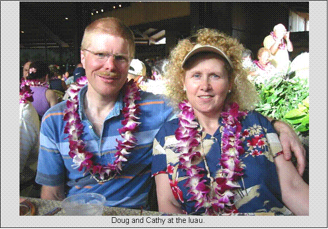
Samoa, Hawaiian, Tahiti, Tonga, etc. We did a package that included the evening
show and luau feast. The presentation of
exhibits and the food were excellent. We
did not stay for the entire evening show which started around 7pm (1am EDT), as
I was getting very tired (and cranky) and had a one hour drive back to
Waikiki. We got back around 9pm.
April 17, Sunday Morning, Pearl Harbor
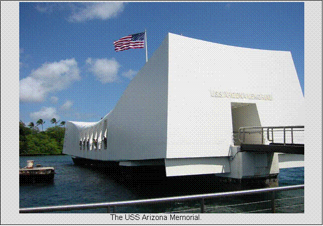
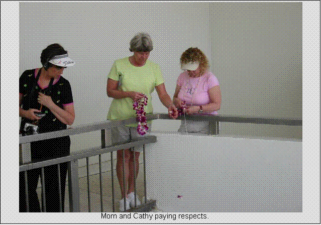
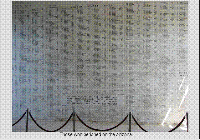
No visit to the Islands can be
complete without visiting the memorials at Pearl Harbor. The Arizona Memorial opens at 7:30 and the
free tickets are on a first come first served basis. It was not particularly busy during this
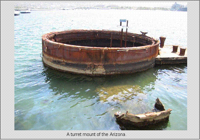
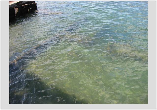
off-season, so we got on the ferry boat to the memorial in about an hour. Pretty solemn place. I never realized the deck of the Arizona is just below
the surface and is visible from the memorial open-air deck. Much above deck was salvaged,
however the remainder of the ship was left intact as the final resting place of
the 900+ sailors entombed here.
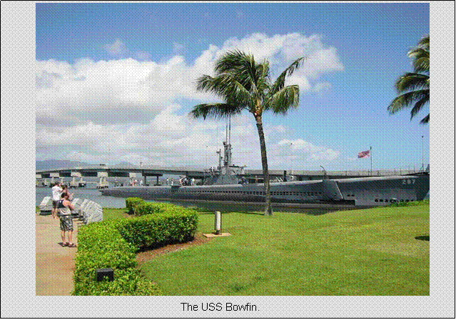
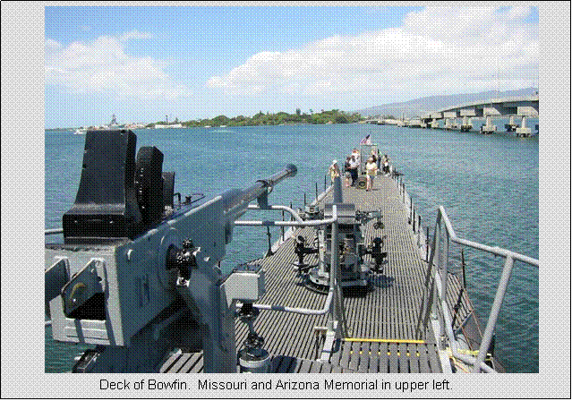
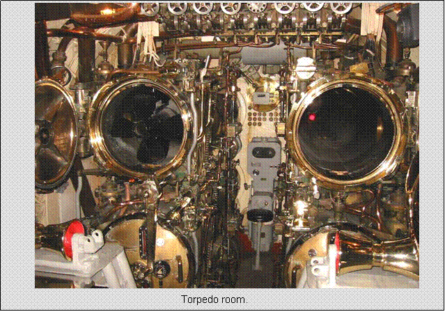
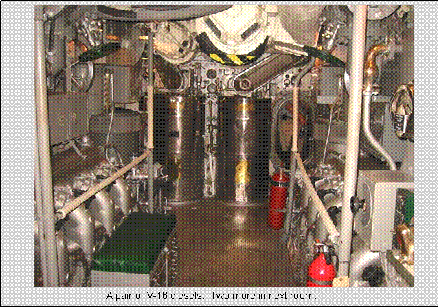
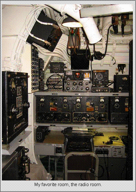
After visiting the Arizona
Memorial, we toured the USS Bowfin Submarine dock at the Arizona visitor facility. It is a WW-II era sub with four 16-cyllinder
diesel engines, plus batteries and electric drive. It is beautifully maintained/restored.
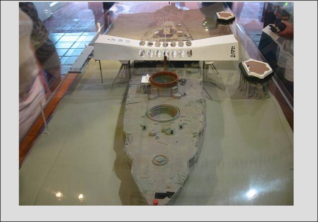
Model of Arizona and the Memorial built
structurally independent of it.
|
|
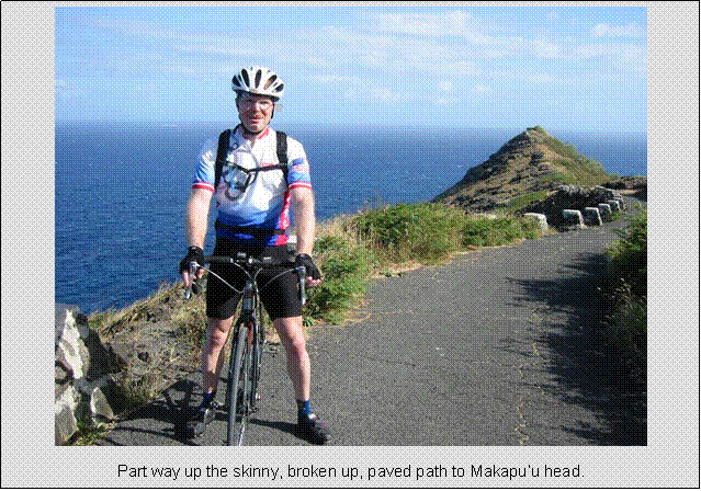
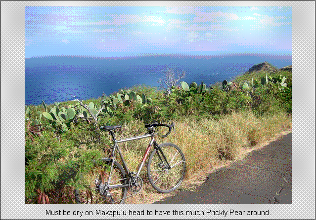
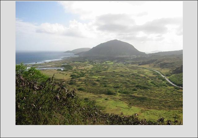
April 17, Sunday Afternoon, East Oahu
road ride
47.9 miles
2:37 hours
3000 feet estimated total climbing
After our Pearl
Harbor visit, I was able to get out for an afternoon ride. I choose to go miles instead of vertical this
time, although I got a liberal dose of climbing in anyway. Seems I can’t pass a hill without climbing it
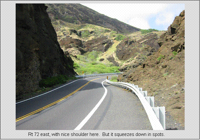
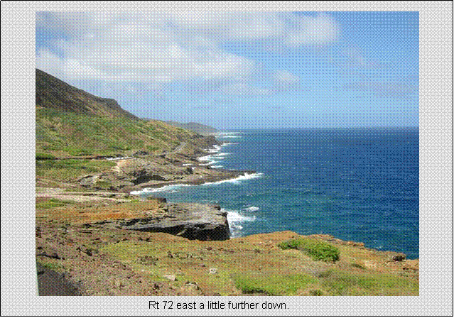
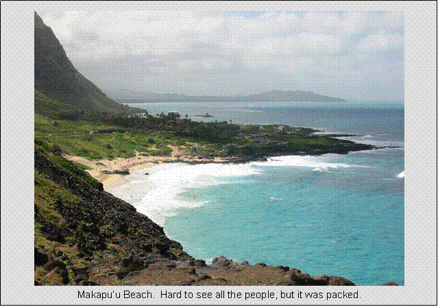
first. I headed east out of Waikiki on Rt 72, wrapped
around Makapu’u Head, to a town called
Waimanalo. Highly
scenic, as most of it was coastal riding. The road was busy however, and in tight spots
there was no shoulder. The trade winds,
which are very strong late in the day, were mostly out of the east. This made for a fast cruise on the way back,
at times 32 mph on the flatter parts. Ended up being a fairly hard ride as I had two days to recover for
the 10,000 foot Haleakala climb.
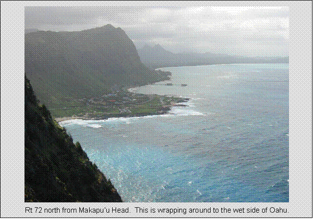
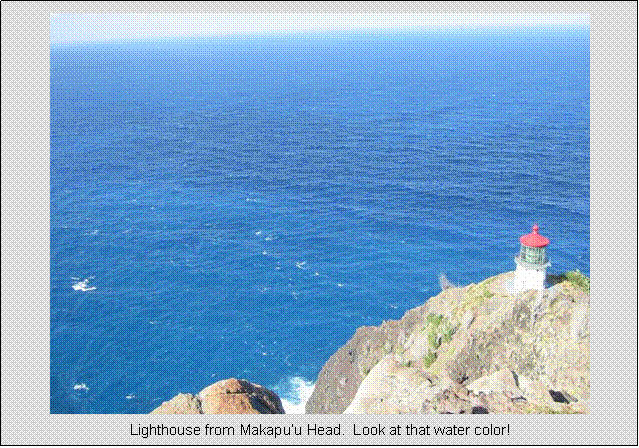
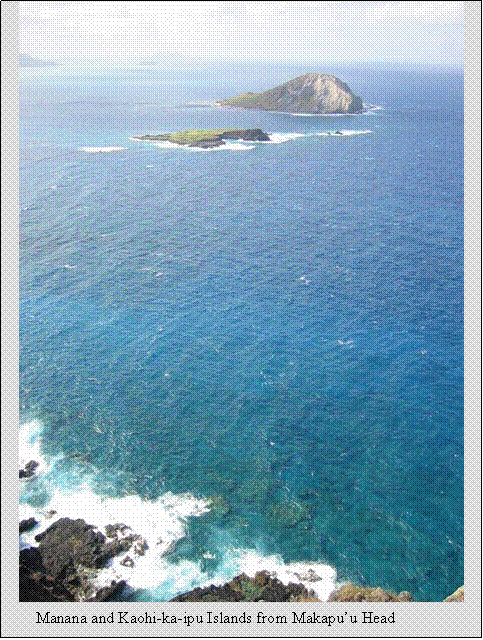
Looking back towards Waikiki,
with (front to back) Koko Crater, Koko Head, and Diamond Head
in the wee distance. From Makapu’u Head.
|
|
Maui
Monday, April 18
Travel to Maui, recovery ride day,
swim
15.0 miles
1:01 hours
500 feet estimated total climbing
We left Honolulu
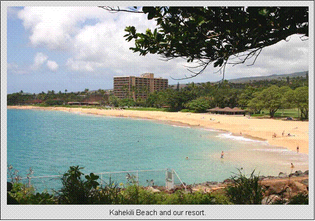
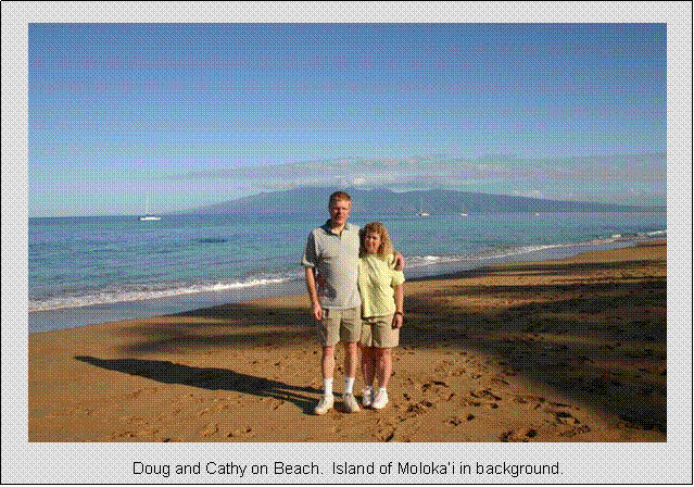
early on Monday to have some time the same day on the island of Maui. Our stay on Maui
was less action packed, so we had more time to relax and check things out. We stayed 6 full days. We were fortunate that our room at the Royal Lahaina Resort was ready in the morning so we could check
in early. I went out for a short ride on
Rt 30 north, but the wind was something else. Even 15mph avg (I
went about 30 back) was harder than I wanted to go. Turned around at Kapalua,
where there was a nice view of the ocean from a world class golf resort. Pineapple plantations along
the way too. Went
for a swim here. Beach and
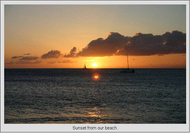
sunsets were spectacular.
Tuesday, April 19
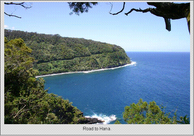
Road to Hana car tour
We reserved this entire day to
drive the famous Road to Hana. This road contours the rainy side of east Maui, a tropical rain forest. Numerous waterfalls and ocean views are found
along this sometimes very narrow winding road.
It supposedly has 617 turns in it.
It might only be 50 miles Kahului to Hana, but
the tour typically takes all day. Our
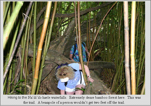
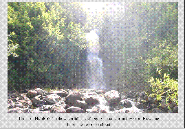
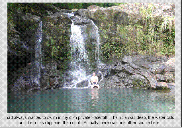
first stop was at the Na’ili’ili-haele Falls. There are four falls here, two of
which are easily accessible. The other
two require some minor “repelling” skills, using a rope to pull yourself up a 12 foot rock face. We opted not to risk it, stopping at the
second falls which had a nice swimming hole.
Even the hike to the first two falls was a bit treacherous from the
road. Steep slippery clay-like soil
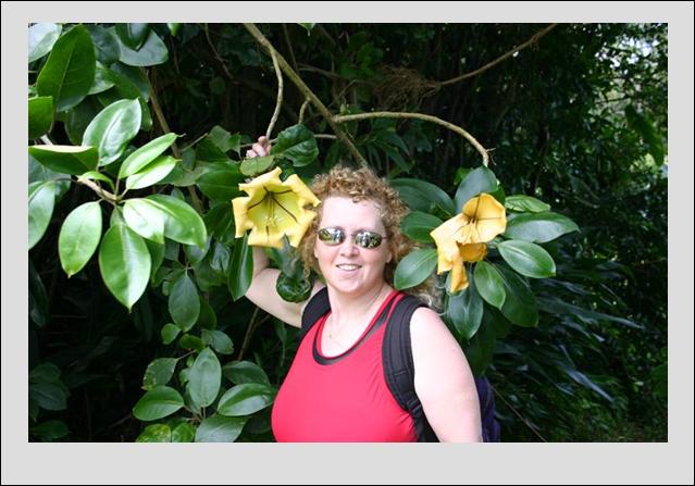
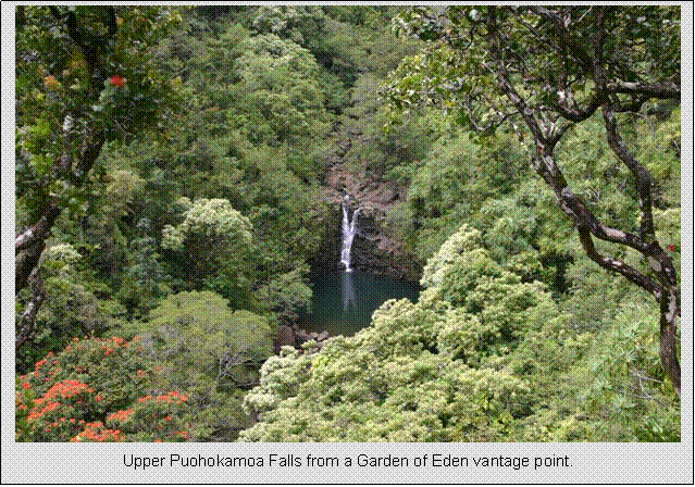
forced use to use bent over bamboo trees as pull ropes. We also hit the Garden of Eden along the way,
located above the valley where the opening scene of Jurassic Park
was shot. We only went a little past
half way on the Road to Hana. Went for a swim when we got
back. Needed to rest and relax in
preparation for the big Haleakala climb the next morning.

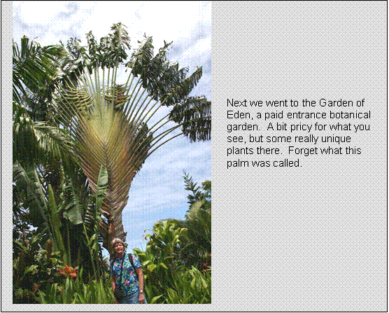
Cathy at the
Garden of Eden.
|
|
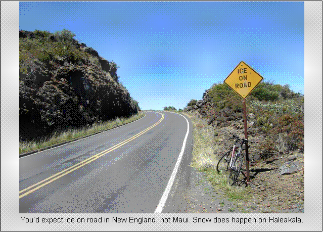
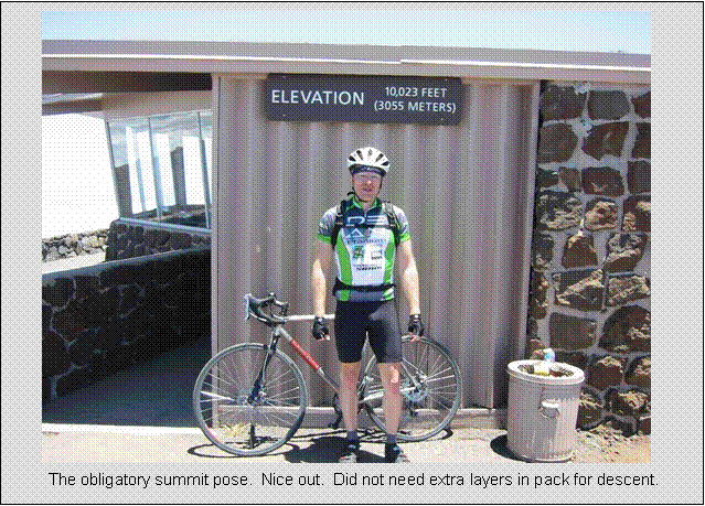
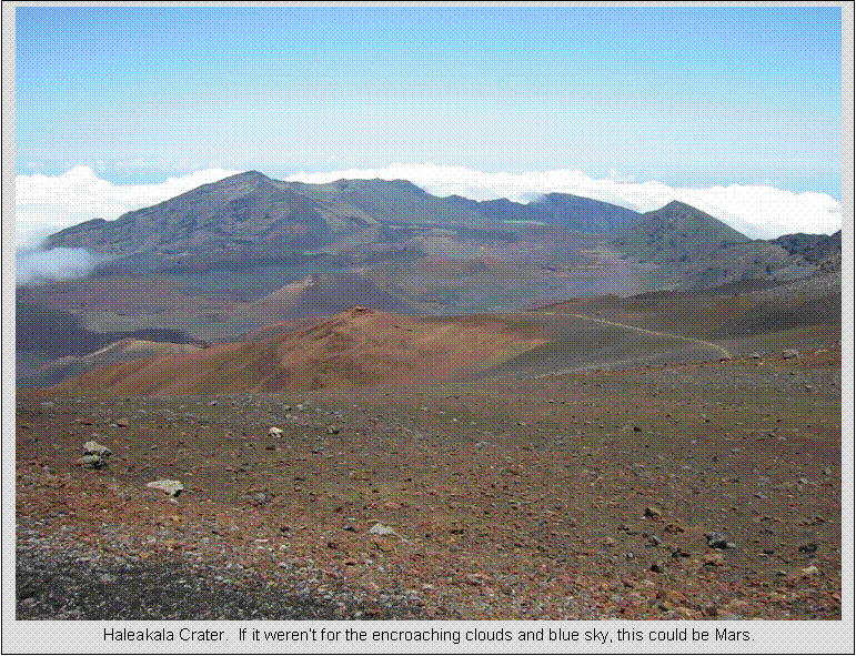
Wednesday, April 20
Haleakala Hillclimb
75.0 miles
5:31 hours
10,000 feet net gain
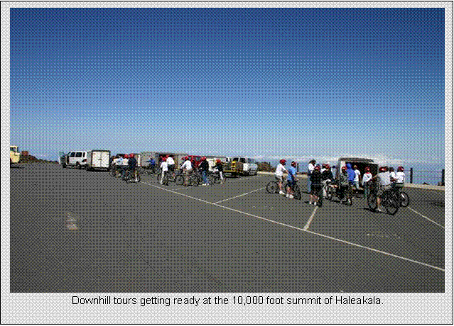
There are several paved routes
from sea level to reach the entrance of Haleakala National Park. I chose to start in Kahului, as my wife and
mother wanted to do the touristy thing of biking (coasting on singlespeed
cruisers with dual drum brakes) down from the 10,023 foot summit to sea
level. I pedaled up while they shuttled
up. 70,000 tourists
downhill Haleakala per year. The
easterly trade winds were particularly nasty that day, steady 30mph, and the
first 10 miles of the 37.5 mile climb was dead into the wind. Thought for sure I wasn’t going to make it,
and when the van carrying wife and mom up passed me a few miles into the climb,
the tour guides said I didn’t have a chance due to how I was already
struggling. But the climbing route
eventually wrapped around into the shelter of the mountain itself, so a good
portion of the remainder of the climb had moderate wind.
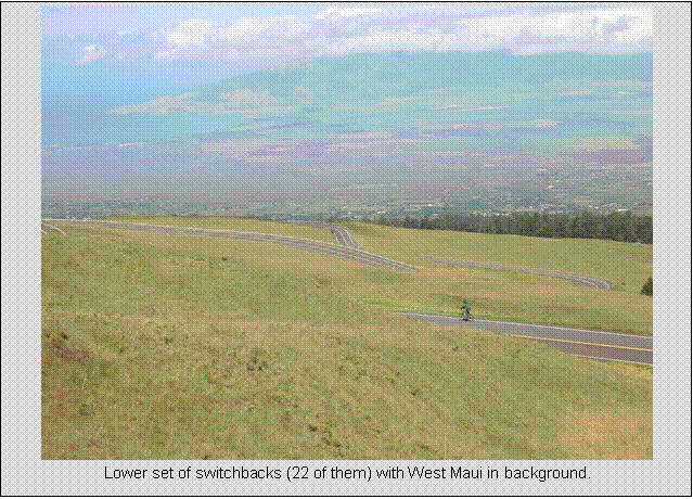
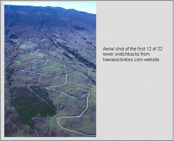
There are two predominant sets
of switch backs, a tight set of 22 leading to the national park entrance, and
another set of about 10 inside the national park. All are above tree line, and the views are
stunning.
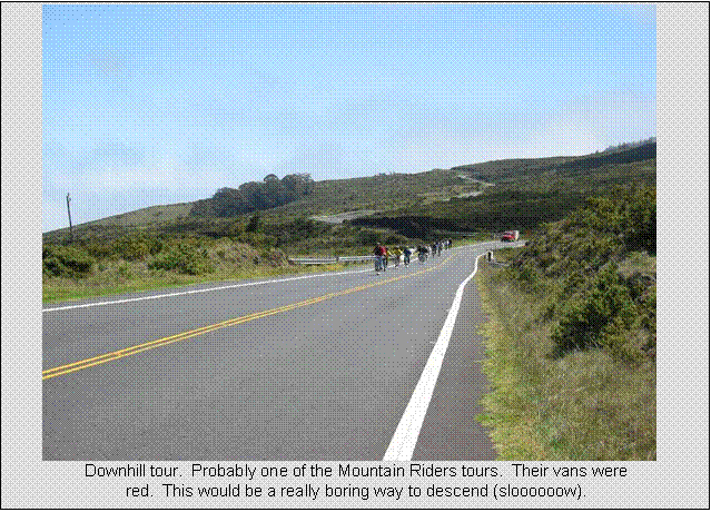
There were at least a few
hundred tourists coming down Haleakala during my climb. All in formation in groups of 10-13, with
bulky Gore-Tex rain gear (crash liability gear) and full face helmets. Looked like astronauts. Tour groups are allowed to descend from the
summit through the national park if they have a guide up front to limit speed
(to exactly 18mph), and a chase van to warn cars coming down of group up front
and to take timid/slow riders down in van.
Individuals like myself have no
restrictions. Just pay $5 and
enter. Got a lot of comments from the
train of folks coming down, like “you’re going the wrong way,” or “you bought
the wrong tour!”
Many of them paid $100+ to go down, while northeast hillclimbers pay
$300 to go up Mt Washington. Non-hillclimbers won’t get it.
I didn’t have any time goals
in mind for the climb, other than around 4 hours. I was on vacation after all. I reached the summit in 4:11 riding time,
having stopped a few times along the way to take photos and eat a snack.
The grade is fairly constant,
between 5% and 6%, and the pavement is perfect.
Near the top, there may have been some 8% grade. There is a claimed 19% section, but I don’t
believe it. This has been my second
climb to 10,000 feet, the first starting at 3000ft, rather than sea level, in Arizona. Climbing at 10,000 feet doesn’t particularly
bother me, other than the expected racing heartrate
and shortness of breath. You go a LOT
slower at 10,000 feet than you do at Mt Washington’s
6,000 feet.
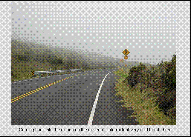
The descent was my most
enjoyable ever. 37.5
miles, monotonically descending except for one tiny blip. Only took me 1:20 to get back to car. I passed a couple cars on the way down. Maui asphalt
is made from lava rock. It is extremely
abrasive, and tires stick like glue to the stuff. Hate to think what kind of road rash it would
produce. I went around some of the
switchbacks at ridiculous speeds.
I had originally planned on
biking down with Mom and Cathy from a rendezvous at 7000 feet. Mountain Riders felt it was best if they
joined the group descending from the summit, where they’d be guided the whole
way. I didn’t know this until they came
blasting by at 8000 feet when I was still climbing. Oh well, at least I got to enjoy a rocket
descent. We got back to the car within
one minute of each other.
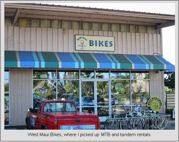
The next day, I rented a MTB,
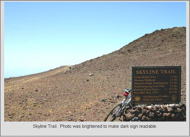
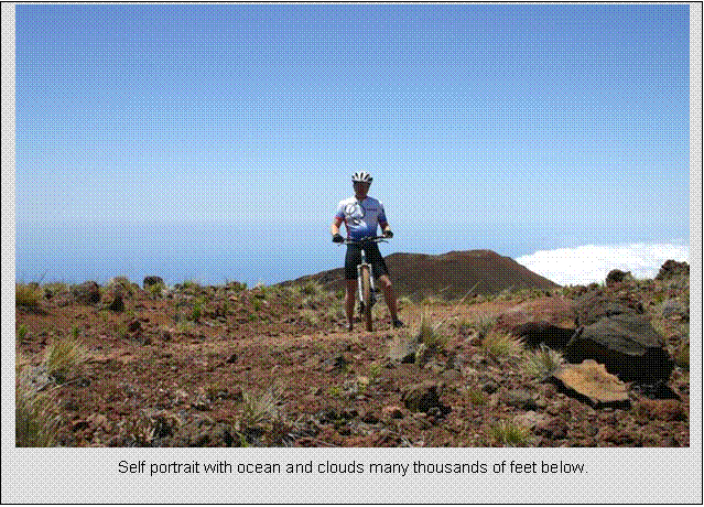
shuttled to summit, and biked down the “other” side of Haleakala. This is Skyline Trail to Mamane
Trail through Poli
Poli State park, about a 7,000 foot descent
with views too surreal to describe. It
follows a moonscape spline of volcanic craters. I rode for an hour before getting down to the
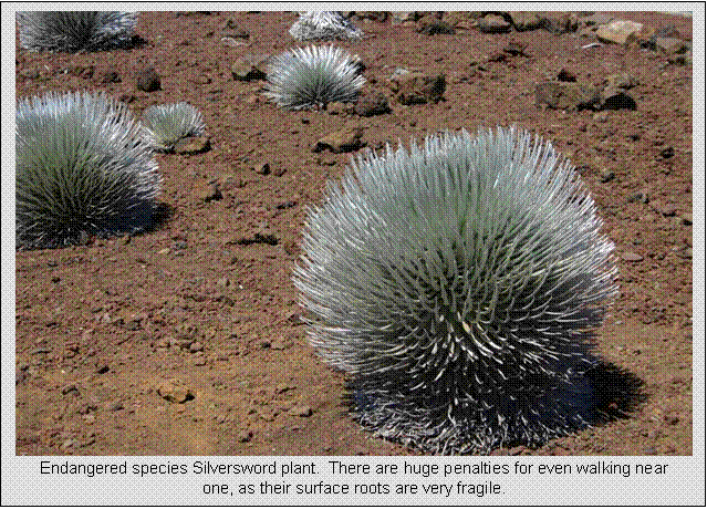
clouds. Mom and Cathy hiked the crater while
I biked, and we later met at 3000 feet for the drive back to Lahaina.
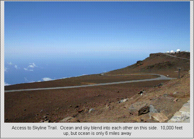
The locals say no where else
in the world can you be 10,000 feet above sea level only 6 miles (as the crow
flies) from the ocean. I wouldn’t mind
trying the Haleakala hillclimb “Cycle to the Sun” race some time. Top notch times fall around 3 hours, last
year only one person finishing in just under 3 hours.
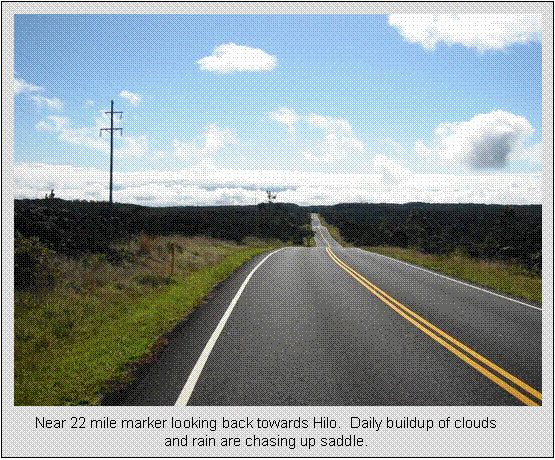
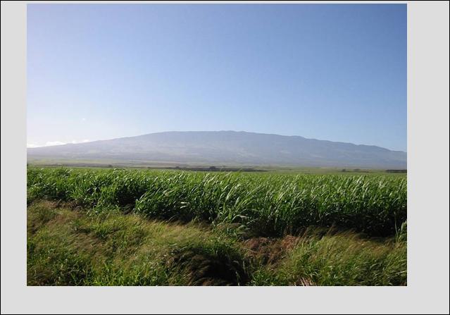
Starting out
on Rt 37. Wind was
30 mph. Note sugarcane leaning
over. Skies are almost always clear
first thing in the morning.
|
|
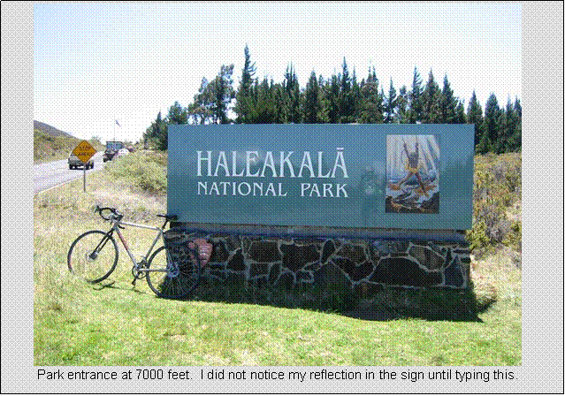
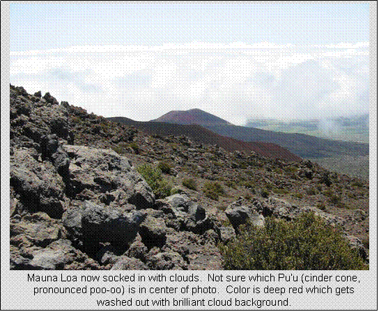
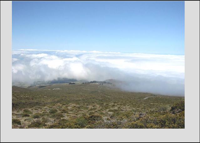
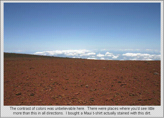
After climbing well past park
entrance at 7000 feet (center of image), clouds began to move in.
|
|
Thusday, April 21
Haleakala Off-road Descent
20.1 miles
1:40 hours
7,000 feet net loss
This turned out to be my only
pure MTB ride. The
night before I swung by West Maui Bikes to pick up a Giant Iguana hardtail mountain bike with disk brakes. A fairly low end bike, but seemed to be in
descent enough shape for what I wanted to do.
Strangely, they steered me to another rental outfit that offers high-end
free-ride bikes for blasting down hills and over cliffs and stuff. Not my thing.
There was a chance I’d be up for some climbing too, and having huge amounts
of squishy travel under you is not much fun to climb with. Sucks the life right out of
ya.
Thursday morning, the three of
us head up Haleakala with the Toyota Camry rental. After last minute bike adjustments, Mom and
Cathy head off into the Haleakala Crater
trails, while I swooped around the observatories to pick up the Skyline Trail
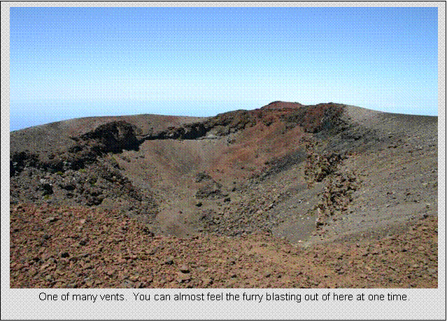
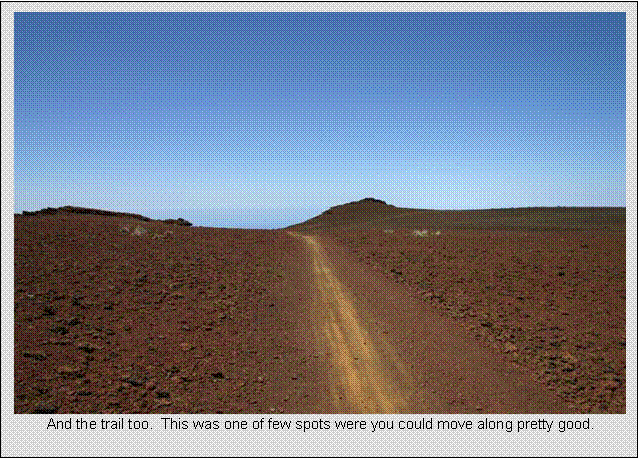
trailhead. The pictures I’ve seen of
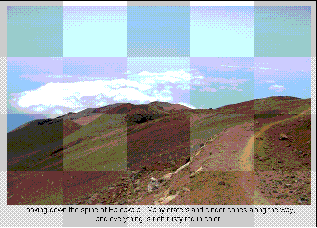
this were spectacular, and I was not disappointed seeing it in person. The trail consists of a long ago closed 4WD
road, which now has a singletrack-ish ribbon winding
down it. However, the surface is nothing
but loose lava rock. A few places were
firm, but that would just tempt you into building speed before spewing you into
more loose rock. Sink up to the rims
loose. I nearly lost it so many
times. Problem was you wanted to look
around while bombing down, but you’d certainly crash if you did. I stopped many times to take in the few and
snap pictures.
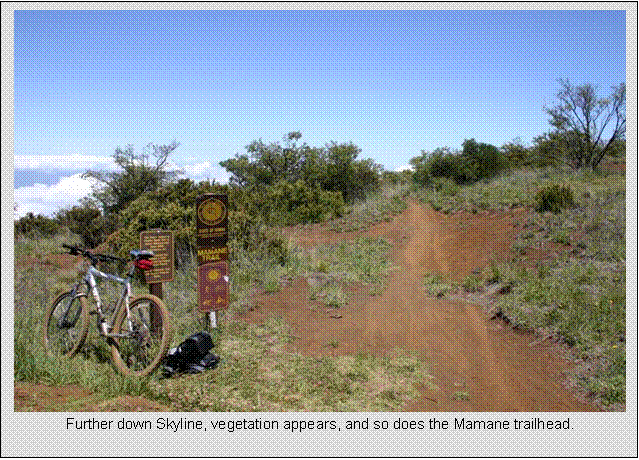
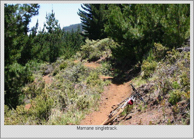
After roughly 5 miles of
Skyline, Mamane (pronounced Ma-ma-nay) trail is taken. This is true singletrack. It descends very steeply at times, over lava
outcroppings, roots, ruts, and loose sandy sections. Very fun, and quite
technical. The trees here were
huge, not unlike those I’ve seen in Montana or
Washington. I’ve read there are Redwoods in the
park. Only down side was it is quite
short at around 1.3 miles. I
pinch-flatted bad on this trail too. I
had the pressure low for the loose stuff up higher, plus as you descend, tire
pressure drops. Things you don’t think
about in flat land.
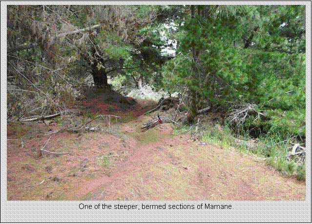
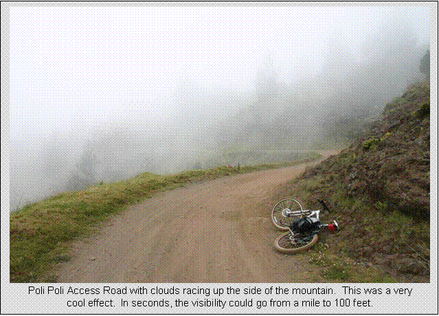
Mamane
trail dumps out on Poli Poli
Access Road in Poli Poli Springs
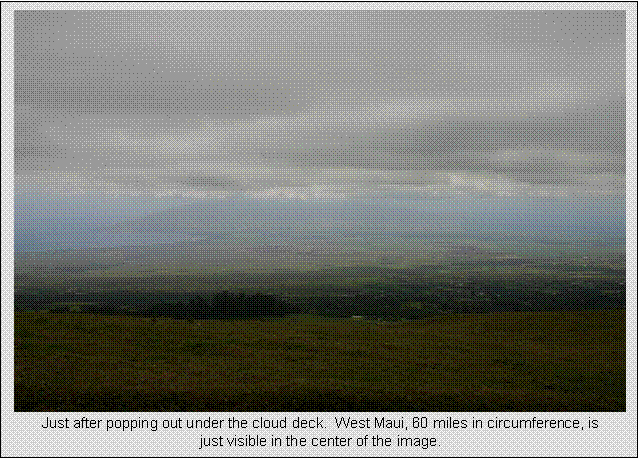
State Park. This is now around 6000-7000 feet I believe,
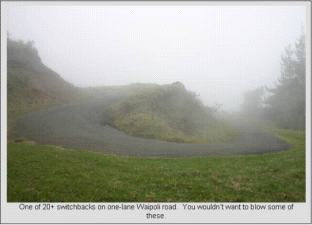
and I was coming down into the clouds. Poli Poli is about the only legal
place on Maui where you can ride singletrack,
and only a small portion of the trails are open to bikes. Poli Poli Access initially traverses mostly flat around
Haleakala. Once it turns into very
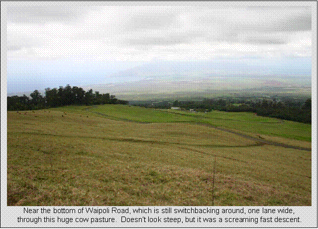
narrow one lane paved Waipoli Road, it descends
steeply through 20+ switchbacks, all of it through open range ranch land. There were a lot of cattle around here. Just like coming down Haleakala on the road
the day before, coming through the clouds was very cold. This time I did not have extra layers along,
as it was so nice at the summit.
Waipoli Rd eventually
comes out on Hwy 377, which traverses the mountain some more to the rendezvous
point with mom and Cathy. I did not know
that there was a 500 foot climb in between me and the car. The previous days
big climb left nothing in my legs for climbing today, so I had to poke along
and grind it out. After this brief
climb, a 500 ft descent then brought me to the end of the ride at Sunrise
Market. Ironically, mom and Cathy arrived
within seconds after I did. I decided
this would probably be the only chance to MTB on this trip and let me color Hawaii in on my map, so
I dropped the bike off on our way back.
The swim at the beach felt great.
Friday, April 22
Tandem Ride Around West
Maui
65.0 miles
4:20 hours
5,000+ feet total climbing
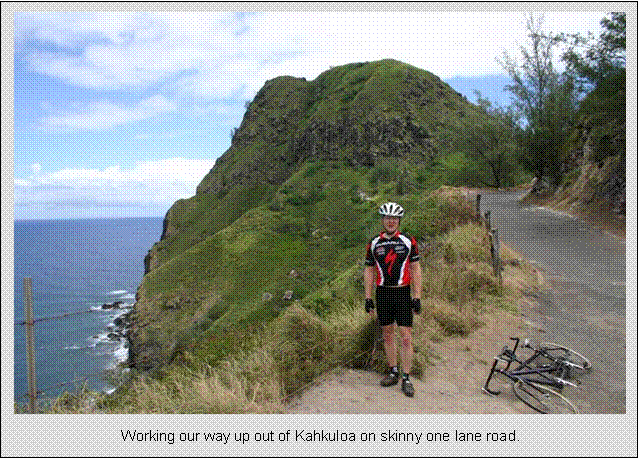
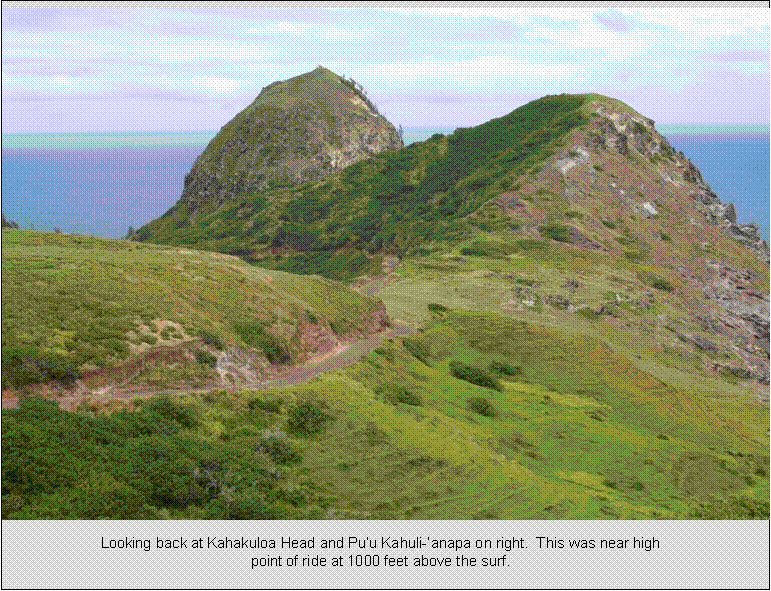
The ride around West Maui is a
classic loop that any serious cyclist visiting Maui
must do. It almost continuously hugs the
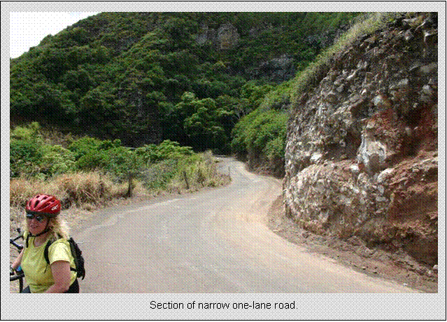
highly scenic coastline. Long sections
on the north shore are single lane wide (barely wide enough for a car and
bicycle to pass) and hug very steep cliffs to the water below. The loop has considerable climbing too. DeLorme’s Topo 5.0 says over 7,000 feet, but I know Topo is inaccurate where roads contour steep terrain. The local bike shop says the loop contains
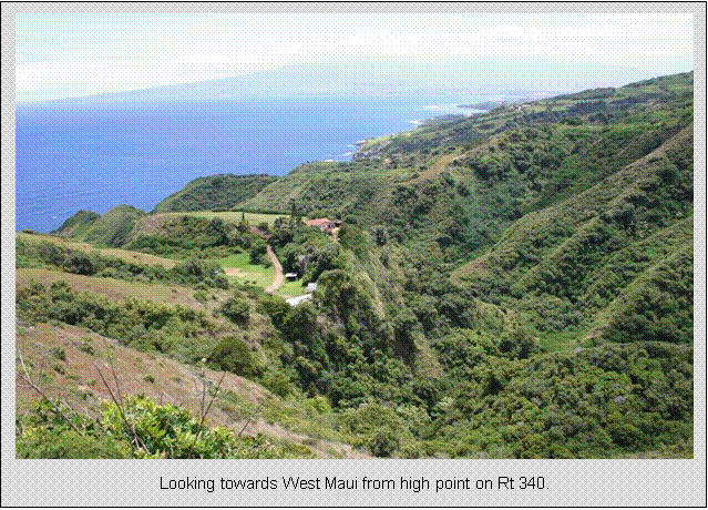
over 4,000 feet of climbing, and we added the inland climb to the Iao Needle on our ride.
The road along the north shore would contour every nook that came
inland. It had to. Ironically, the low points of each nook were
inland, coming down nearly to sea level each time. Then when you’d pop back out on the sea
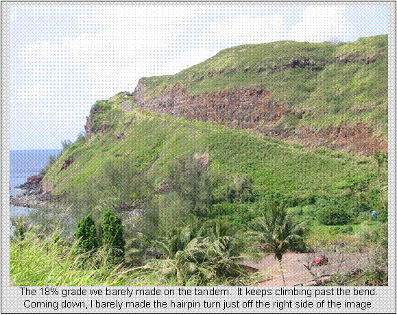
cliffs, you would climb, climb, and climb to get there. One of the climbs is sustained 18% grade, and
we barely made it with our 30t/34t granny gear.
High points above the surf made for very nice views.
I wasn’t sure how my legs were
going to hold up for this ride, having ridden 7+ hours over the last two
days. I was counting on Cathy to at
least carry her share, and she did. She
was worried too, having hiked and bike many hours the previous two days also.
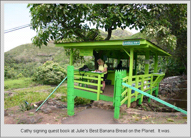
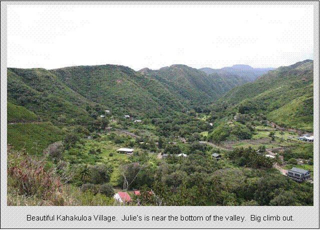
One of the high points of the
ride was Julie’s Best Banana Bread shack.
Straight from the oven to a roadside stand. Melt in your mouth good. It was the best banana bread I’ve had. One loaf was perfect size to refuel Cathy and
me. This was mid ride, in the middle of
the most scenic part of the ride.
There was, how should I put
it, a strange encounter on the route. We
passed a man and woman touring on a motorcycle a couple times when they’d stop
at pull-offs for views. They then would
pass us on the road. Well, one time when
they passed us and we came by them later, they weren’t enjoying the view. Let’s just say they were engaged in a
completely different activity. Cathy
didn’t even catch it, and neither did they until we passed them. We tread quietly.
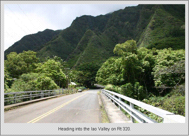
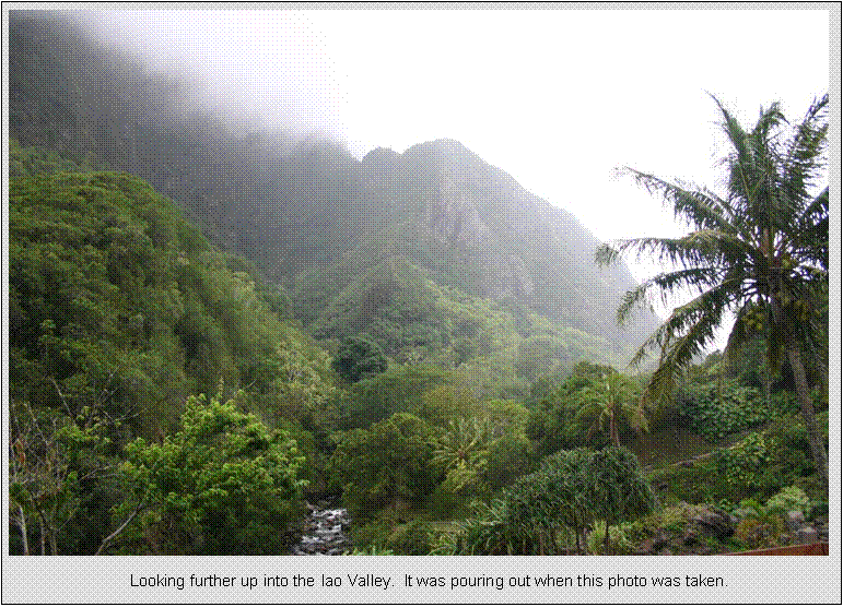
When we came inland through
Wailuku to begin cutting across to the south shore, I took a diversion. Cathy was starting to feel it and was hoping
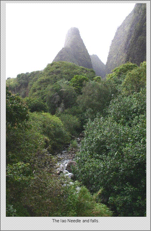
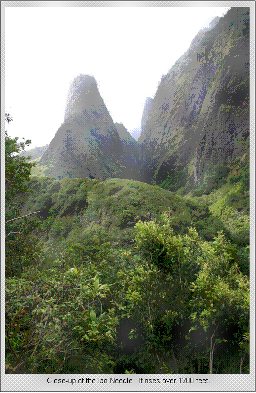
we’d get back soon, but I really wanted to see the Iao
Needle in the beautiful Iao Valley. Cathy didn’t at first know where we were going,
but she new it was up. And up. After nearly a thousand foot gain, we reached
the end of the road in the Iao valley. The needle was visible from where we stopped,
and Cathy yelled “we came all the way up here for that!?” Guess she didn’t think it was worth it. I hiked a couple hundred yards to the viewing
deck for photos while Cathy rested by the bike.
This was deep in the West Maui mountains, on the wet side.
It suddenly started to pour out.
I wrapped the camera up good, came down and expected to get a butt
chewing. Instead, Cathy was sitting out
right in the rain enjoying it. The rain
made the climb up into the valley worth while to her. On the way out, we didn’t ride more than 200
yards and it was dry. A bit further, it
was sunny. Looking back, it sure was
dark up in the valley. Probably stayed that way the rest of the day.
Continuing our descent on Rt 30 to the south shore, we had strong tail wind and
slight downhill grade. Being on a
tandem, we hauled. Maybe 40 mph coasting, and it looked almost flat. We just passed the Rt
380 junction and, POW, the rear tire blew.
I barely brought the tandem to a controlled stop. I was horrified to find a hole big enough to
put my finger through in the rear tire.
We had just passed a sign that said we had 17 miles to go to Lahaina. Just then,
a local pulls up and asks if we needed help or a ride. She tells me, “Oh, I have a patch kit for my
son’s bike in the trunk. He won’t be needing it, he’s back in jail.” We’ll I needed more than a patch kit (and I
had my own anyway), and I had serious reservations about accepting a ride from
this person. Small
car, big tandem too. I told her
thanks, but I should have everything I need to repair the flat. I was taking a gamble. I had just started carrying a 1” by 2” oval
patch of milk jug with my patch kit.
This can be inserted in between a severely damaged tire and tube to keep
the tube from herniating out and blowing. The gamble was the hole was so big, and I
have never tried this before. My friend
Steve who recommended the idea has successfully used it before, so I was
keeping my fingers crossed. I put my own
tandem tube (28mm) in the tire, and just before slipping the last of the tire
bead on, I carefully inserted the polyethylene patch between tube and
tire. I inflated the tire to about 1/2
pressure for fear of milk jug rupturing through the tear. It seemed to be working. You could see the milk jug through the whole,
but it looked ok. We headed off and I
remained ultra cautious to avoid glass or bumps that could pinch-flat the soft
tire. Fortunately, most of the way back
was on wide, clean, recently repaved shoulder.
It held the 17 miles back to the bike shop. When I told West Maui Bikes what happened,
they were impressed that we recovered from it.
But they also said that was a new tire and I would have to pay for
it. I expected to. They only charged me $9, which I think was their
cost on a basic touring tire. I thought
that was extremely fair.
One thing I’ve noticed riding
on all of the islands is how much glass is on the road. Almost continuous broken booze bottle or
smashed car window glass. Car window
glass happens two ways. There were many
abandoned cars along the roads on Maui. In fact, this problem is in the news a
lot. Invariably, all the windows are
smashed out. Also, in many popular areas
to park (beaches and trails), thieves break windows. I have no idea what I hit with the
tandem. We were going so fast we were at
least 200 feet past it when we came to a stop.
I suspect bottom of beer bottle.
Overall, the ride was very
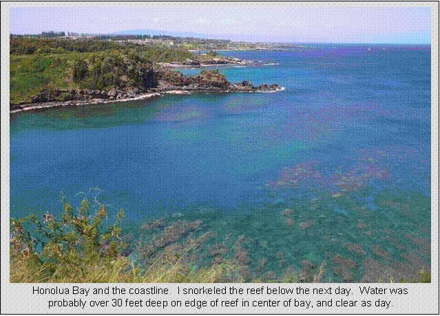
satisfying. We got to see part of Maui we wouldn’t have otherwise. It was a hard ride due to all the climbing, and I pushed quite hard on the climbs. We passed by the beautiful Honolua Bay, a popular snorkeling sight. I told myself we had to come back there and
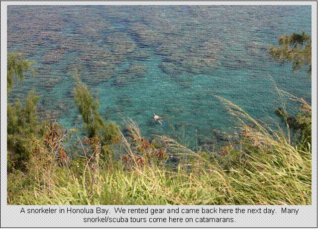
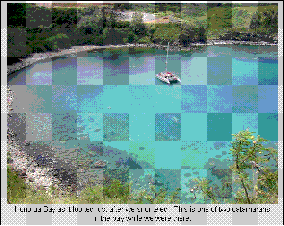
try it, thus setting up activities for the next day.
Saturday, April 23
Solo West Maui coastal ride and
snorkeling
32.2 miles
2:00 hours
3,000+ feet total climbing
2.5 hours total snorkeling
We ate our normal buffet
breakfast (all the good stuff that’s bad for you) and headed to the nearby Maui
Dive Shop and waited for them to open.
Glad we stopped there for snorkeling gear. The staff was highly knowledgeable, and the
equipment was a step up. I even got
corrected lens goggles, as I do not where contacts. We drove about 9 miles to the north to Honolua
Bay. Many cars there already had a small walk to
get down to the bay. Honolua
can be murky if it rained at all recently, but Maui
was having an unusually dry spring. Mom
and I also rented wet suit tops to help with floatation. I sink like a rock, even in sea water. I have always been dense in the water. Took us a while to figure out where to paddle
too and develop the nerve to go way out where the water is very deep. But that is where the water is the clearest
and the coral most colorful. The fish
were amazing. All sizes, shapes, and
colors. I should have picked up a disposable
underwater camera. There was a catamaran
there too, with many snorkelers and scuba divers on
board. It was cool to see divers way below you.
The water was so clear. I would
guess the visibility was at least 60 feet, maybe even 100 feet. The water by the edge of the reef was maybe
30 feet deep, and you could see bottom like you were looking through air.
After an hour and a half
snorkeling, we headed back to the resort.
I jumped on my bike for a short moderate pace ride. Went same way Cathy and I did on tandem the
day before and came back. I hit 42 mph
going down the 18% grade and nearly didn’t make the hairpin at the bottom. Went pretty hard on the
numerous hills, and a strong headwind going out made for a pretty hard ride. Hope this wasn’t too much just three days
before the climb of my life on Mauna Kea.
When I got back from my ride,
I talked mom and Cathy into snorkeling at Black Rock a short walk from our
resort. Mom didn’t want to snorkel at
first. Cathy just wanted to putz around close to shore, and I went out to the
point. Can be currents
and big waves there late in the day, so I didn’t go out fully exposed. Black rock juts a few hundred feet from
short. It’s a popular jump rock, maybe
30 feet to the water, but you have to jump from the right spot. There were submerged lava outcroppings. Water was maybe 20 feet deep at the base of
Black Rock. Water was clear, and lots of
fish to sea.
While I was out by the point,
Cathy hollers “Turtles!” So I swim over
closer in to shore, and sure enough, two huge sea turtles were feeding on what
may have been kelp drifting near the sandy bottom. This was enough to get mom back in t he
water too. Every few minutes, they would
come up for a gulp of air and swim right in your face. Almost scary. Was really cool to get to
swim with these huge docile creaters. After an hour of hanging out with turtles, it
was time to head in and head out for dinner.
Sunday, April 24
Rest day, Maui Ocean Center, and Travel to the Big Island
Today was somewhat of an open
day. We evening travel, we didn’t want
to do anything too big. Plus, two days
out from my epic climb up Mauna Kea was the
most important recovery day. We relaxed
in the morning, returned beach towels and snorkel gear, and then headed to Maui Ocean
Center, which was on the
way to the airport at Kahului. This
small center had a highly diverse selection of marine critters, from sharks,
giant stingrays, turtles, fish, shrimps, crabs, coral, you name it. Lots of things I’ve never seen before. The main attraction here is their 750,000
gallon tank with sharks and stingrays in it.
You walk through an acrylic tube through the tank, so critters swim all
around you. After this, we shopped for Maui t-shirts and went to the airport. To get to Hilo
from Kahului via jet service, we first had to fly back to the Honolulu
hub, then 216 miles direct from Honolulu to Hilo on Hawaii. We needed jet service because the little
planes don’t take bikes. Flights are so
short. We almost walked from getting off
one plane to getting on the next in Honolulu,
so it wasn’t a big deal.
Monday, April 25
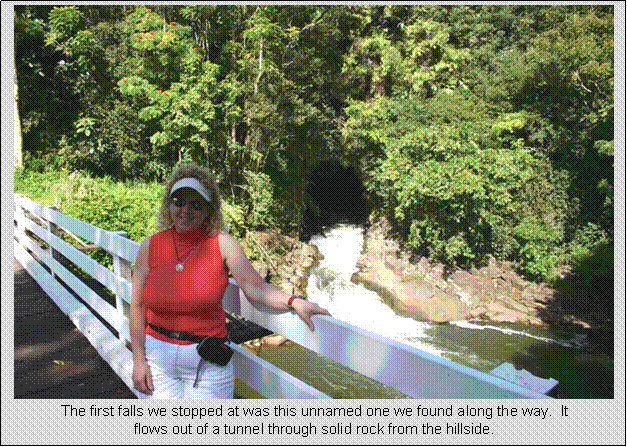
Big Island Waterfalls Day, Short Recovery Ride Through
Hilo
12.7 miles
0:58 hours
1,000+ feet total climbing
Two hours hiking waterfalls and lava tubes
In the morning, we toured most
of the waterfalls close in to Hilo. Hilo is on the
wet side of Hawaii,
the side opposite Kona, where most of the resorts
are. Hilo is not a very touristy area, but it’s
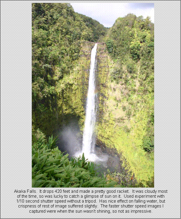
where you stay for seeing volcanoes in action or climbing the biggest bikeable climb in the world. Heading north on Rt
19, we first stopped at Akaka
Falls. This was impressive, a 420 foot drop with
good flow. There was a second falls on
the mile long loop hike. It was slightly
obscured by vegetation and almost as big.
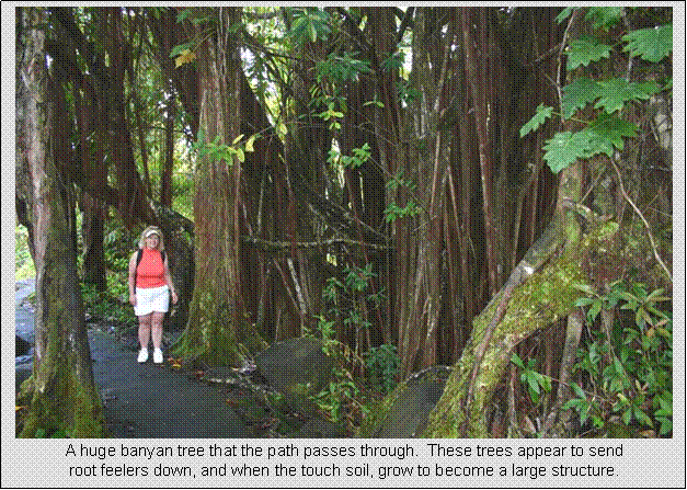
The forest here was how I imagined rain forest to be. Huge leafy ferns and other
broad leaf plants. Tall bamboo
stands. Hundreds years
old banyan trees. Interestingly,
there were very few bugs.
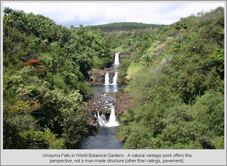
We next went up to Multi-tiered Umauma Falls in World Botanical Gardens. The gardens themselves were still quite
new. It is a work in progress and will
really be something in a few years. Many interesting flowering and fruiting plants. In fact, there was a large pomelo tree there.
It was heavy with fruit, including a cantaloupe-sized one lying on the
ground. After we finished our garden
tour, I asked the attendant at registration about it, and she said if I wanted
it, go grab it. We put it in the fridge
and ate it a day or two later. A bugger
to get into, but tastes something like a pink grapefruit. The big attraction at the gardens is the
multi-tiered Umauma
Falls. They have a monopoly on viewing access. This was probably the most impressive falls
I’ve seen that can be viewed from the ground.
After finishing up at the
gardens, we headed back south on Rt 19 towards Hilo. There are a couple falls right on the
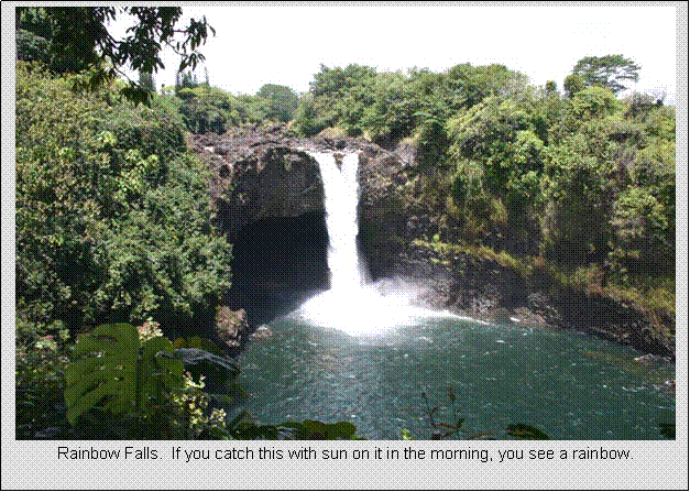
outskirts of town to see. The first was Rainbow Falls.
Also rather impressive, but I’m not a really big falls guy. Through in a little adventure, like a
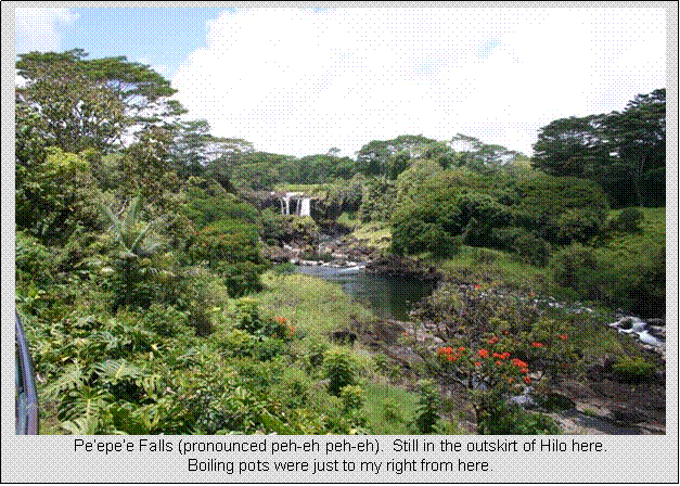
challenging hike or swimming, there’s enough in it to keep me interested. Another mile or so up the road was yet
another falls, Pe’epe’e Falls. This one is viewed from a bit further back,
but also very natural and tropical looking for being in town. The Boiling Pots were also here, a cascade of
falls with deep roiling pots of frothing water.
Hard to capture a photo that does this scene justice.
Late afternoon, I jumped on my
bike to tour town and make sure I knew which way to go early the next morning
for my biggest ride of the trip. I got
on Kaumana
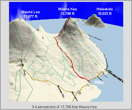
Drive, Rt 200, which
turns into Saddle road. Saddle road cuts
across the island to the Kona side, but pass through
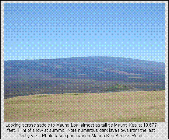
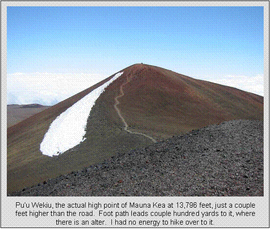
the saddle between 13,677 foot Mauna Loa to the south and 13,796 foot Mauna Kea to the north.
The saddle itself crests at about 6,600 feet. The ancients used to believe the Mauna Kea was home to Poli’ahu,
the snow goddess. Mauna
Loa was home to Pele, goddess of
fire. The two often did not get along,
and the saddle was their battleground.
The saddle was avoided in ancient times.
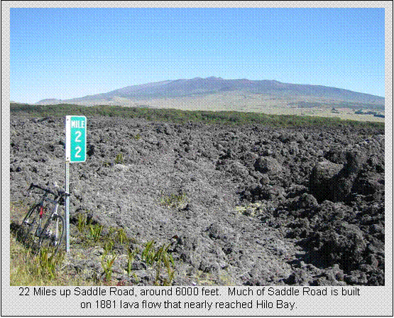
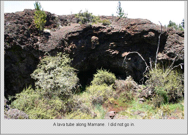
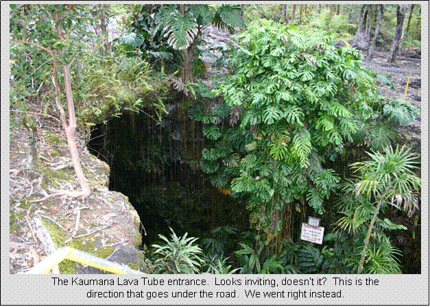
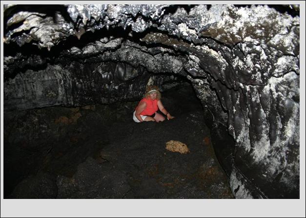
I rode up to just past mile-marker 4, or to the Kaumana Caves.
This is a lava tube that was created in the 1881 eruption of Mauna Loa. I
walked down into the opening and decide I would have to bring Cathy and mom
back yet that evening with lights to check it out. Four miles up Saddle Rd was nearly 1000 ft net gain,
which was more than what I wanted to do that day, so I screamed back down into
town to tell of my find.
On our way to Kuamana
Caves, we stopped at a
7-elevin to pick up a flashlight in addition to our two head mounted LED
lights. The three of us go down into
tube, and we immediately realize it is black in there. And it’s no Disneyland
walk either. You could get hurt bad
stumbling, or even falling off ledges.
We needed much brighter head-mounted lamps that freed hands up, and
gloves to catch yourself when stumbling or for the hands and feet parts of
it. Mom chickened out and didn’t go far
enough in to be out of entrance daylight coming in. Cathy in I went in
several hundred yards. There were all
kinds of neat formations and colors in there.
Rock slides to scramble over in some places, ledges to climb up or walk
along in others. Had to watch your head
in places, as Cathy learned the hard way, and she’s only 5’ tall. With mom waiting at the mouth of the cave for
us, we cut our hike short and headed back out.
Got a couple descent pictures out of it. The lava tube went both ways from the
entrance, and we only hiked one of them.

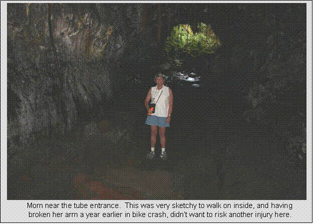
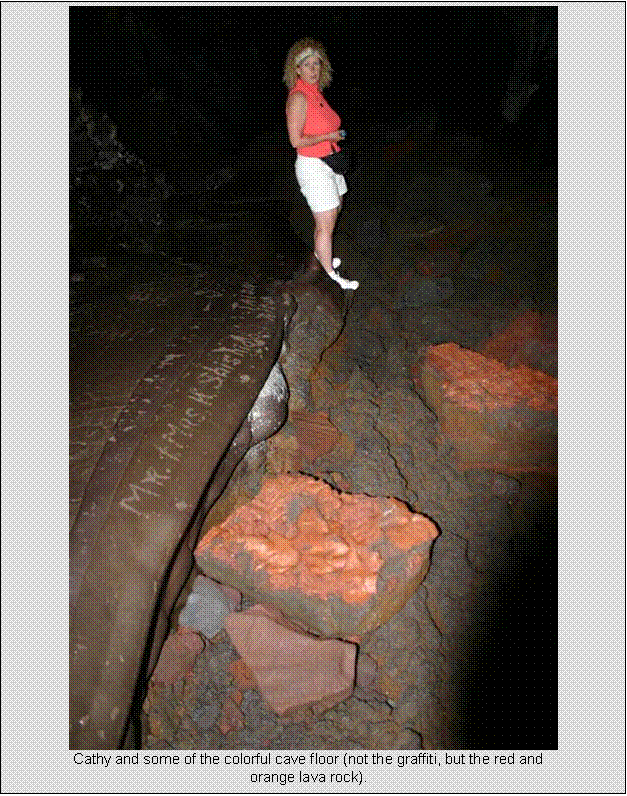
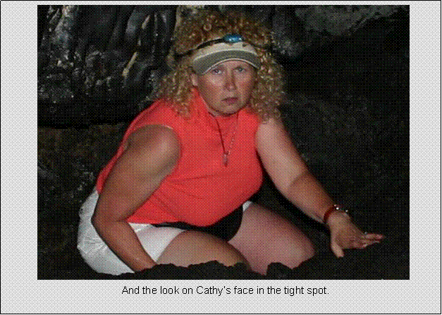
A tight spot
in Kaumana
Cave that made Cathy
extremely nervous. It opened up to large cavern
on the other side of this squeeze that also dropped many feet.
|
|
Tuesday, April 26
Mauna Kea Hillclimb
88.6 miles
8:18 hours
13,790 feet net gain
The Mauna
Kea climb was to be my capstone ride for this trip. I put my odds on completing the climb at 50%
before leaving for Hawaii. I estimated a 25% chance the weather could
have been foul (50mph winds) or a 25% chance physically I could not do it
(altitude sickness, bonking). I had a
two day window to climb it, Tuesday or Wednesday. After readily completing the Haleakala climb
6 days earlier and now with the weather forecast looking highly favorable, I
was feeling very confident the morning of the climb. Winds were expected to be light, and no
fronts were moving in that could bring clouds and rain to the higher
elevations.
I found the following trivia
on Mauna Kea on americasroof.com, a
high-pointers website:
·
It is the highest in
the Pacific (more than 1,000 feet higher than Mount Fuji).
·
It is the world's
highest mountain from base to summit (it rises more than 33,000 feet from the
ocean floor -- Everest's height is 29,000 feet).
·
It -- along with the
rest of Hawaiian islands
-- are the most remote places on earth -- nearly 2,500 miles from the closest
continent.
·
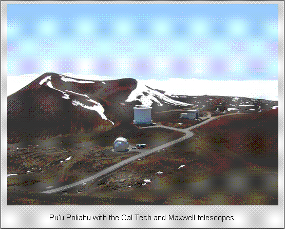
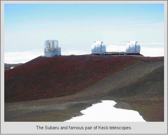
The telescopes on its
summit are among the most sophisticated in the world. The space
exploration phase were underscored by the fact that a Challenger astronaut was
from here and astronauts trained here in preparation for the lunar landing.
·
The mountain which on
one side climbs up a desert and other a jungle it encompasses most of the
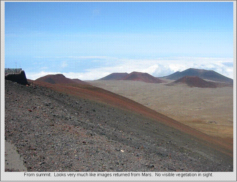
planet's ecosystems -- from plains to arctic tundra.
You can pass through 10 of
Earth’s climate zones ascending Mauna Kea, including artic tundra (there is perma frost deep in Mauna Kea
in places). Hilo
is also the wettest city in the United
States.
70” in a year is a severe drought, triggering water rationing.
This climb will probably be
the most challenging I’ll ever complete on a bicycle. It gains nearly 14,000 feet in 42 miles. Average grade doesn’t seem that bad, only
6.2%, but in terms of net gain, it’s almost three back to back Mt Washington’s. Further, the last 6,500 feet of vertical
averages over 10% with sustained 17% grades, is in very thin air, and five
miles of it is loose cinder gravel. I
opted to stay with skinny 23mm road tires since 37 of the 42 climbing miles
were paved. My bike was set up with a
compact double, 34t front, 34t rear low ratio.
Both tire choice and minimum ratio proved to be inadequate as I’ll get
to.
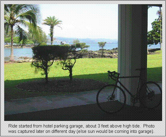
I set out at about 6:15am from
our hotel in Hilo. Hawaii is not on daylight time, and days seem
are shorter there, maybe only 13 hours of usable daylight due to proximity to
the equator. A short 1.3 miles at sea
level brought me to the base of the ascent.
The first 30 miles on dangerous Saddle Road gains only 6,600 feet or so. This road sees many deadly crashes as it is
often socked in with clouds and idiots drive ridiculously fast on it. Rental car agencies make a big deal of
notifying you that you are prohibited from driving their cars on that
road. This portion of the climb went
quite easily and I made good time on it, even being careful to keep my
intensity very low. I chose to not wear
a HRM for this climb. Visibility was
maybe 50 miles in the morning. But once
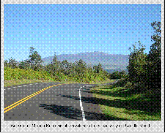
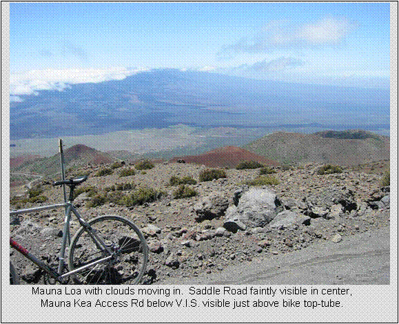
you turn off on Mauna Kea access road, the
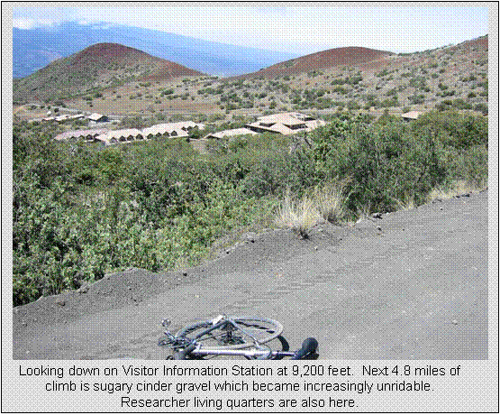
grade nearly triples, gaining another 7,200 feet in only 12 miles. I reached the visitor center at 9,200 feet in
less than four hours and stopped to re-fuel and re-hydrate before continuing. Felt good at this point, well ahead of
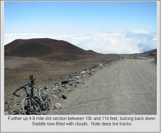
schedule. But the next 4.8 miles after
the visitor center is unpaved. It is
graded on Mon/Wed/Fri. I thought
perfect, the cars will pack the loose grading down by Tuesday so my skinny 23mm
tires will be good. NOT! Parts of it are so steep that it immediately
turns into washboard bumps. Think loose
pea gravel on hardpack with big rocks thrown in. There was no way to maintain traction on
it. I walked the steepest switchbacks
initially, but the last 0.8 miles of dirt were so loose and steep, I walked all
of it. This stuff was even hard to walk
up, as each step would slide back a half step.
When I could ride, I mostly rode up the wrong side of the road since
cars descend on that side and didn’t bump it up as bad. This was very dangerous due to all the blind
switchbacks, but I could easily hear them coming and get out of the way. There was maybe a car (usually 4WD) every 10
to 20 minutes, so not busy at all. A
ranger did stop once to make sure I was alright, had enough water, etc. I’ve read that they want you to talk to make
sure you aren’t suffering from hypoxia and becoming incoherent.
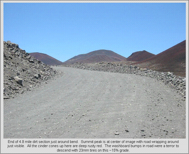
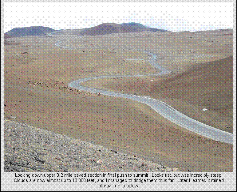
Once you get past the dirt
section, the last 3.2 miles are paved and I thought I was good to crank it
out. But by now you are around 12,000
feet, and altitude becomes an issue. It
was steep, and my speed dropped so low (<2.5mph) that my computer was
dropping out. This would have given me
about a 30rpm cadence. I was getting so
dizzy I had to stop a few times. I finally
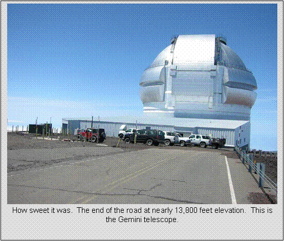
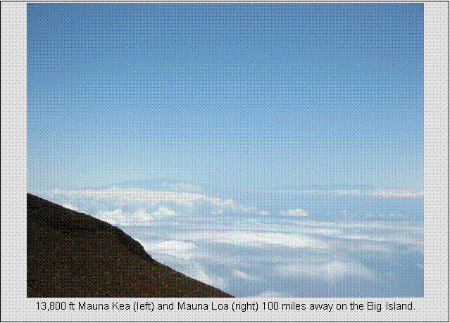
crested one of the last switchbacks and the observatories came into view. I was almost there. I reached the summit in 6 hours, 18 minutes
of riding/walking time. There was still large patches of snow about, even some snowboard
tracks, but the temps on this calm day were probably about 50 at the
summit. The summit is typically 40
degrees cooler than sea level. I had
such an excruciating headache developing that I had to get down fast. In fact, I’ve read 0.5% of the adult
population (8% of children) can die at 14,000 feet from pulmonary edema. It’s a genetic thing, where your lungs become
water logged.
A couple of things I noticed
at 13,000+ feet. The air is much
thinner, and you get little wind resistance to slow you down. In fact, it was even harder to blow snot of
your nose. In terms of atmospheric
pressure, the summit of Mauna Kea is 40% of
the way to space. I read a story where a
woman arrived up top and she was completely orange. Even the inside of her car was covered with a
bright orange powdery film. When the
researcher asked what happened, she said that as she approached the summit, a
large unopened bag of Cheetos in her vehicle
exploded. Hilarious. Who would’ve thunk?
During my initial descent,
wrists would immediately start to seize up with a death grip on the
brakes. Don’t know how you could descend
this beast with rim breaks. They’d never
last. As I descended to the dirt
section, two mountain bikers were coming up.
They started at the 9,200 foot visitor center. Even they, with their wide knobby tires, had
to walk some sections of the dirt. For
me, the descent was horrible. At best, I
could go about 5-7mph on the washboard.
It was even worse than a couple hours earlier during my ascent, as
cars/trucks roughed it up even more. My
wheels would not stay under me. Many
times I’d skid out and barely get unclipped in time. Other times I couldn’t control my speed due
to skidding tires. I didn’t walk any of
it going down, but could just as well have.
The washboard drove my altitude headache past unbearable.
Back at the visitor center at
9,200 feet, I took three Ibuprofen and had a cup of
coffee to quell the headache. That and
being lower worked well. The remaining
34 miles was a speedfest back to Hilo.
The clouds already built up to the visitor center at 9,200 feet, and I
didn’t pop back out of them for good until I got below maybe 2000 feet on Saddle Rd.
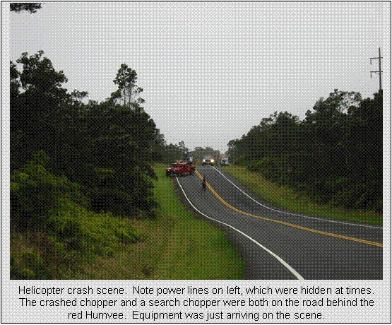
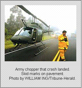
As I was descending Saddle Road,
somewhere around the 18 mile marker, I got blasted by wind from all
directions. I was going 30-40 mph, so I
could only hear wind in my ears. But I
also noticed the vegetation was blowing all over the place. I looked up and nearly fell off my bike. There was a chopper hovering no more than 50
feet above the road in dense clouds. I
slowed to stop, look, and grab the camera, but the chopper moved away slightly
and was just hidden in the clouds. I
thought that was odd. Nothing out there,
maybe a car every 5 minutes, so why would a chopper be that close to the
road. I start riding again, and before I
even get up to speed I’m confronted with flashing lights and people. Then I thought there was a wreck and it was
airlift chopper. When the people at the
scene quickly motioned me to come through, I went around two more choppers
right in the middle of the road, one military.
There were no wrecked cars. Now I
was really confused. Later that night I
watched the news. It turns out I just
missed a helicopter crash landing right on Saddle Road by no more than 10
minutes. The headlines said an army
chopper was doing drug surveillance when it hit powerlines
in poor visibility along the road. Pilot
suffered only minor injuries. I was
lucky they let me continue my descent through the mess.
Below the clouds at 2000 feet,
it was just warm, humid rain. I was so
afraid of getting hit by a car in the clouds, but I did have a HiViz shell on and wasn’t going much slower than cars, so
only a few passed me. Parts of the Big Island
can get over 300” per year. I was very
fortunate this was the bulk of the rain I encountered riding in two weeks.
I got back to the hotel around
4:25pm, with no more than 2 hours daylight margin. That’s a total elapsed time of 10 hours, 10
minutes, with 8 hours, 18 minutes riding.
Most of the non-riding time was spent at the visitor center at 9,200
feet on the way up and down, with 10 minutes or so up top, and many minutes
stopping for photos along the way. Don’t
think I would do this climb again. I was
so unprepared for the effects of altitude, and afternoon clouds sock much of
the descent in with poor visibility.
Completing this climb was thoroughly satisfying though, and it was on my
must do list for several years. It is
likely the most vertical that can be ridden in 42 miles anywhere in the world. Mt Evans in Colorado is a few hundred feet higher, but
net gain is only 7,000 feet. Even if you
started in Denver
far away, you would net about 9,000 feet.
People will ask “how much
harder than Mt Washington
was it?” Really, I can’t compare
them. Not because Mauna Kea is nearly
three Mt Washington’s in vertical, but because
Mt Washington
is shorter and raced. I hurt more the
day after racing 4700 feet on Mt Washington
than I did climbing at a very low intensity 13,800 feet up Mauna
Kea. Mauna Kea was climbed
at an extensive endurance pace, a 6hr/130bpm climb, while Washington is climbed right near my
anaerobic threshold in just over an hour.
Of course, if I geared a bike very low and climbed steeper Mt Washington at a 2 hour
pace, it would be far easier. Mauna Kea’s altitude is a huge factor. A local bike club does organize a race on Mauna Kea. It is
called Sea to Stars and finishes at 9,200 feet.
Here’s a tally of food
consumed from just prior to and during the ride. I ate very well for dinner that evening too.
Breakfast:
- 3.5 bowls of Kashi
Honey-Wheat-O’s type of cereal with 2% milk
- 2 cups of coffee
Ascent:
- 90 oz Gatorade mix in Camelbak
- 1 Clifbar
- 2 granola bars*
- 1 Milkyway bar*
- 4-16oz energy drink*
- 1 long Slimjim*
Descent:
- 2-16oz energy drink*
- 1-100cal chicken noodle soup*
- 1 coffee*
- 3 ibuprofen
* purchased and consumed at
the 9,200 foot visitor center (a couple drink bottles went in Camelbak).