|
Everest Challenge Trip, Bishop, CA October 4, 2007 Trip Stats: ·
Three road rides, approx. 143 miles, 20,000+ feet of climbing, in ~10
hrs riding time ·
Five MTB rides in NV and CA, 133 miles, 16.4hrs, and uber amount of climbing ·
Six racers in Everest Challenge, two riders for MTB riding after race ·
Weather ranged from below freezing with snow to sunny and 80F during
day ·
No flats, mechanicals, or mishaps, except for a nutritional failure
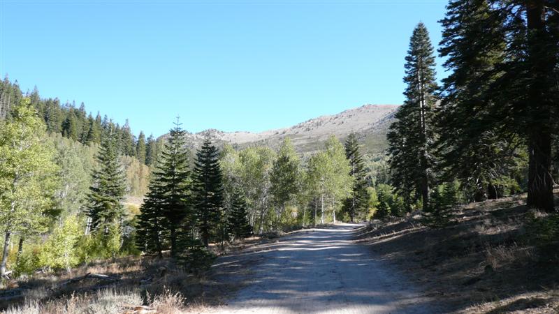
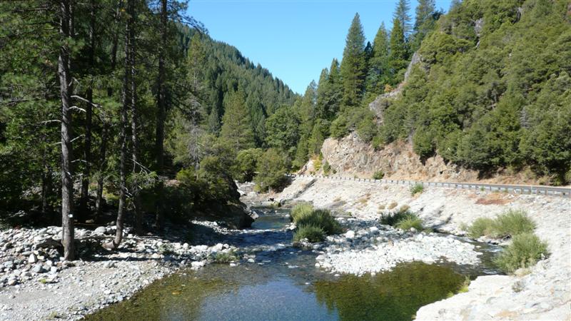
and a physical problem during EC race Day 1 Friday, Sept. 21 Recovery Road Ride in Bishop 9.2 miles This
trip was a long time in the making. A
group of We all
pre-shipped road bikes out to
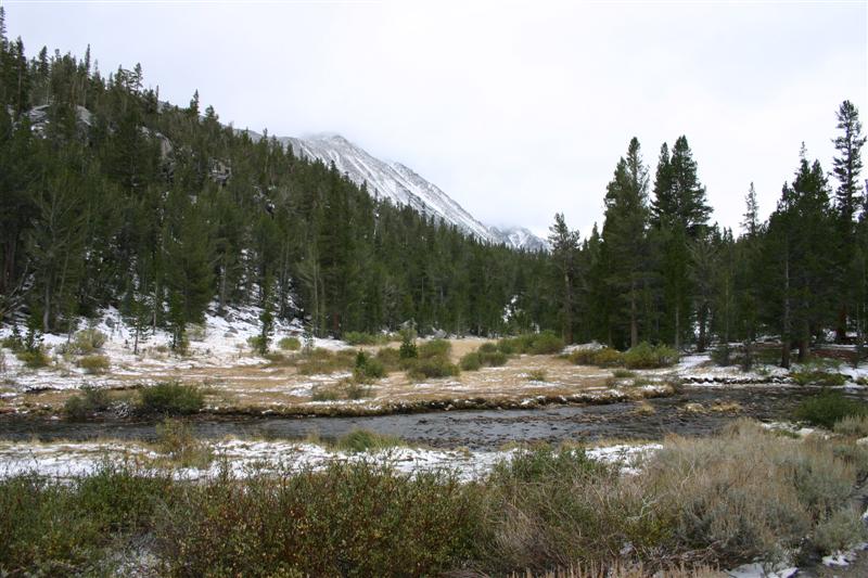
The eastern Sierra’s. Lots of snow cover
that fell in last day or two.
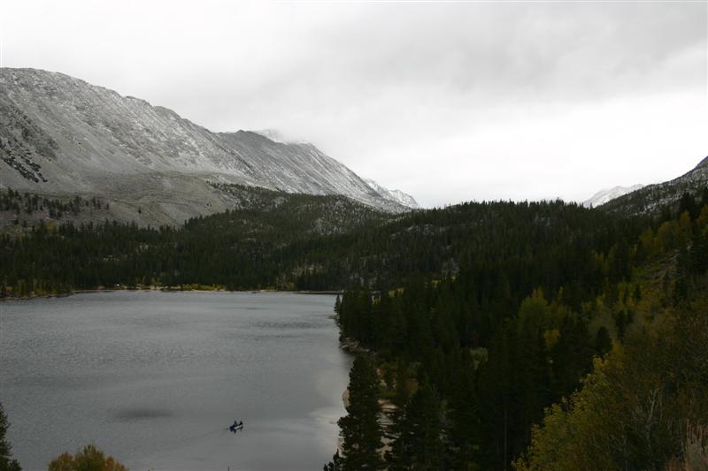
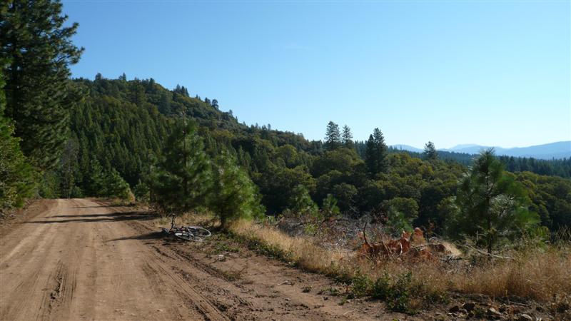
Ride group heading south on Bishop side
street. After a
short test spin, Dave and Rich decided to continue riding further, heading a
good ways up final climb of stage one.
The rest of us jumped into one of the minivans to survey the first
couple climbs of the Saturday’s stage.
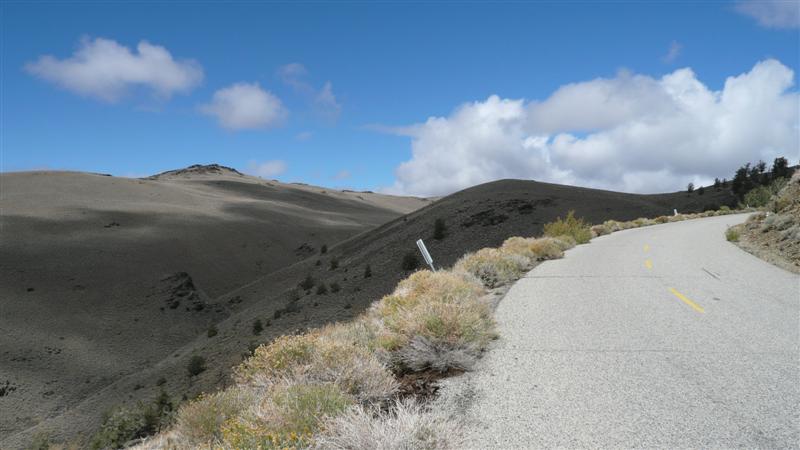
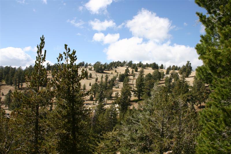
The first climb was huge, over 20 miles, and it gained nearly
6000ft. Some rollers along the way
increased the total climb. Views were
stellar everywhere.
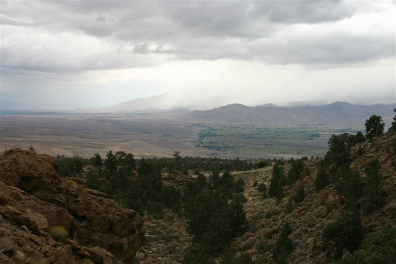
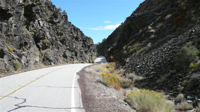
Part way up
Descent into a ravine while still
climbing
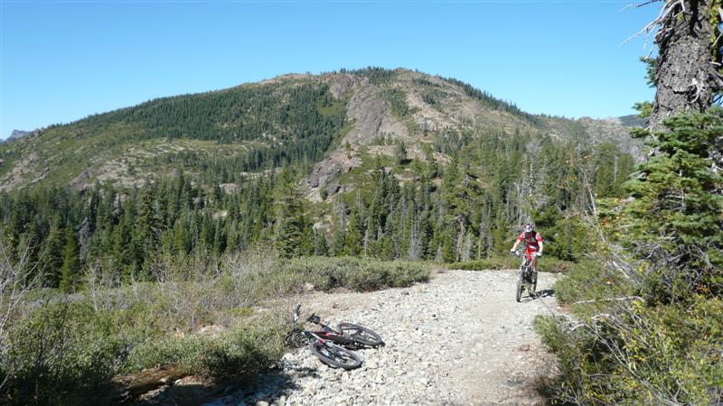
Approaching Pine Creek summit, climb
#2 in first stage. This turned out to
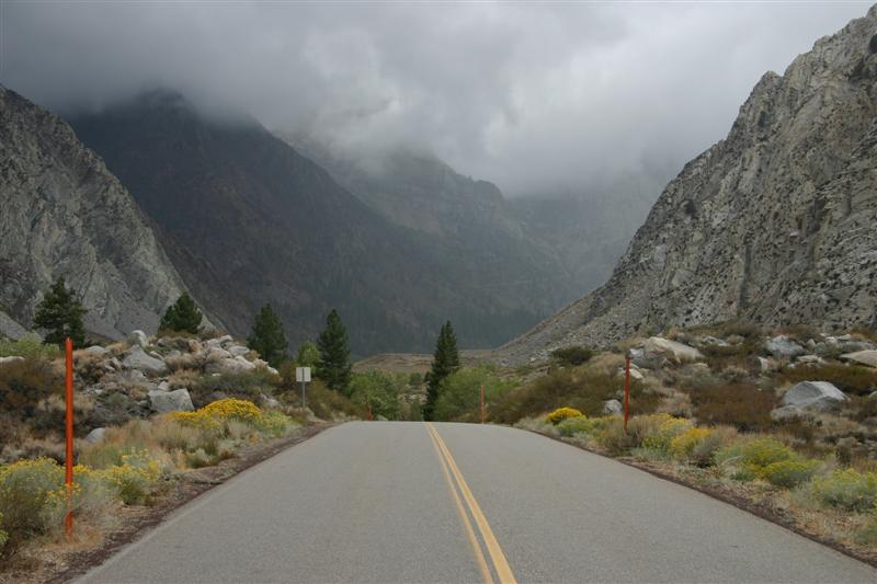
be climb #3 with alternate course. Everest Challenge: Stage 1 Saturday, Sept. 22 92.5mi, 6:14 ride time After
our driving tour, we had a good dinner and hit the sack early. The forecast for the next morning was
bleak, 10-15” of overnight snow down to 7500ft, 80% chance of rain in the
valley on Saturday, and chilly temps.
Overnight, it stormed something fierce. Heavy rain, hail, and lightning in
Bishop. It woke all of us up. Getting up in the morning, the rain had
stopped, but everything was wet. The
mountains were much whiter than the day before. Tom had gotten up at about 4am to eat at Denny’s
so that his food would have time to settle before his 6:30am start. We ate at Denney’s much later than that and
waited forever to get served. No
surprises there. There was no
immediate rain in the area, so we had our hopes up. A
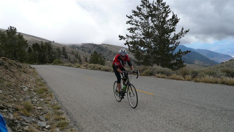
complete race report will not be given here (follow this link). I did not finish the first stage, cramping
up severely just before the finish line.
It never poured on our race, although we did encountered brief
sprinkles a few times. This was barely
enough to make the roads wet one time.
But we stayed dry and bikes stayed clean for the most part. That was a huge relief.
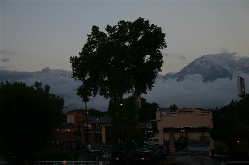
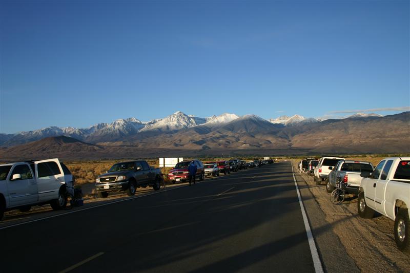
View from hotel balcony pre-sunrise
on race day (slow shutter speed, no tripod).
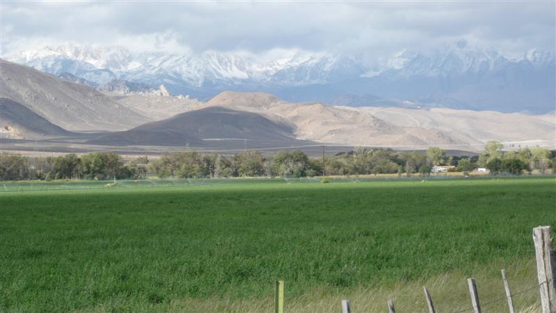
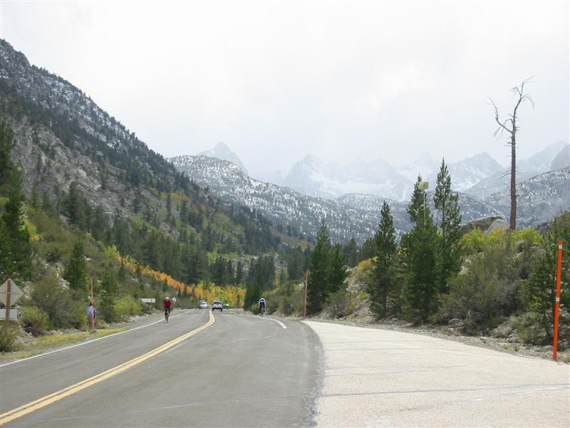
From food station near final climb of
stage 1, looking up climb towards finish about 1km away. It snowed heavily shortly after taking this
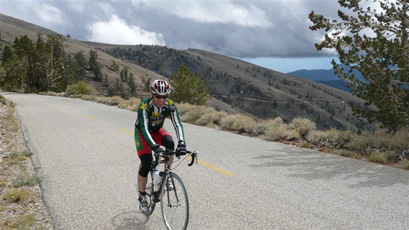
photo. This is just above 9000ft. Everest Challenge: Stage 2 Sunday, Sept. 23 40.8mi, 3:08 ride time So
stage 1 was a disaster for me, but I was not going to let my destroyed legs
keep me off the bike the next day.
After dropping racers off at the start in Lone Pine about 15 miles
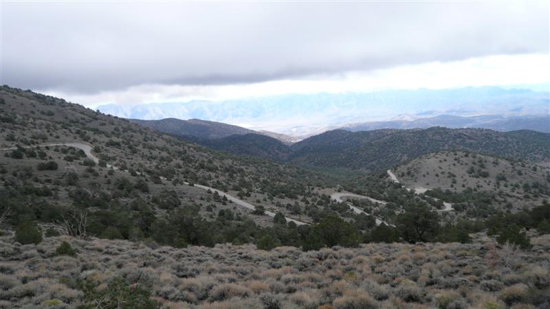
away, I went back to the hotel and stewed over not racing. Sunday was a beautiful day. The vertical not covered on Saturday would
be made up by extending one of the climbs up and over the mountain pass a
short distance before turning around and coming back up and over. The last climb of stage 2 would be the
biggest in this year’s EC, gaining over 6200ft net in 20 miles to 10,100ft
elevation. When I dropped the other
guys off, my plan was to do some easy spinning in town to work out the knots
in my muscles from the severe cramping episode the day before. But it was too nice, so I loaded the bike
up in the van and headed back to Lone Pine to ride up the finishing
climb. I figured I had low gears, all
the time in the world, and I could just soft pedal up it. Then I could wait for the others to finish
their race and take lots of pictures.
Going was tough at first, but half way up, most of the knots were
working out and I could put out enough power in short sleeves to keep warm.
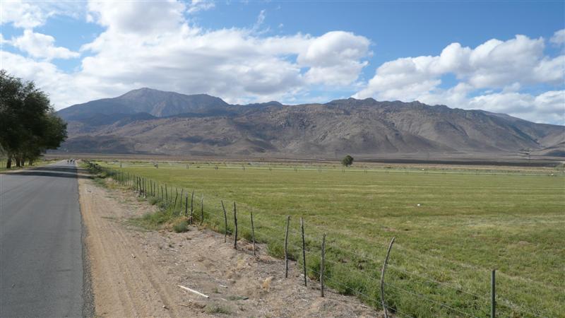
Starting area of Stage 2. The first climb of stage 2 goes right up
the mountains in the distance.
Couple miles into final climb of
race.
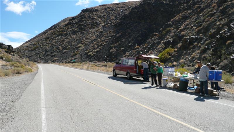
First food stop
setting up on final climb of race.
A tight squeeze spot where road
briefly goes down to one lane.
The dreaded switchbacks. The climb was persistently steep in this
section, but it was a blast to descend.
A very steep spot just before
wonderful vista pull-off on the left.
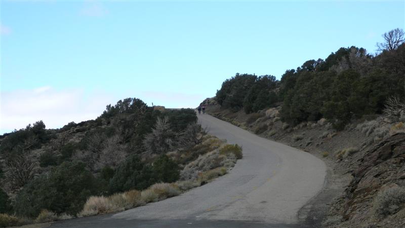
Two local riders out for a ride are just cresting this steep pitch.
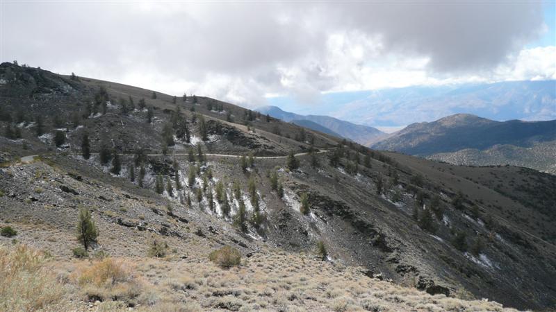
Just about to the finish looking back
down. Bits of snow in the shadows
here.
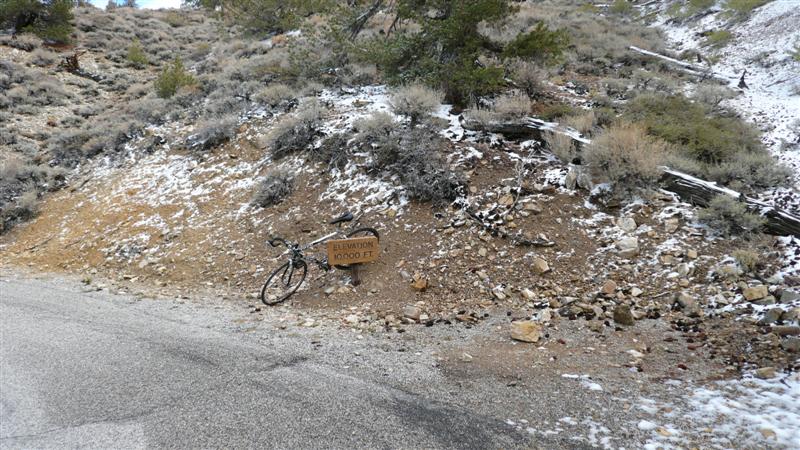
Looking in upward direction from same
spot of photo above. This is right
around 10,000ft level on
And the sign...
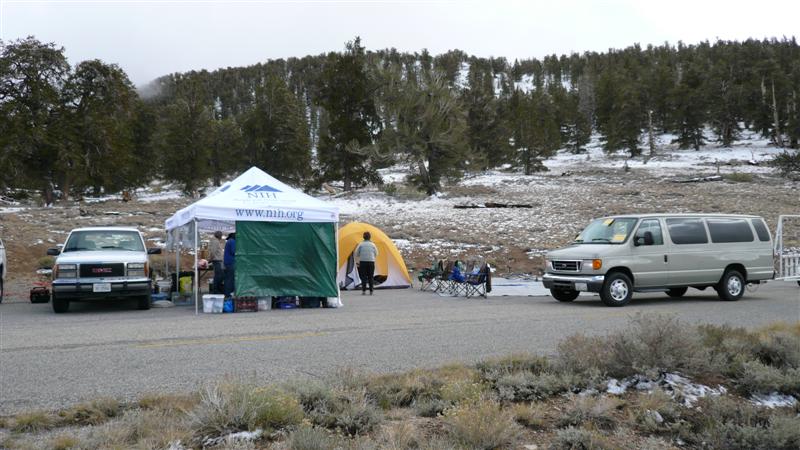
The finishing food station just past
and below the finish line. Nobody has
made it up yet other than a couple local riders. Very cold here. I made it up in short sleeves but needed to
quickly get into my long layers. I
still shivered a bit in them.
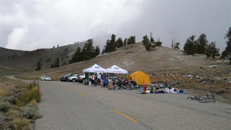
Another shot of finish after several
racers have come up. Clouds would
intermittently move through and the temp would drop dramatically.
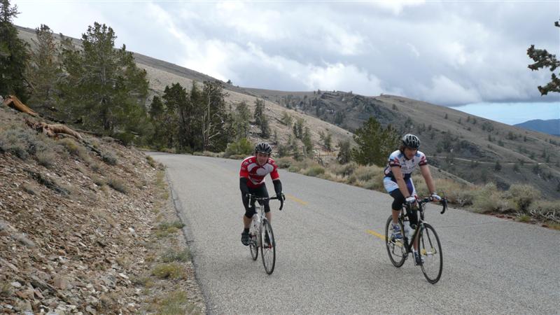
Tom finishing up his race.
Rich approaching the line and even
smiling. That’s just not normal.
Dave finishing. He does not look happy.
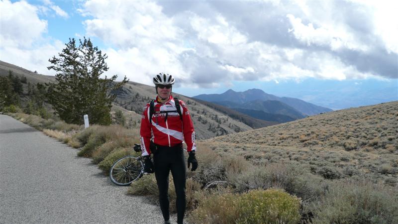
And myself. Disappointed I didn’t finish, but happy to
be up here. So that
covers the race. I never got to see
two of the climbs from stage 2. Maybe
next year. After feasting in Bishop
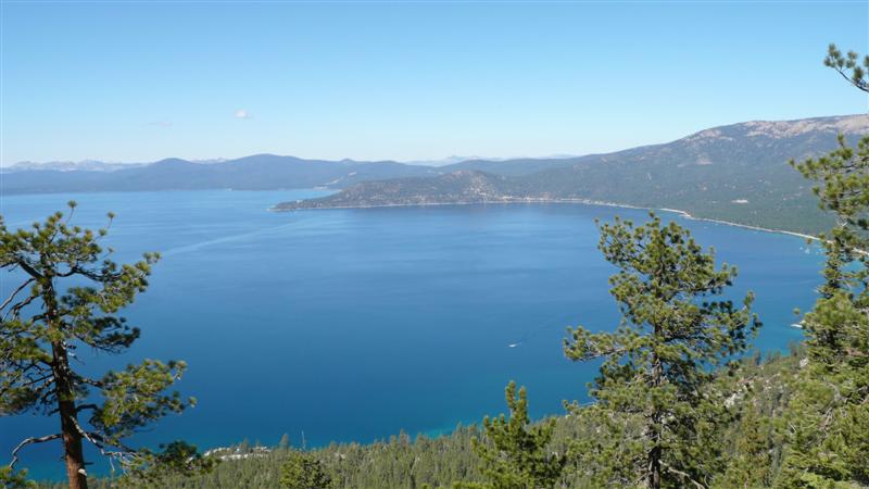
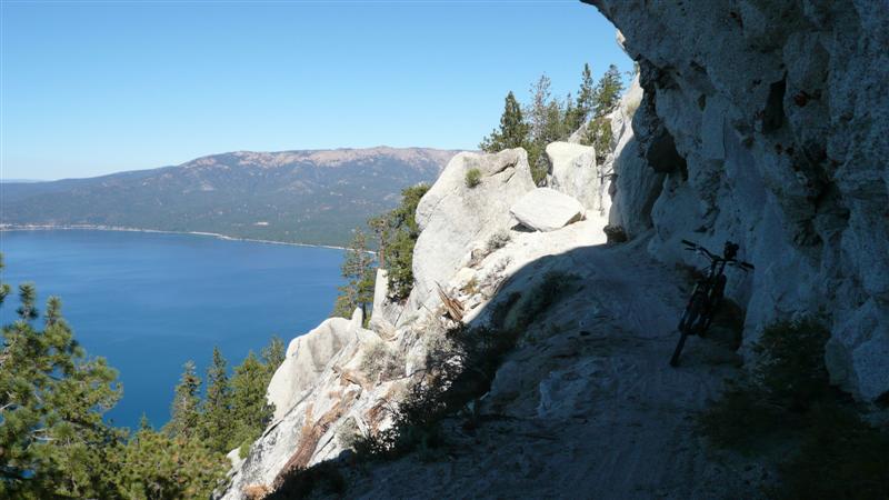
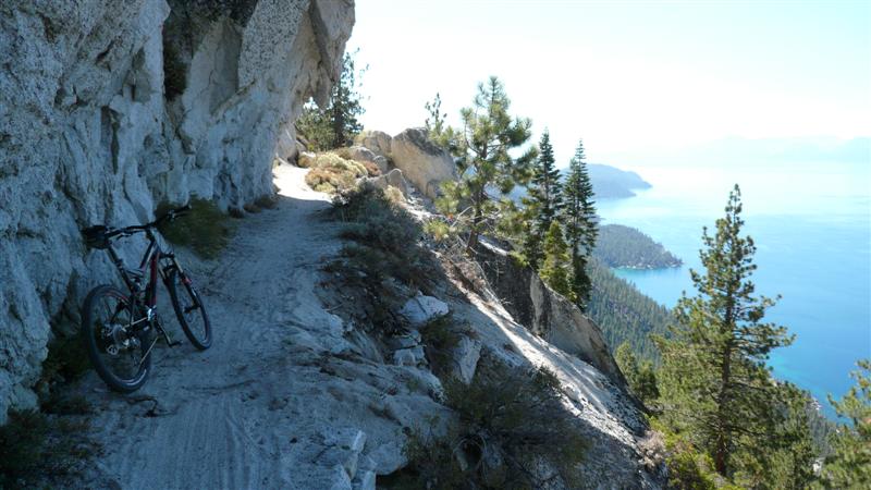
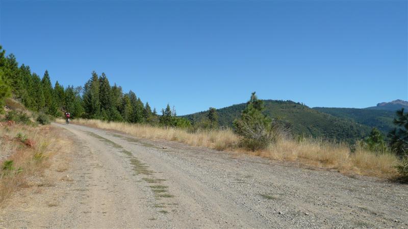
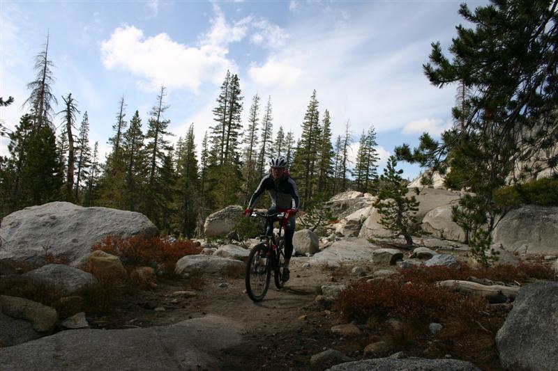
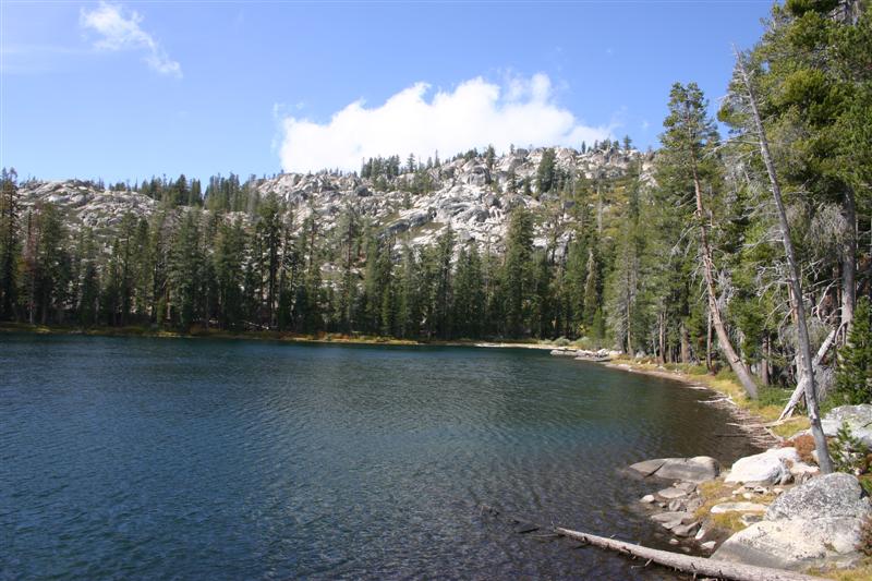
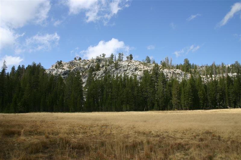
and sleeping in the next morning, we packed up the bikes. We dropped them off at a FedEx/Kinko’s in Epic MTB Ride #1 Tuesday, Sept. 25 Tahoe Rim Trail/Flume Trail 29.8 miles, 3:48 riding time, 4:24
total time Rich
and I went back to Flume rentals about 9:30 to pick up our bikes and begin
the ride from right there. I had
originally planned to do a slightly bigger Mr. Toads Wild Ride loop, but Rich
really wanted to hit the Flume Trail loop again. He had been out there several years
ago. The change in plans was fine by
me, and the Flume trail was the one I most wanted to hit while out there
too. I’ve wanted to ride it ever since
reading about it maybe 7 or 8 years ago.
My legs were still in sad shape from cramping incident during race,
but I survived. Temps started out with
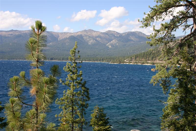
frost on car in the morning warming to around 60F at 9000ft in the afternoon. We
started up the
Climb up to the Tahoe Rim Trail
(TRT).
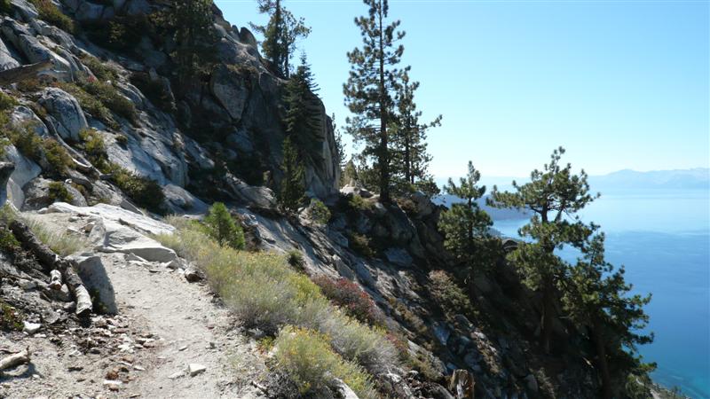
The TRT above
Rich on TRT descending north of
Marlette Lake
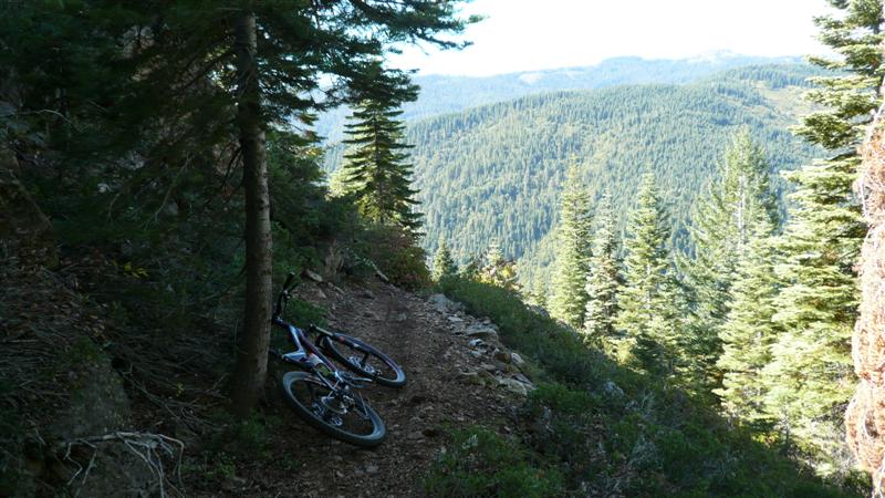
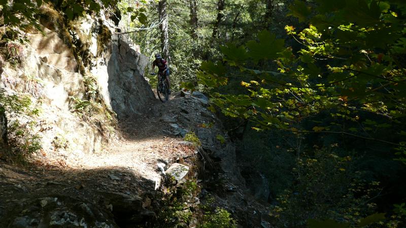
Getting into the tight stuff.
Other side of the squeeze.
Some more exposure.
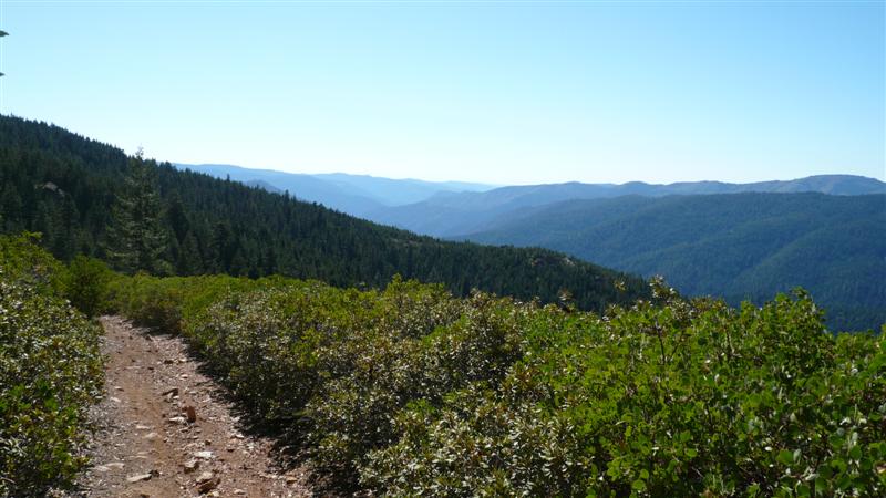
Views were tempting, but best enjoyed
after stopping in sections like this.
The famous
Rich on the TRT. Epic MTB Ride #2 Wednesday, Sept. 26 Downieville XC Loop 41.5 miles, 4:30 riding time, 5:30
total time After
our Flume Trail epic, we headed to With
full Camelbaks and a large water bottle on the
frame, we headed out initially on the paved Rt
49. After 6 miles of gradual climbing,
we picked up the dirt FS-93 fire road.
This climbed earnestly for 14 miles.
Yep, we had to climb for 20 miles before we got to anything that resemble a trail.
This resulted in a net gain of about 4200ft. But total climbing for the ride was much
greater than this, as there were other large descents and climbs before we
got into the singletrack. From the
saddle, we took FS 93-31, then FS 93-3 to pick up Big Boulder Trail. An insane descent ensued, using every bit
of suspension my FSR had to offer.
Baby heads, loose slabs of rock, sand, gravel, anything but firm buff
soil to ride on. After crossing Pauley
Creek, and equally insane climb ensues. This seemed to go on forever, maybe not
quite as gnarly, but lines had to be carefully picked on this climb lest you
spin out. But finally after reaching
the top of this one, climbing for maybe 3 hrs, were at the top at last. The
ride back down to Downieville was one of my best 15
miles on a bike ever. Nearly all down
hill, buff and scary fast at times, tight switchbacks at other times, and
fear of death ledges along the river.
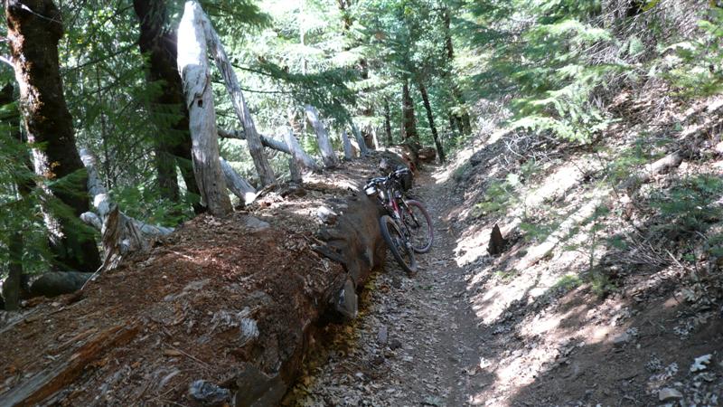
We took Big Boulder Trail down to 3rd Divide, then
turned up 3rd Divide for just a bit to pick up the upper end of 2nd Divide
Trail. This was the nicest part of the
ride for me. Nice views of the gorge,
but lots of exposure. Not all down
either, but mostly. 2nd Divide pops
out on
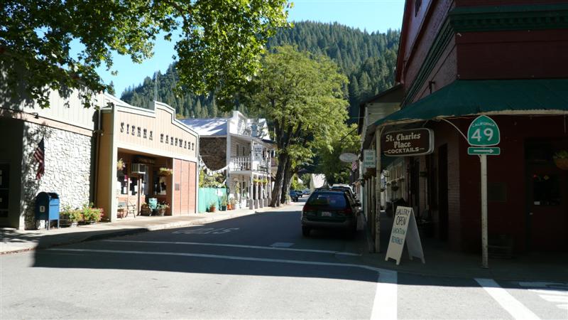
Beginning
ride on scenic Rt 49 along
the
Rich climbing on the very long FS 93
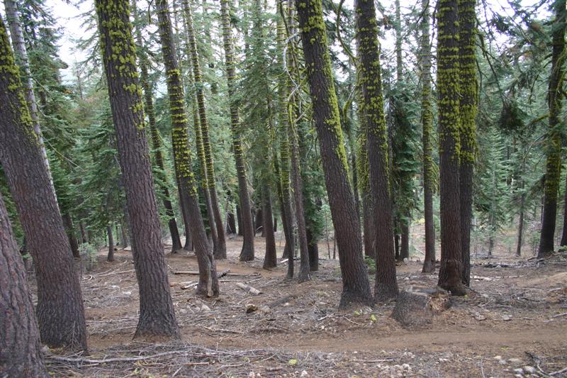
fire road.
Further up FS 93 on ridgeline. Many areas here had these bands of funky
fluorescent green moss wrapping around the trunks.
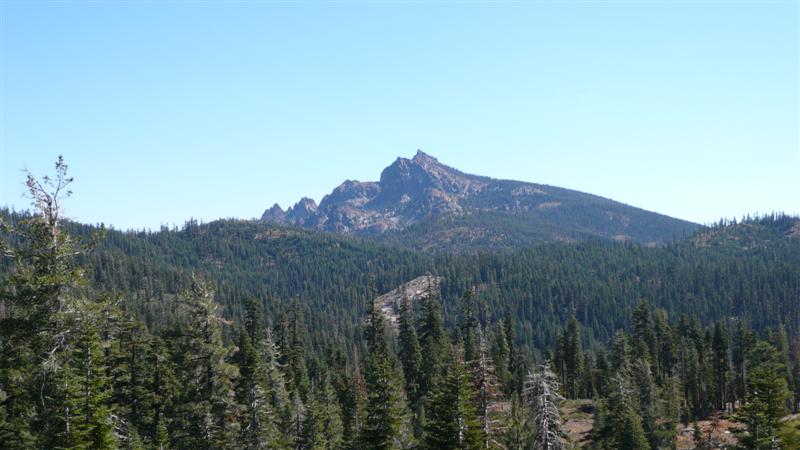
Craggy peaks called Sierra
Buttes. This might have been from FS
93-31.
Nearing finish of climbing to top of
Big Boulder Trail.
Beginning of miles and miles of
descent nirvana. Top of Big Boulder
Trail. Thousands of feet of drop back
to Downieville.
Yummy...
One of the more exposed parts near
top of Big
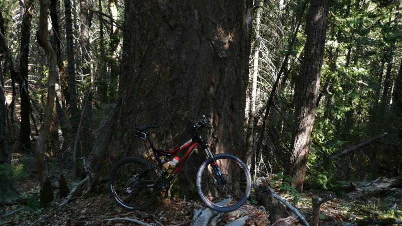
A fine specimen of old growth.
Typical Big
This might have been 2nd Divide
Trail.
Exposure on 2nd Divide.
Probably 1st Divide Trail here, as
river is now on right side. Smooth,
fast, but quite exposed in spots.
More 1st Divide Trail with stream far
below.
A nice vantage point...
and going
over the edge here is not an option.
Final shot of Downieville
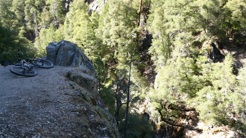
ride. Epic MTB Ride #3 Thursday, Sept. 27 34.5 miles, 4:01 riding time, 5:00
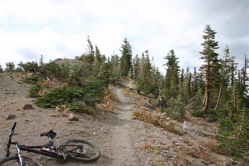
total time We
would need an early start on this ride in order for Rich to get his bike back
to rental shop in time. He flew back
the next morning. I had a lot of
uncertainty in how long this ride would take.
It was less miles, but so many reports warned
it takes longer than you think due to a lot of climbing and the technical,
risky nature of the trail. It is
rumored guys got caught in darkness out here and had to spend the night in
the woods (there are animals that eat humans out here – bear scat was all
over the place). We didn’t anticipate
roughing it overnight in the woods, but we had a schedule to keep. I think
we got started around 8:30am with full Camelbaks
and extra water bottle each. The ride
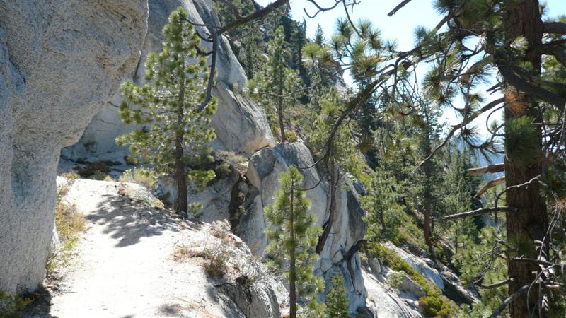
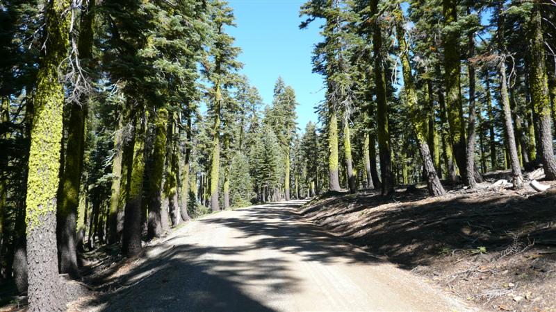
begins with some steep dirt road climbing on N. Bloomfield Rd, picking up a
really sweet singletrack trail called Rim Trail around the Malakoff Diggins site for 3 miles, then resuming climbing on
one-lane Relief Hill Rd. The Rim Trail
was a nice early morning treat. Buff
stuff without too much climbing. But
about half way around on it, something very big went crashing into the brush
right in front of me. I suspect it was
a bear. I made a racket to make sure
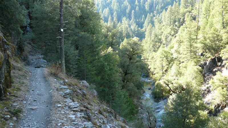
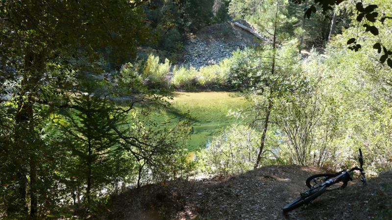
it kept going. Eventually the We pick
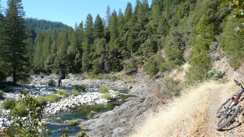
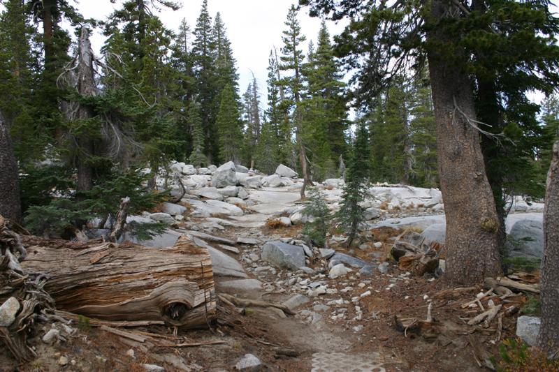
up the South Yuba River Trail at the trailhead near
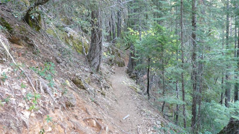
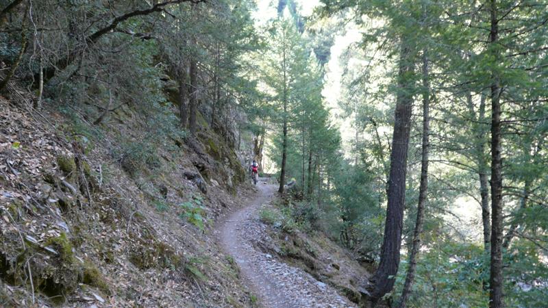
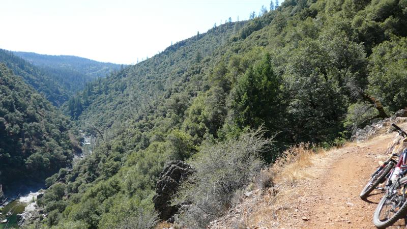
Near
Starting out on South Yuba River
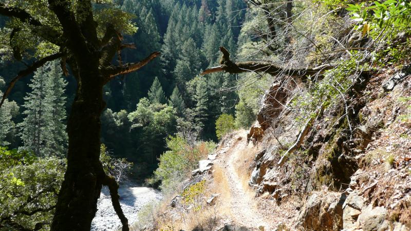
Trail, the more technical section near
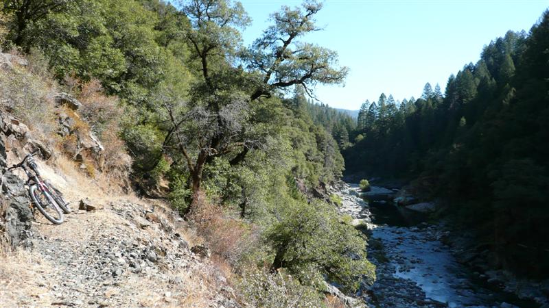
Typical bench-cut ledge on S. Yuba.
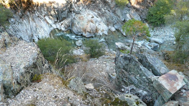
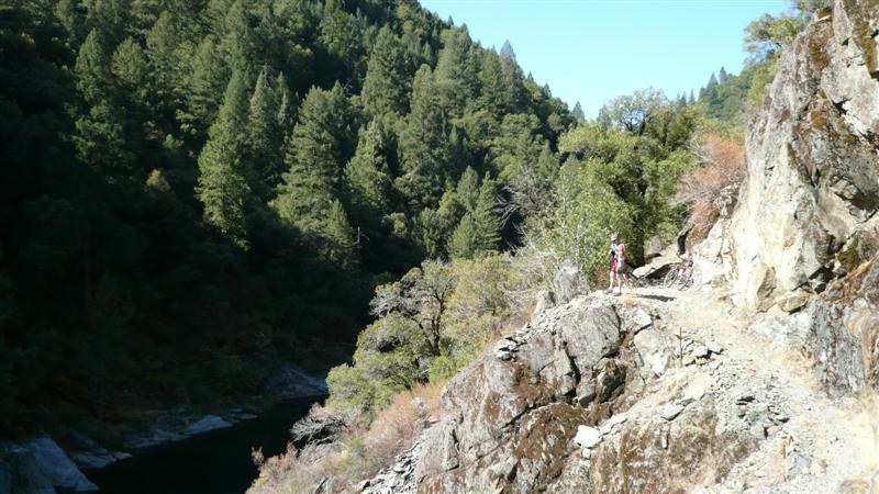
Rich pondering the depths of this
very deep pool in the S. Yuba River.
No room for error here. Stop
before looking.
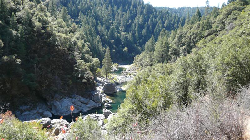
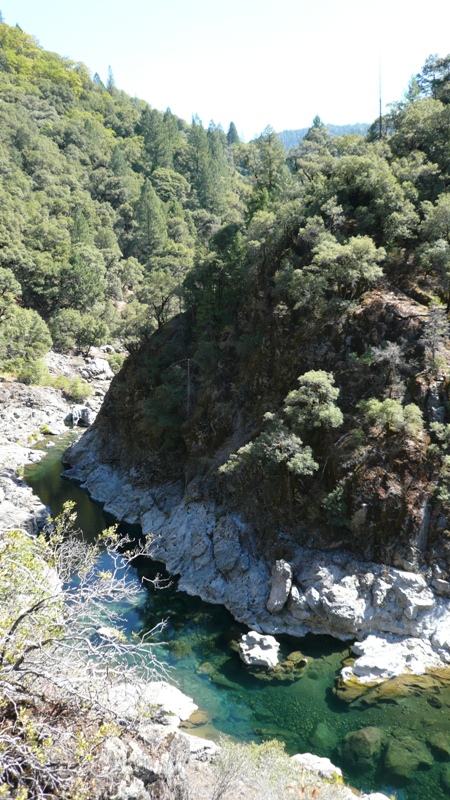
Most of the rivers around here had a
green tint to them, but the S. Yuba in particular had an iridescent green
glow too it.
More
skinny ledge on the S. Yuba.
Magical green swimming holes.
The water might have been 10-15ft
deep here, yet crystal clear.
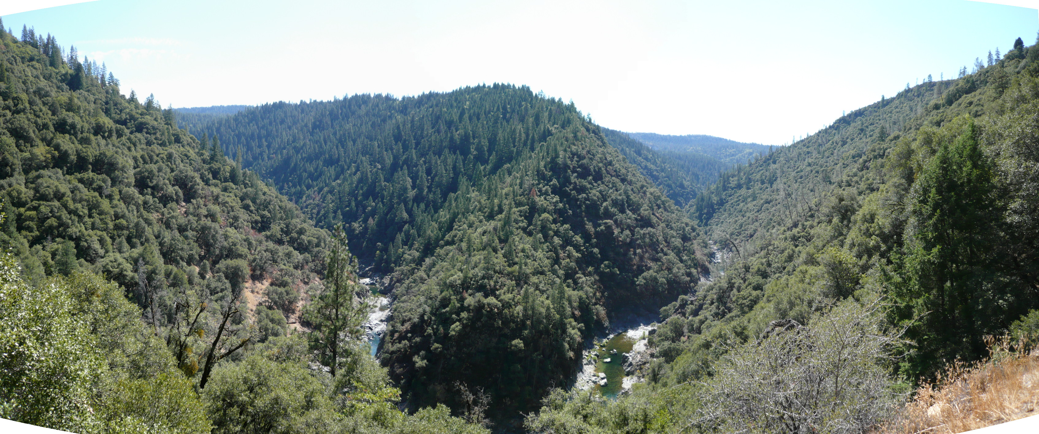
My favorite view from the ride. Click on this photo to open a large
panoramic view. View at 100%, full
screen, and pan around. Taken with
Panasonic Lumix FX-100, three stitched exposures at
ISO100.
From same vantage point above, capturing
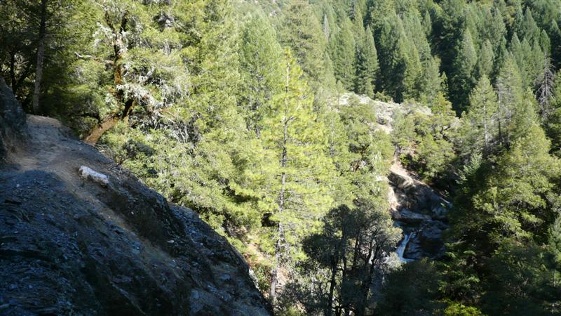
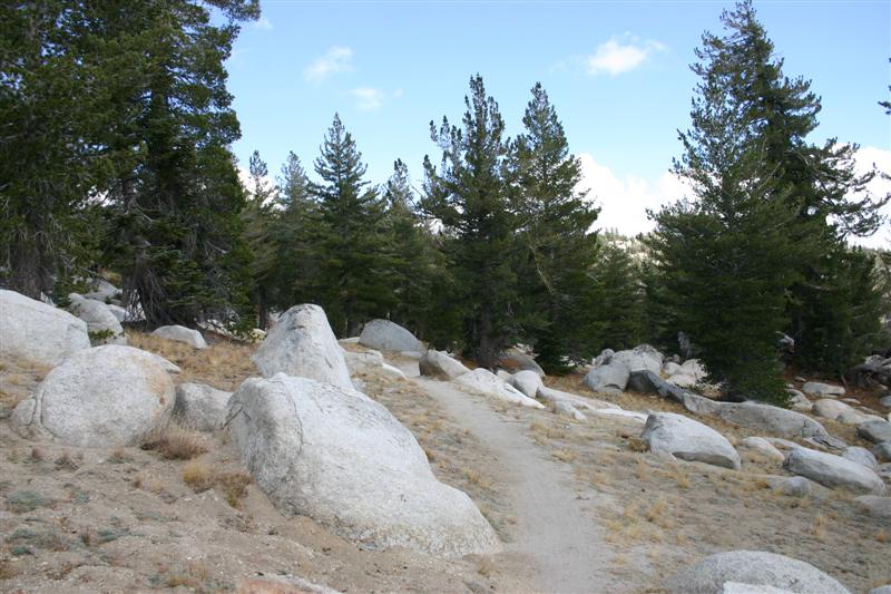
a bit of the trail surface. MTB Riding, Day #4 Friday, Sept. 28 Hole in the Ground Trail 17.0 miles, 2:19 riding time,
~3hrs total time Tahoe Rim Trail 10.5 miles, 1:15 riding time,
~1.5hrs total time There
was 30-40% chance of rain in the forecast this day. Skies were mostly cloudy. I dropped Rich off at the airport and
headed back west on I-80 to The
middle section of the ride was very technical. I could ride all of it, but for me to carry
speed would entail considerable risk.
I was riding alone and had two expensive cameras with me. Lots of slick rock, ledge stair step drops,
loose switchbacks, washboard coming into switchbacks, it was all there. The
descent finished out on a section called “The Steps.” These were first rail road tie erosion
control bars, but spaced closely enough together that you’d be hitting more
than one at a time. There were also
some very big, steep rock bars too with loose dirt in between. I had trouble controlling my speed on this
stuff and ended up walking a segment.
I didn’t want to break my digital SLR camera (that’s my sorry excuse
anyway). After
bottoming out at the bottom of the steps, climbing on gravel road and some
more singletrack begins. I didn’t
study the topo of this ride, but it descending a
long ways down the west side of
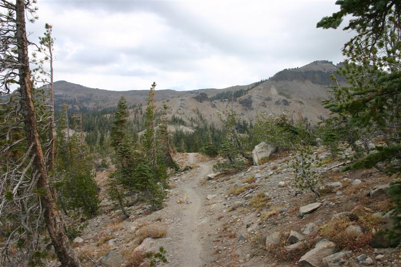
Hole in the Ground climbing
switchbacks with moss-ringed trees.
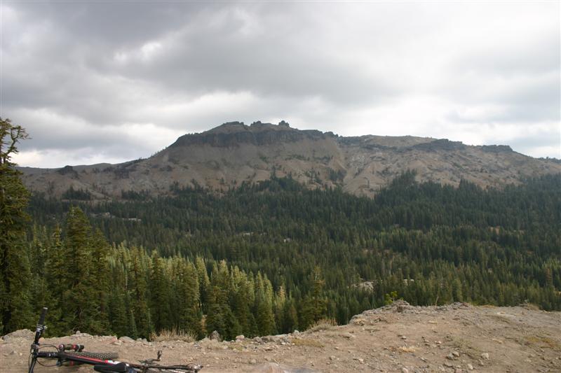
View of Castle Peak (9100ft) from
Beginning of Hole in the Ground
singletrack descent. It was fast and swoopy here, but not for long.
Continuing Hole in the Ground
descent.
Looking back up Hole in the Ground.
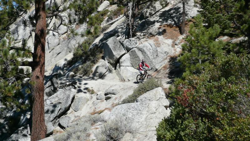
The trail became many miles of rock
garden like this. All rideable. There
were lots of slickrock side features that others
appeared to play on.
Self portrait on Hole in the Ground
loop.
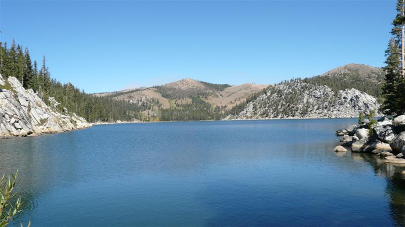
I took a short spur to see
A nice meadow near the lake just
before wrapping up the descent on the “Steps” section. Still
being early in the afternoon, I just could not bring myself to calling Hole
in the Ground the last ride of the trip.
I had several hours before the rental bike had to be back. After wolfing down a large sandwich at Quiznos and picking up a grande
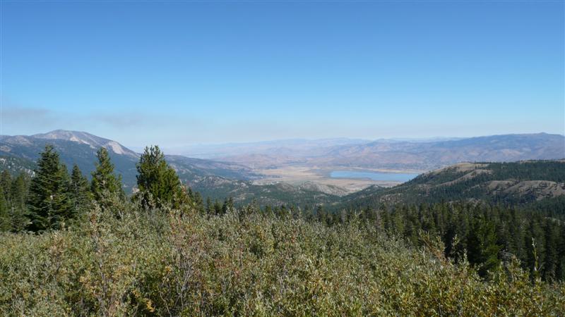
Starbucks, I was good to go for at least a little bit more. I drove up Hwy 431 from It was
extremely windy this afternoon, and so far the threat of rain held off. I had to brace myself to take pictures from
the ridgeline. It was also very cold
up here, maybe only in the 40’s. I
wore long layers, two up top including wind breaker. Could have used an ear band. Lots of riders were out on this, despite
being a Friday afternoon. The scenery
was spectacular almost everywhere. I
only had about an hours’ time, so I turned around just over 5 miles out on
this trail. Not stopping to take
pictures on the way back to the car was nice on this flowy
trail.
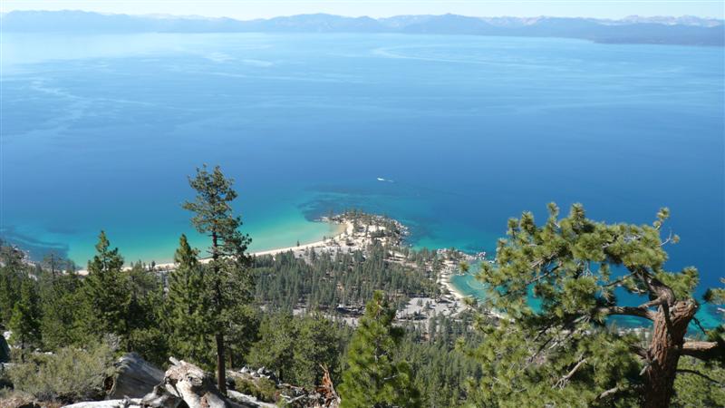
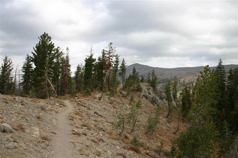
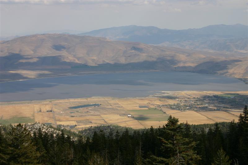
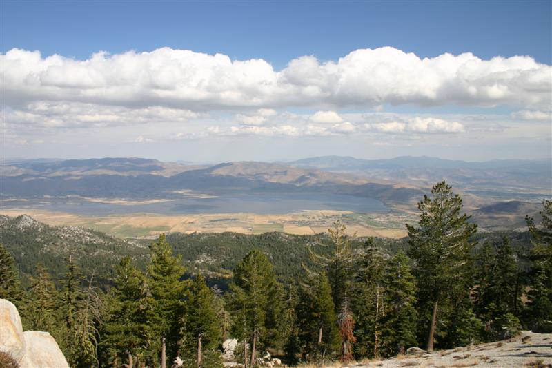
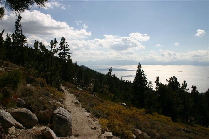
Tahoe Rim Trail from Hwy 431.
View along TRT. Trail actually cuts through the center of
this image but not visible without blowing up high-res
photo.
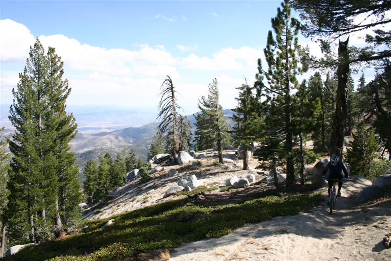
Other riders shredding on TRT.
Different view of
TRT with
Trip Wrap-up So the
trip overall was a success, despite my race being a major
disappointment. I haven’t decided yet
whether I’ll come back to redeem myself in the Everest Challenge. It requires a pretty big time commitment, logistically
is tough to get self and bike to, and requires a season long focused training
regimen. I would do more mountain biking around As I
left I can
now color another state in on my map of states I’ve
mountain biked. Compiled
by Doug Jansen 4-October-2007 |