September 15 – 21, 2005
Doug Jansen
Trip Highlights:
- Solo off-road cycling trip to
- Hit Mt Evans, Fruita,
and Crested
- Six Days Cycling summary
- 213.0 miles
- 23 hours, 3 minutes riding time
- 28,260 feet of climbing
- Zero mechanicals, one minor crash
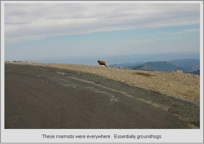
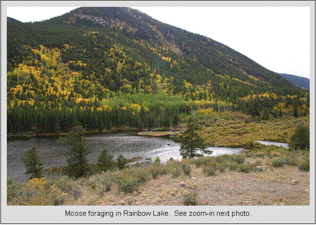
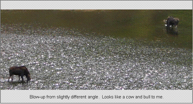
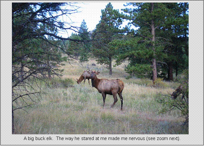
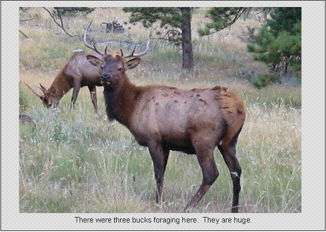
- Wildlife sightings: Elk, Moose, Deer,
Coyotes, and Marmots
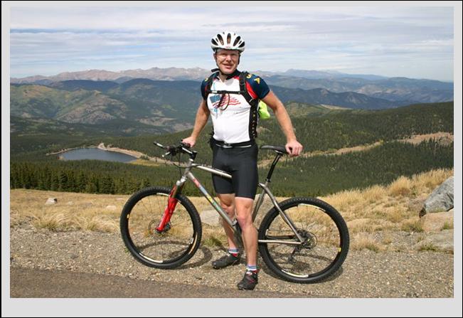
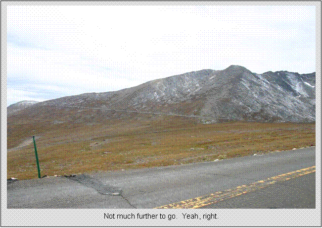
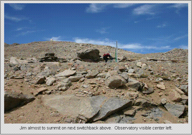
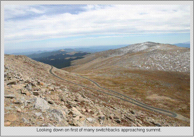
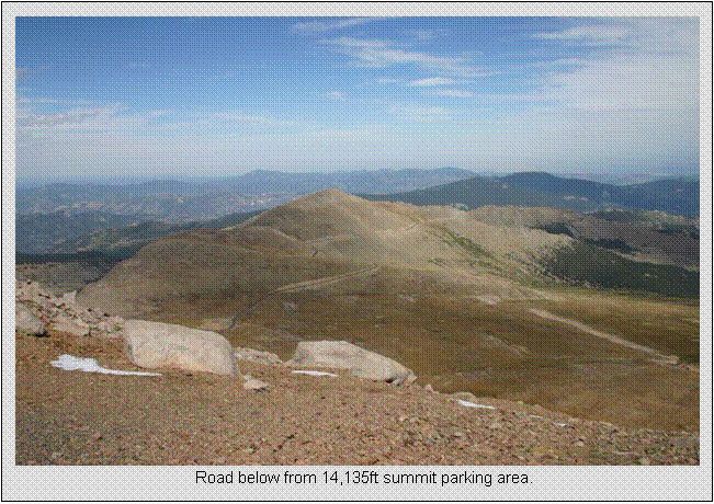
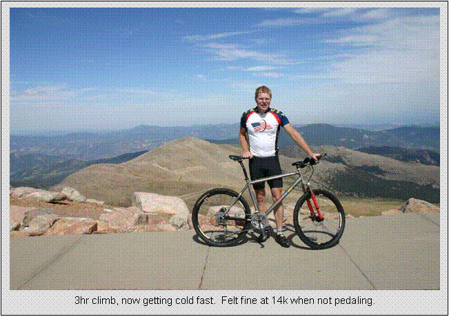
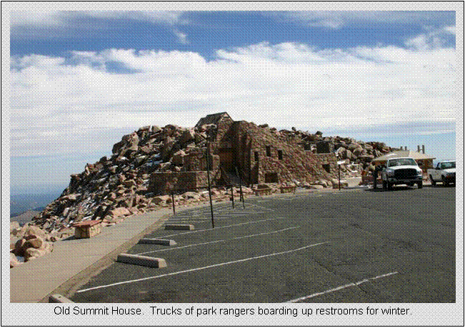
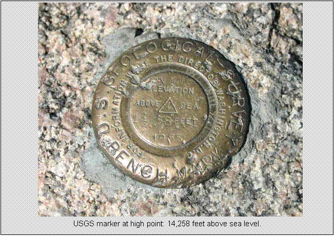
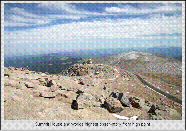
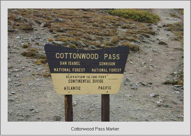
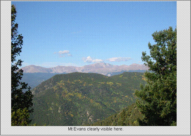
Mt Evans, Idaho Springs
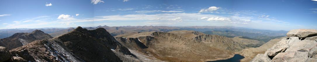
Western 180-deg Sweep from
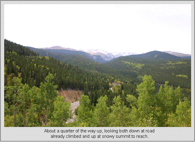
Friday, Sept 16, 27.1
Mile Paved Hillclimb to
54.5 miles
4:13 hours
6580 feet net gain, nearly 7000 feet total climbing
I arrived in
The climb starts very gradual from Clear Creek at 7,555ft,
no more than 3% grade. In the race, you
could gain considerable benefit here by drafting. The grade picks up some after a few miles,
but still probably no more than 5%. Upon
reaching
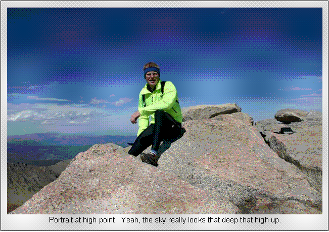
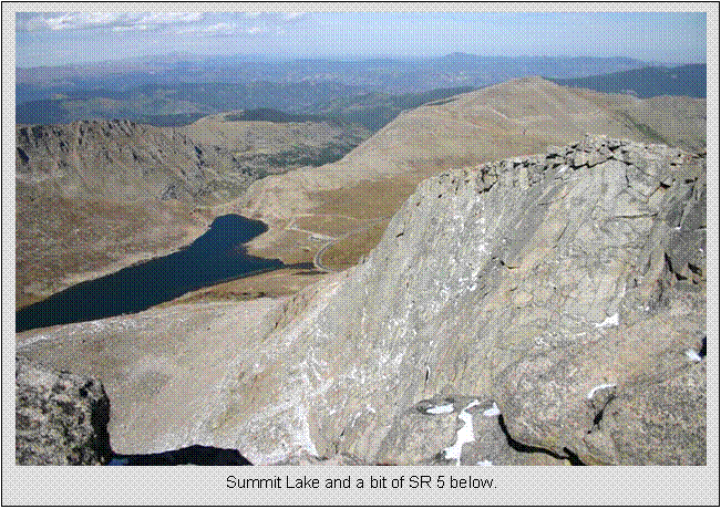
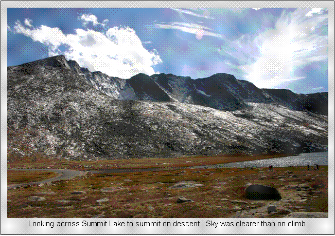
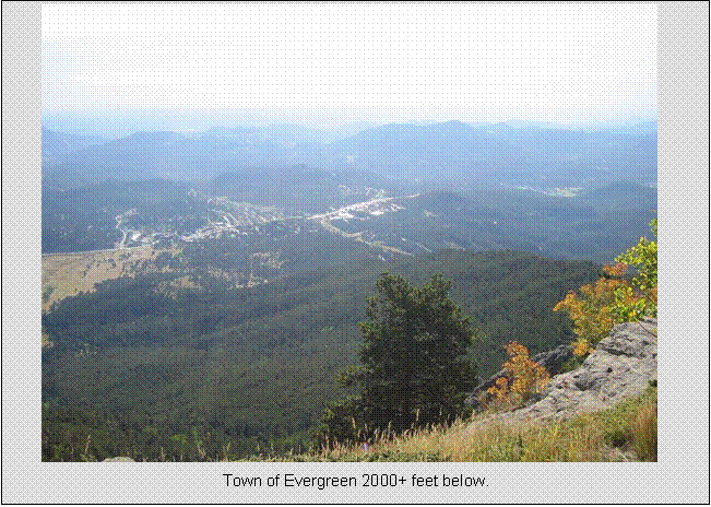
The summit area is a special place. A short hike brings you to the
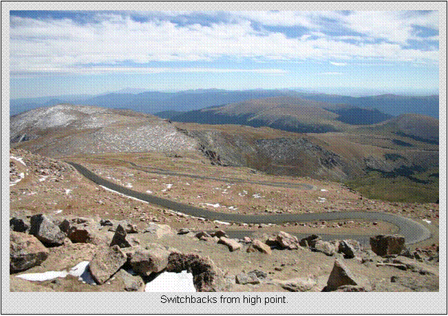
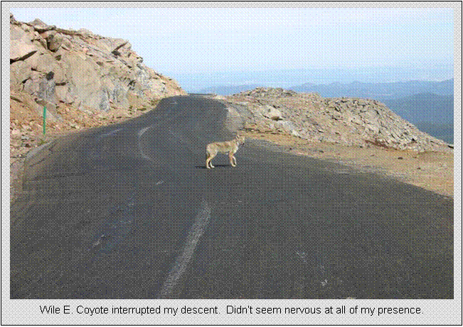
The descent was a blast.
Nearly no brakes required except at hairpin switchbacks. I did have to pedal a portion of the
bottom. I was overheating with all the
layers on by the time I got back to the car.
It must have been in the 80’s by then.
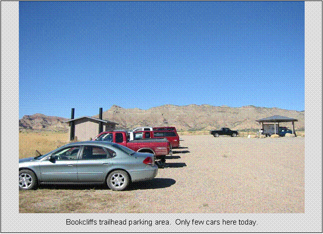
Bookcliffs Trails, Fruita
Saturday, Sept 17,
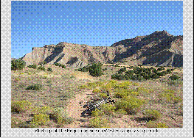
Edge Loop Trail Ride
44.0 miles
4:56 hours
~5000 feet total climbing
After wrapping up Mt Evans, I continued up I-70 to the Grand
Junction/Fruita area.
I had wanted to stay in Fruita, but had to
book Motel 6 in
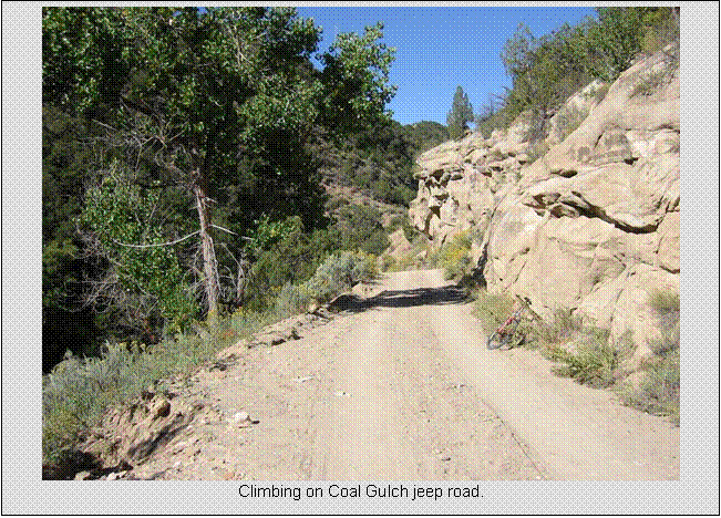
Saturday morning, after a terrible Burger King breakfast, I drive over to the Bookcliffs trailhead. My plan was to ride the Edge Loop (29.2 miles) then hit some of the popular trails closer in. The Edge Loop starts out on singletrack, then goes behind the cliffs you see from the parking lot, steadily climbing Coal Gulch on jeep road until you reach the ridge line. A couple thousand feet is gained. The views down Coal Gulch and of the cliffs across the gulch were what this ride was all about. At the ridgeline, I kept taking wrong turns. One of them infuriated me. There’s all these gas well heads up there, and you can’t tell the side roads from main road. One descended hundreds of feet to a dead end. I forgot to bring detailed guide instructions with me. Turns out the most inconspicuous route was the one I had to take. This cost me an extra 4 miles and upwards of 1000ft of climbing.
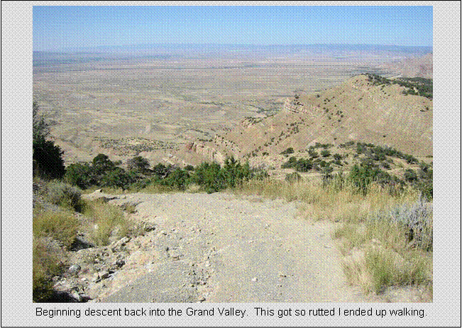
The descent down the front side of Bookcliffs
was chocked full of terrors for a limited skills XC weenie like myself. First some
extremely steep loose, rutted pitches, where you are looking practically
straight down. I could not control my
speed on a couple of these by braking, so I walked a couple stretches. Views of the
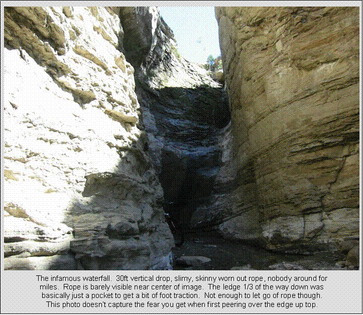
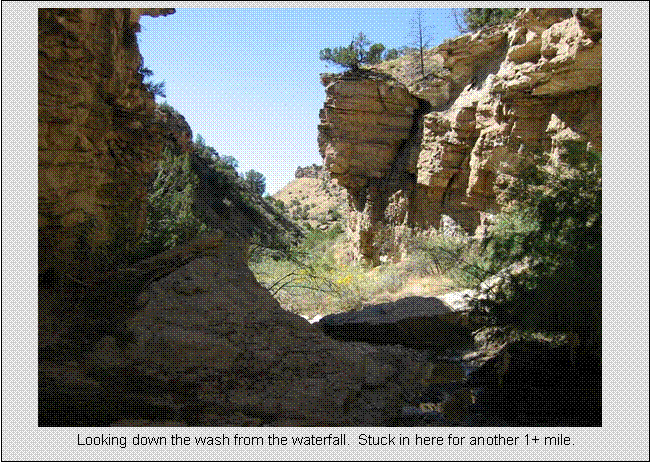
Then came “The Waterfall.” The guide book warned of this, said it was a 30ft drop, usually a rope there, and use the buddy system to get down it. The book also said “although is seems dramatic, nobody has ever been hurt here.” I thought it can’t be that bad. When I reached it, I said to myself “ain’t no friggin way!!” I was horrified, as I would not have enough energy or water to climb 2000ft back up and ride 20+ miles to back track the way I came. I had to repel down this thing. The rope was a heavily abused climbing rope (about 1/2” diameter), but the outer sheath was gone, so it was a loose pile of small strands. Plus, it didn’t reach the bottom. There was no way I could descend with bike, as I was going to need both hands on rope, and I would have to drop the last four feet to rock at bottom. A small amount of water was flowing, so everything was slippery. There was a short rope also attached to the anchor point. I used it to drop my bike to a ledge part way down, but it was too short too. So my bike is hanging maybe 8ft down, I’m hanging on the long rope trying to untie bike with one hand. Then I had to drop my bike to “ledge” and hope it didn’t keep going another 20+ feet and smash into the rock below. It didn’t. So I get to ledge and now have no way of going back up, and no way of getting my bike down the remaining huge drop but to literally toss it down. Hanging on the rope, I drop my bike from the front tire. It free fell about 15 feet to water and rock below. I couldn’t use the rope I was using to repel down to lower my bike, as the end of it came about 8-10ft from the bottom. Once I dropped to the bottom, there would have been no way to reach my bike. Now my bike is laying in the water, probably with bearings filling up, so I quickly slid down the rope and dropped the remaining few feet. I was sooooo glad that was over. Nobody was out there had I gotten hurt. Bike seemed to be ok, only minor abrasions on legs from sliding against the rock.
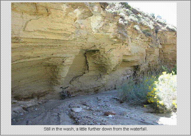
The ride continues down the wash for at least another mile,
some sections completely rideable, others forced me
off my bike. Skilled riders might be
able to clean the whole descent. Eventually,
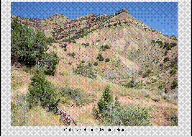
singletrack leaves the wash for good with a good climb. A few more steep climbs on nice singletrack
ensue before a long, easy descent to the car finishes the ride. This loop was truly an epic, something I
would never do again alone. I never saw
another rider during this 3:46hr loop.
The only human I saw was a grater operator on
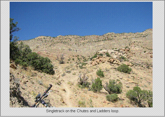
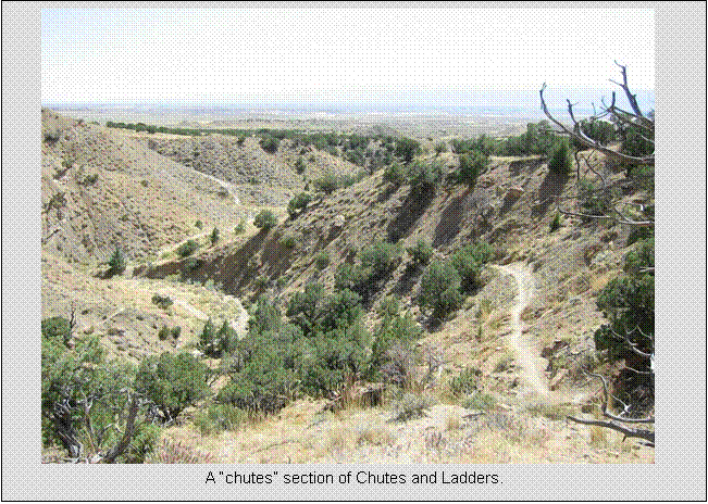
Upon reaching the car, I ate a bit, refilled Camelbak which was empty, and went out on the Chutes and Ladders loop. This is one of the more challenging singletracks there. I rode up on Prime Cut trail, then looped back down on Chutes and Ladders. It gets its name from the series of short, nasty steep climbs (ladders) followed by steep, technical descents (chutes). I cleaned all but one climb, but dabbed a few times on descents. Fun stuff.
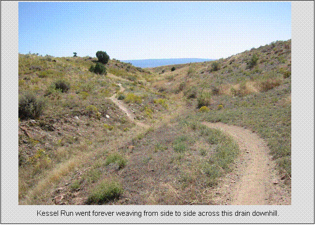
I had wanted to also ride the famed Zippety Do Da trail, but I was trashed at this point, and I was beginning to believe the trail ranking system in the guide book. I speculated I would have been intimidated by some of the drops on Zippety, so I opted for a shorter Kessel Run loop. I climbed up 18 Road, took Kessel Run back down. Kessel is a 2+ mile “slalom” run. Was the most fun two miles of trail I’ve ridden. Nice down hill bias, and it follows this shallow, hard-packed wash the whole way down. It’s a narrow ribbon, non-stop swooping, banked turns in the shallow drainage, with many drops or even rock launches into the wash. Light pedaling here and there, but very little brakes needed. Non-stop adrenaline rush.
I figured Kessel Run was a good note to finish my riding for the day on. The day was perfect, cloudless, 60’s to 70’s temp, and never more than a dozen cars in the lot. In fact, in nearly 5 hours riding, the only place I saw other riders was right around the parking lot! Felt like I had the place to myself, and this was a Saturday! I also lucked out in that a week earlier it had rained heavily for a couple days. This makes the trails completely unridable. I could see evidence where riders didn’t wait long enough for things to dry out with deep, baked-in tire tracks.
Kokopelli Trail
System, Fruita
Sunday, Sept 18, All
Singletrack, Numerous Loops
26.7 miles
3:10 hours
~4000 feet total climbing
This day I started out with a much better Denny’s breakfast:
Pancakes, eggs, two kinds of sausage, and a bowl of oatmeal. I checked out, and drove just west of Fruita to the Kokopelli trail
system. Many riders were pulling into
the parking lot. I ran into the same
woman here that I talked to the day before at the Bookcliff
trails. Looked like
another perfect day was in store.
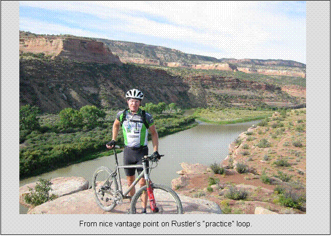
I begin my ride on the Rustler’s loop, an easy rated trail that is also
referred to the “practice trail.” I
thought to myself, if this is practice, what is intermediate,
or double black diamond difficulty? I
had planned to ride trails with double-D sections. This 3+ mile loop was nice, buffed, with some
great initial views of the
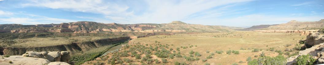
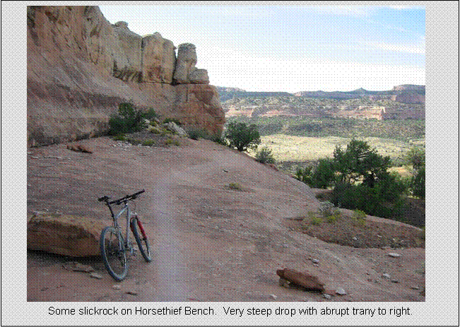
I next ride the Horsethief Bench loop. To get to the bench, a steep hike dropping about 100ft was required. This was nearly hands and feet climbing in a couple spots, but to my amazement, I saw skid marks on the rocks. Hard to belief there are people that can ride something like that. This gets more challenging. A few portages were required on rock ledges or bony sections with serious exposure (where a fall is not an option). But still, really fast, hard surface stuff with bit of slickrock here and there. The views get better too.
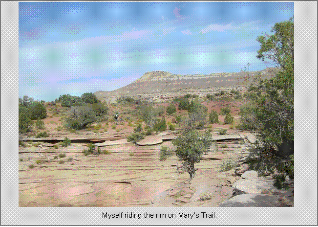
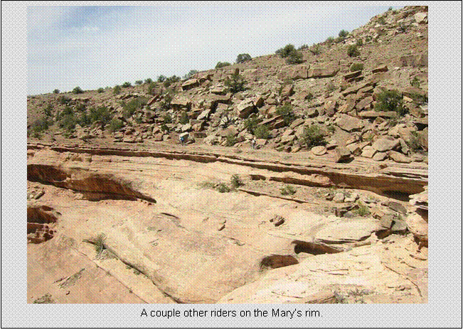
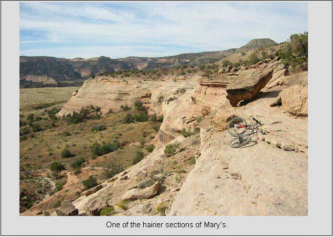
Popping back out on Mary’s
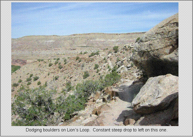
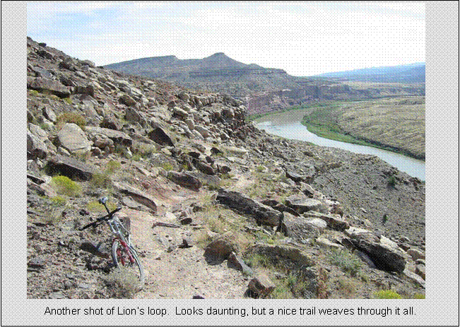
After just a bit on Mary’s, I picked up Lion’s
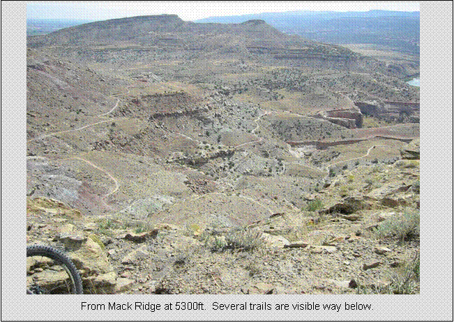
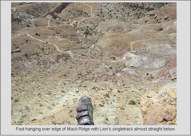
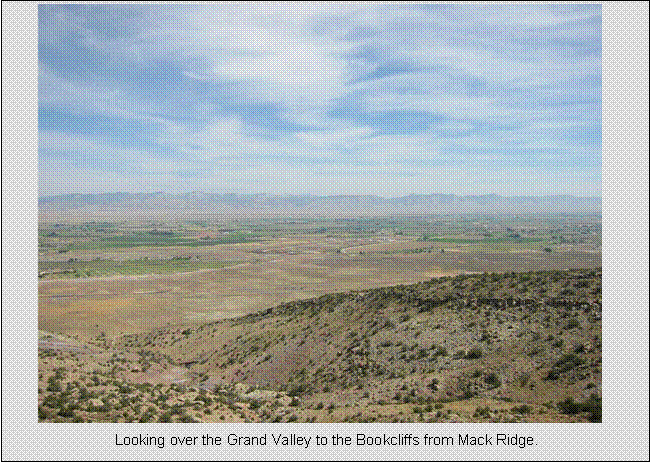
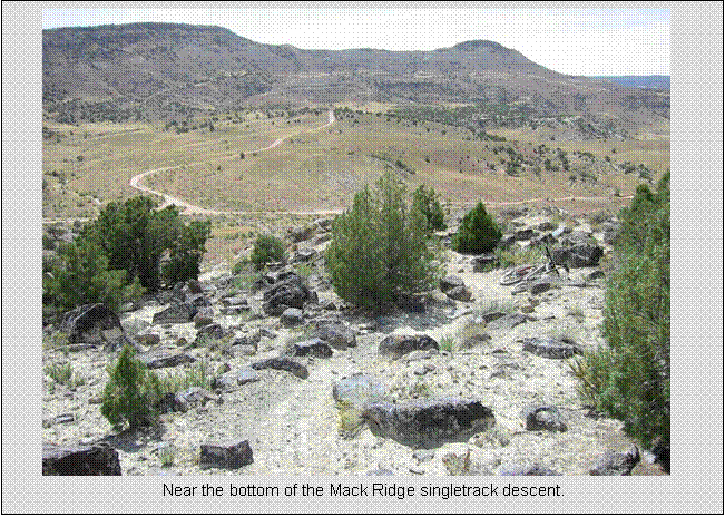
From Lion’s, I pick up Mack Ridge Trail. This was claimed to have a challenging
descent in it, so I assumed I’d be doing some hike-a-biking. The high point of the Kokopelli
Trail system is quickly reached on Mach Ridge, reaching 5324ft, about 1600ft
above starting parking lot. You could
see most of the other trails already ridden in one giant gaze below. Really cool.
Overall, I found the Kokopelli
area trails more fun to ride than the Bookcliffs
trails. Less elevation gradients, great
views of the
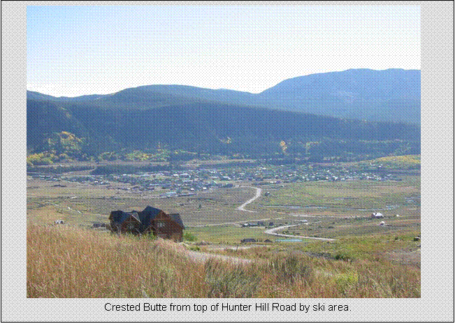
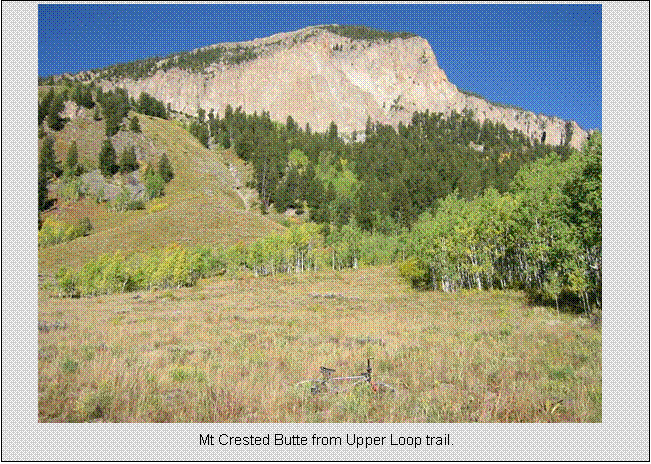
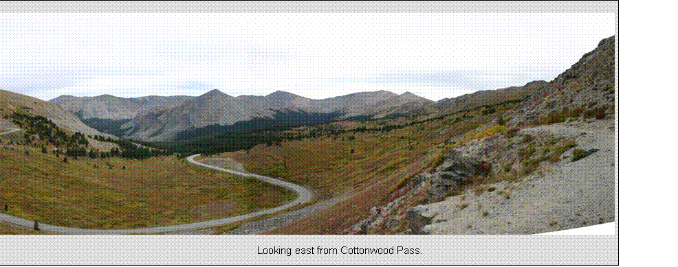
Crested
Sunday, Sept 18,
Evening Bonus ride on Upper/Lower Lower Loop
10.1 miles
0:58 hours
~500 feet total climbing
I finished riding in the Fruita
area a little early and decided to head over to Crested Butte (CB) while it was
still light out to take in the views.
When I stopped in Delta to ask about a potential shortcut to CB, they
said dirt
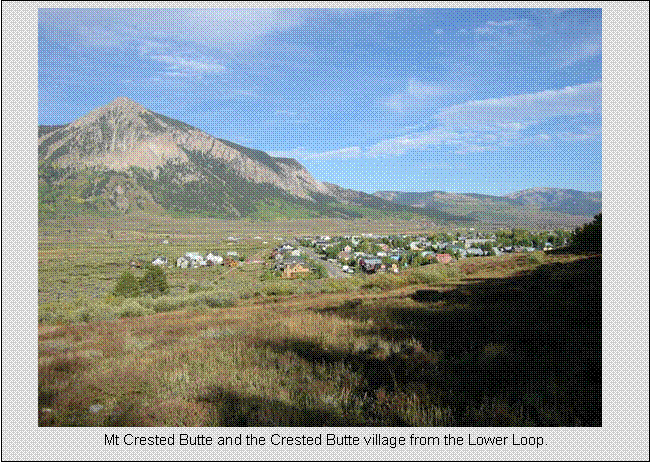
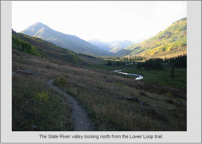
Crested
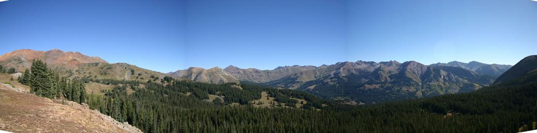
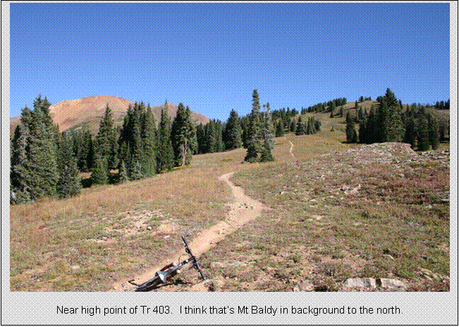
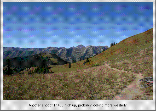
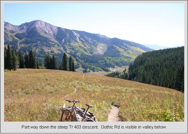
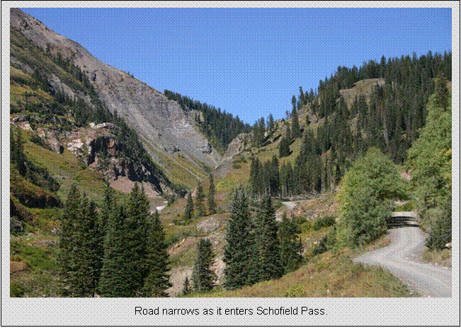
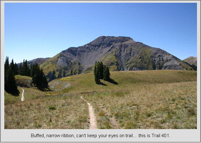
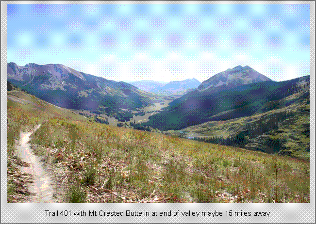
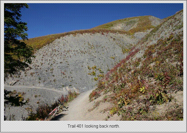
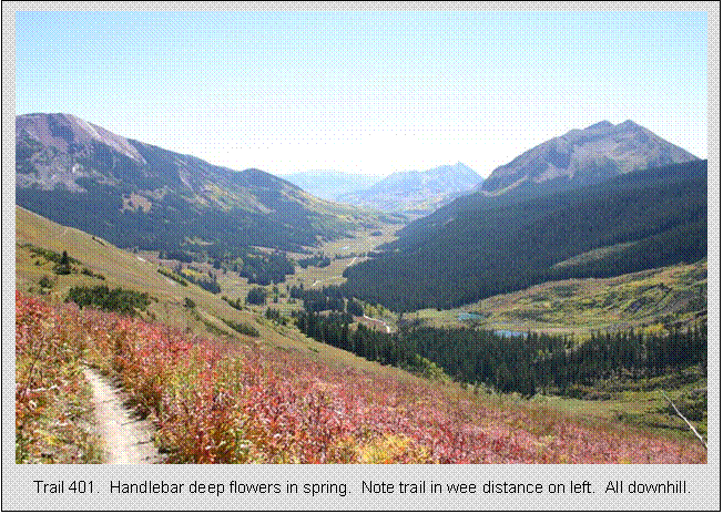
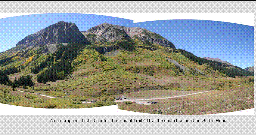
Trail 403,
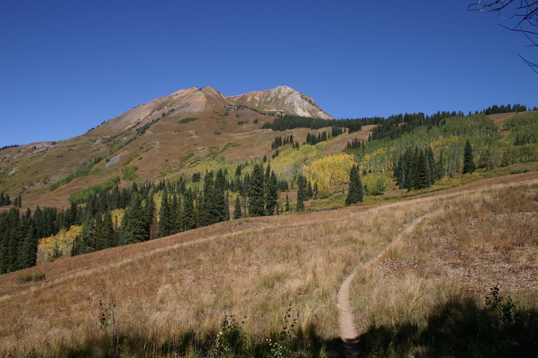
Monday, Sept 19, Epic
403/401 Trail
36.6 miles
4:12 hours
5240 feet total climbing
This was planned to be my “capstone ride” for the trip. I always pick one ride that I plan to be the
greatest in some way and plan the rest of the trip around it. I anticipated this ride would take the
greatest number of hours to complete, the most out of me, and offer the most
spectacular scenery of the trip. Advice
from Mike and friends in
I got up around 7am, ate as much as I could from the skimpy continental breakfast offered by the inn (3 servings of oatmeal, bagel, eng. muffin, banana, 3 small cups of coffee), and changed. Temp dropped into the 20’s overnight, and there was ice on puddles. I started with heavy long jersey and shorts. Knees were a little cold, but temperature rose quickly in brilliant clear skies. In fact, the min to max temperature difference for the day was about 50 degrees! Forecast was for no rain or clouds in site.
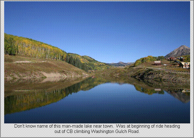
I headed out before 9am, legs feeling quite sluggish. Could see breath in air. CB sits at nearly 9000 feet. I could immediately feel the effects of thin air. It’s a strange feeling. You are huffing like you are going anaerobic, but there’s no associated lactic burn in the legs. You just reach a point where you get too dizzy to continue a hard pace and back down to an altitude forced compromise pace.
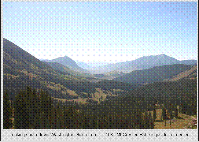
The ride out Washington Gulch was scenic. A lot of traffic at first. There is much construction going on all over
the place, mostly around the
As the town site of Elkton is reached with 12% climbing
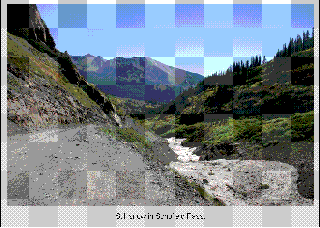
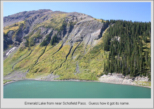
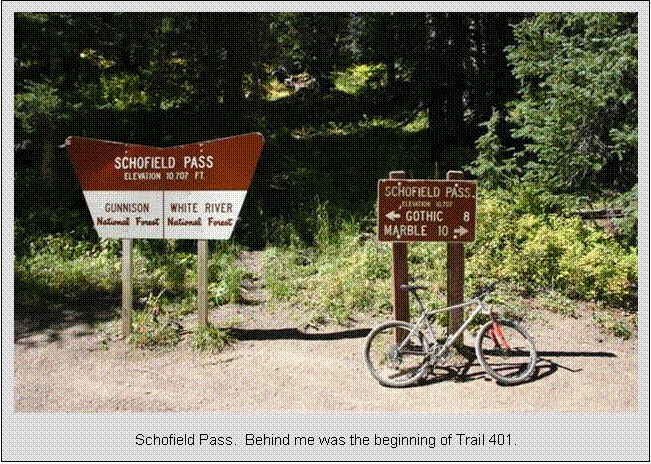
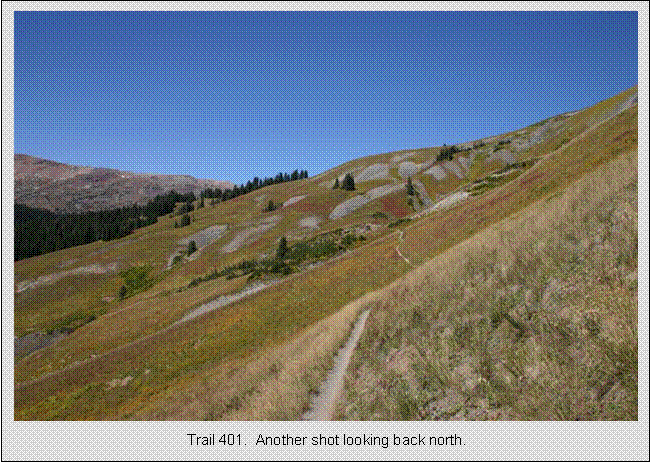
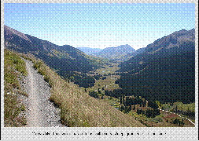
grade, Trail 403 is picked up. This
climbs further, often steeply, to above 11,000 feet. The views from up top were spectacular, big
peaks in all directions. Trail 403
passes between
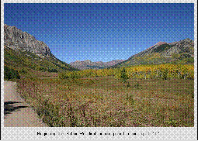
Once on
Eventually, Trail 401 dumps out on Rustler’s Gulch jeep
road. A couple switchbacks down, Trail
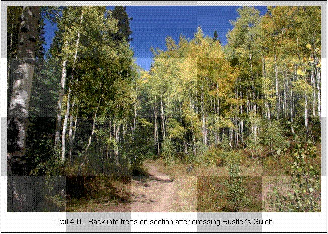
401 singletrack resumes to the left with another hefty climb. This section of 401 doesn’t offer as many
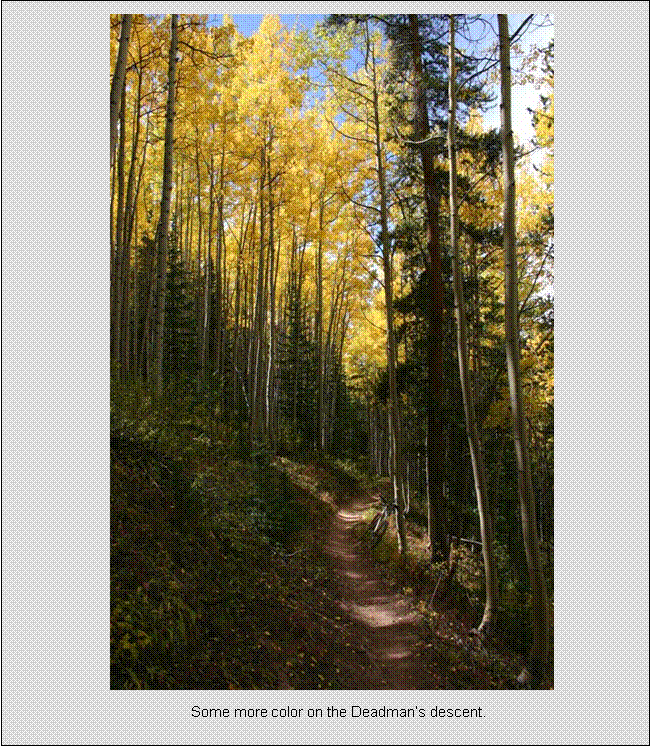
extraordinary views, but at times it transitioned from dark conifer forest to
brilliant golden aspen canopy. Lots of
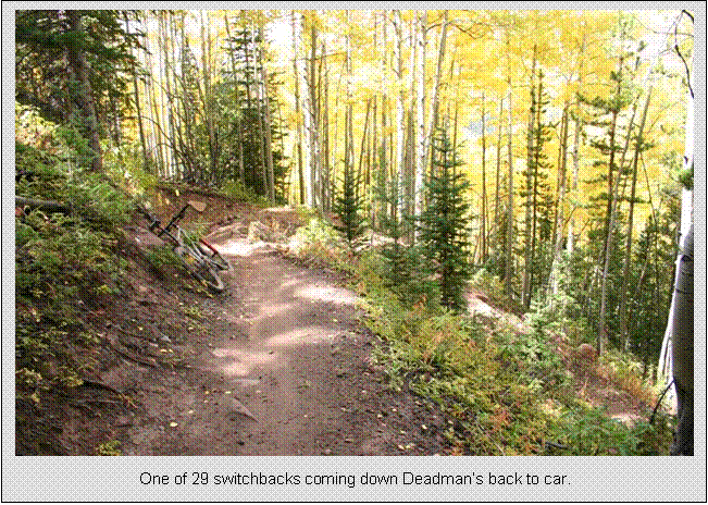
cattle about too, and one time I had to holler at Bessie to get out of my way. Eventually, the final singletrack descent
begins, switchback after switchback, all nicely buffed stuff. Took a long time of carving
switchbacks to get down to
This ride easily ranks as my best all-time trail ride. Sure, some of the scenery in
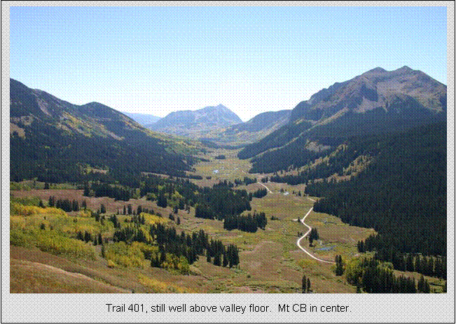
Crested
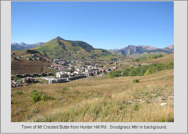
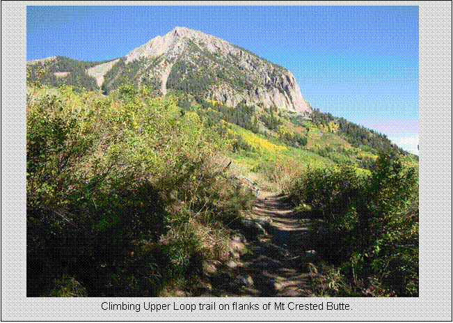
Monday, Sept 19, Late afternoon “bonus” ride on Upper Loop/Tony’s
10.1 miles
1:05 hours
880 feet total climbing
After taking a break from the epic ride and wolfing down a
huge chicken burrito from Teocalli Tamale’s, I jumped
back on the bike for a close in ride on singletrack at the base of Mt Crested
Butte. From town, the paved rec path is taken to the
After washing up and getting ready to head out for supper, I ran into the same three guys I swapped cameras with in Fruita the day before. Bob, Ted, and Jack (I think) were checking in to the Old Town Inn and were planning on doing the 401 loop the next day. We headed out to the Secret Stash pizza house together. Bob plans to do the Leadville 100, so we had a lot of racing and training stories to exchange. All three are retired LA firefighters with a passion for epic mountain bike rides.
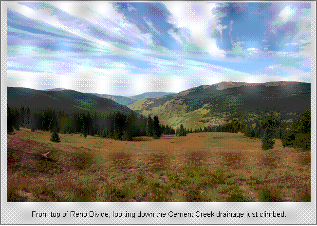
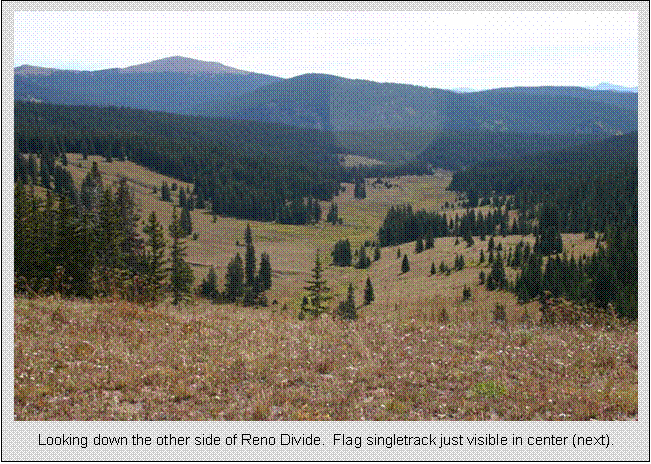
Crested
Tuesday, Sept 20,
Epic Ride #2, Reno/Flag/Bear/Deadman loop
20.4 miles
2:48 hours
3500 feet total climbing
Another big ride day planned. Ate a similar breakfast as day before,
packed, and checked out. I’d be leaving
straight from this ride back to
The ride begins on
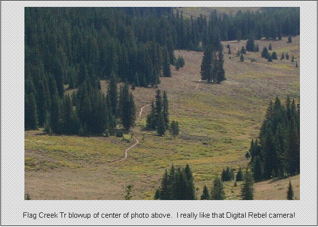
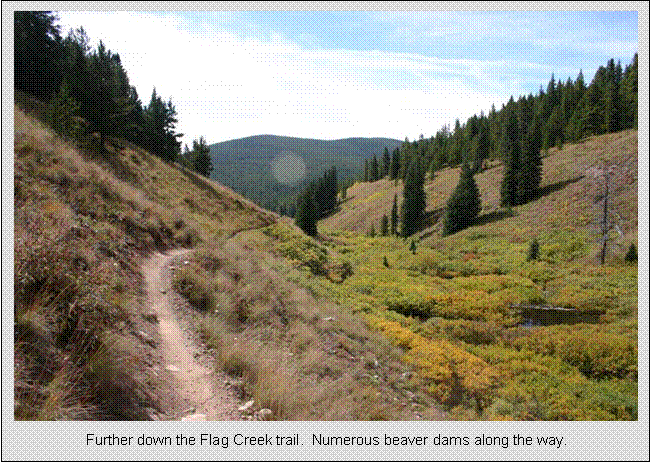
From the top of Reno Divide, Flag Creek Trail is taken for a wonderful descent. Very little brakes needed, fast, but a bit sandy in spots. It follows the Flag Creek gulch for a long time. This whole area is open to dirt bikes, but I saw none while I rode. The only people I saw for the three hour ride were a couple guys on quads that came up and over Reno Divide. I had the feeling of being “way out there” on this ride, as there was no road at the bottom to take you back if you got into trouble.
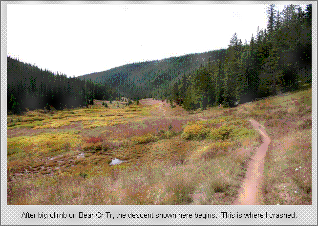
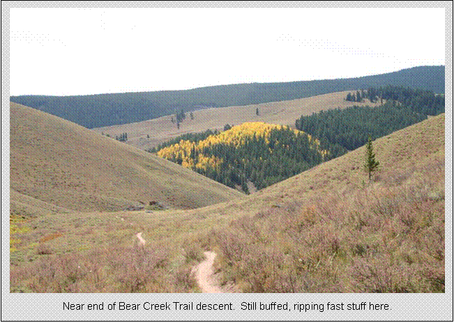
At the bottom of Flag Creek Trail, the Bear Creek Trail is taken. This begins the next big climb, gaining over 800 feet in a few miles. There were some wicked steep patches in this trail, forcing me off my bike with worn-out legs at one point. At the top, Bear Creek Trail begins the most fun descent of the ride. Starts out in an open gulch, then dives into the trees taking tight lines benchcut along the stream with many steepish drops. It was on the initial Bear Creek descent that I had my only crash of the trip. I was too busy gawking at the scenery and hit the outside lip of the trail. The trail was well worn into the grade, leaving it sunken a bit. I was going too fast to recover, so I ejected, but too fast to run also. I took a bit of slide in the brush, getting some brush rash on my leg. No biggie, at least the Canon Digital Rebel was alright. Bear Creek Trail goes on a long time, and the whole time I kept thinking this ain’t good, I’m going to have to climb all the way back up out of here since I was descending on the back side of ridgeline from car. The Bear Creek Trail eventually pops back out into the open, and soon the junction with Deadman’s Gulch Trail is reach.
A pattern is beginning to emerge on this ride. Monster climb up to ridgeline is followed by
long, flowing descent down gulch. I had
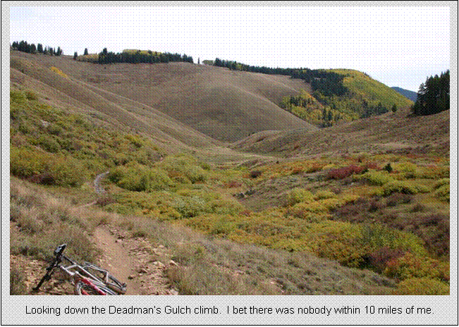
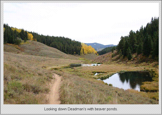
just completed second big descent, so now third big climb was due. The climb up Deadman’s
Gulch was perhaps the most scenic and felt the most remote. The stream in the bottom was dammed up every
hundred meters or so by beavers, so it was a string of small ponds as far down
you could see. Intermittent patches of
aspen or evergreens added color. Mostly just open with great views up and down the gulch. After another climb that seemed to take too
long, the top of Deadman’s is reached, almost as high
as the initial climb up
Crested
When I checked out of the Old Town Inn, I inquired about quickest
way to
Evergreen
Wednesday, Sept 21,
short ride at Elk Meadow Park
10.6 miles
1:41 hours
2140 feet total climbing
This was another “bonus” ride. If the weather held up, me legs held up, I
got out early enough, etc, I could squeeze a quick ride in before checking out
of the hotel and heading to the airport.
I ate one of my better breakfasts, including two large waffles and a
large bowl of raisin bran at 7am. I was
at the trailhead 5 miles away by 7:30.
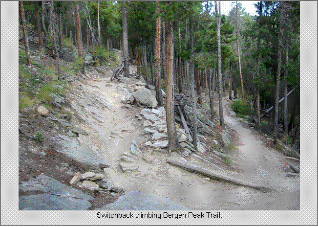
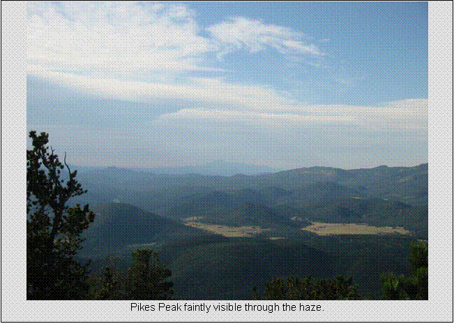
The park is small and has a nice 10 mile loop that crests
the summit of
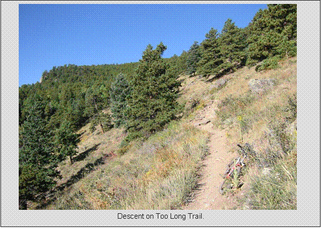
Once on Bergen Peak Trail, the climbing gets serious. This was a very rocky and ledgy
place to ride. For those who have
climbed paved Mt Ascutney in
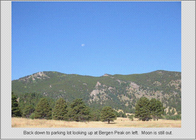
Upon getting back to the car, I quickly broke down the bike for shipment back via FedEx to my house. Had plenty of time to get back to hotel, grab a bit more breakfast, shower, and check out before 11am.
Trip Summary
This has been my most enjoyable cycling trip to date. The key word here is “cycling.” This wasn’t a few days added to a business
trip or vacation with family. Cathy was
away a few days with her mom, so that left me on my own for a few days of guilt
free cycling utopia. I could not have
wished for better weather. I experienced
zero rain the duration of my stay, and most days were brilliantly sunny. The first rain drops I saw were boarding the
plane to go home when a giant dust storm kicked up at the
All photos by Doug Jansen
unless indicated otherwise. Permission
to use any photos by author is granted.
Trip summary was compiled on
September 26, 2005.
Last edited 11/26/05