|
Desert Classic Ride in Phoenix, 22-MAR-07
From Western-most Trailhead
16.0 miles
1:38 riding time (approx. 1.7 hrs total time)
500 feet climbing
We had almost cancelled this trip. All the forecasts were pointing toward cold
temps and thunderstorms for 3 of the 5 days.
We decided to go anyway, packing full New England
winter riding gear. En route to Phoenix, the pilot said
rain moving in at 4pm. We thought
great, as we could get 2-3hr ride in before heading south to Tucson.
It was not raining on arrival, but storm cells were scattered all over
the area. It took forever to pick up
rental car. They bus you half way
across the city to centralized rental system.
That is somehow more efficient.
Despite flight being on-time, we were almost an hour behind “schedule”
picking bikes up at Landis Cyclery. They recommended we not ride at McDowell Mtn Park as planned, as the area is prone
to flash flooding. They said lightning
was much less to worry about this time of year, so South Mtn
Park was better bet
(higher, but more exposed). But as we
unpacked bikes, Mother Nature unleashed a fury of torrential rain and
lightning on us. It move out soon
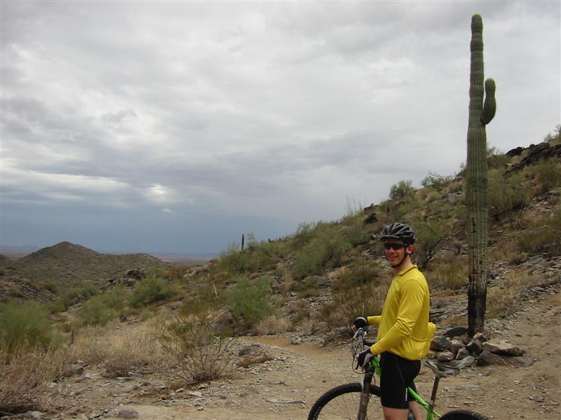
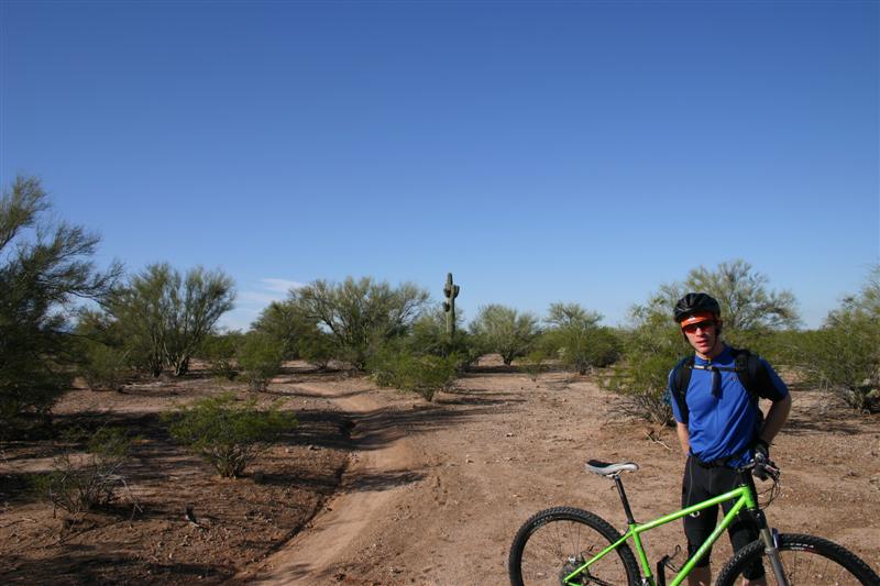
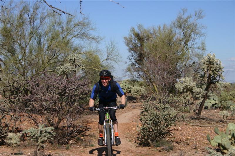
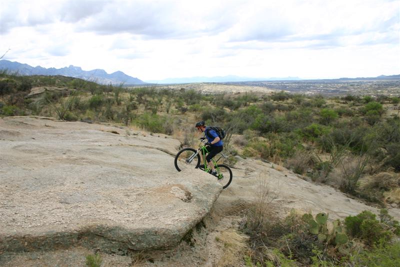
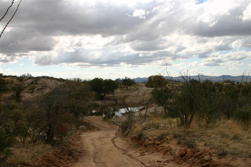
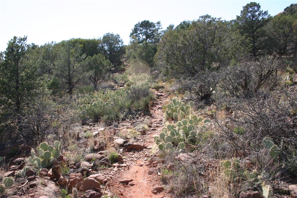
enough, but now there was standing water everywhere. No mud, just wet. We headed out on Desert Classic trail in
hopes of getting back before next cell moved in. We didn’t make it. No lightning, but persistent cold rain
drenched us. Not a good way to start
trip. Forecast for next two days
looked even worse with 60% chance of thunderstorms and snow at higher elevations
for Friday’s hillclimb. Bikes were
trashed already, and we were not in good moods. We got in only 1.6hrs out of 3 planned
hours of riding before heading to Tucson. It stormed whole drive to Tucson after this ride.
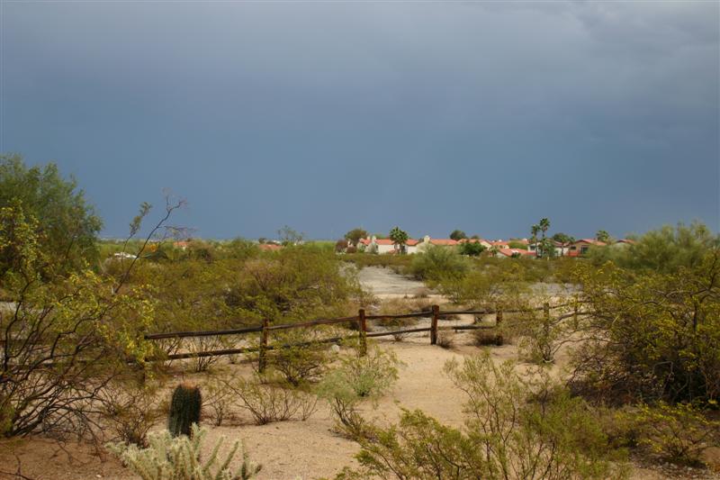
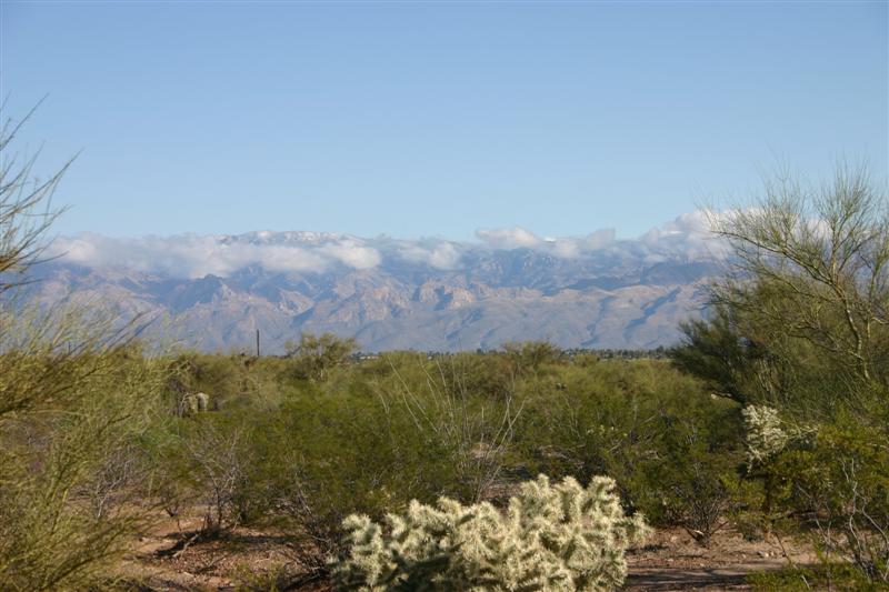
The skies just after bruising
thunderstorm moved through. Everything
was wet, but runs off quickly.
Dave on Desert Classic trail with new
rain cell in distance quickly moving in.
Mt Lemmon Hillclimb, 23-MAR-07
From Tucson
- South Side
80.9 miles
5:12 riding time (approx. 7.5 hrs total time)
8000 feet climbing
2500-8500 feet elevation range
Forecast was bleak, but hole
opened up in the clouds by 9am. It had
rained all night. We decided to
abandon our planned capstone ride of the trip, the “Squeeze the Lemmon” ride. This loops from Tucson
through Oracle, then up back side of Mt Lemmon on dirt and back down on
pavement to Tucson. This would have been over 100 miles and
7-8hrs riding time with the additional climbing. There is nothing back there, so to get
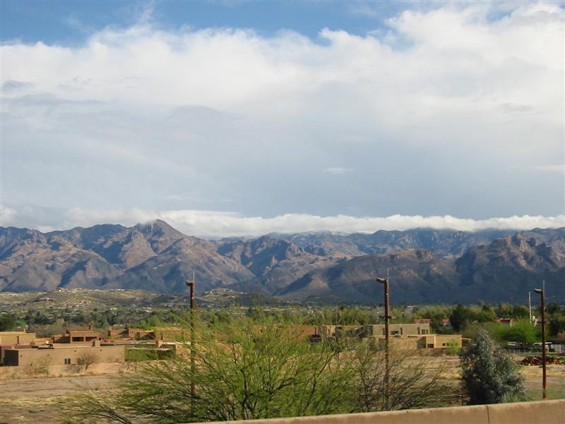
caught in thunderstorm was frightening at least. So we opted for an all-paved climb up the Catalina Highway
to summit of Mt Lemmon instead. From
our vantage point in the city, we could already see the mountain tops were
snow-capped. We weren’t sure how far
we’d make it, but with everything else wet and rain moving through during the
day, we really had no other riding options.
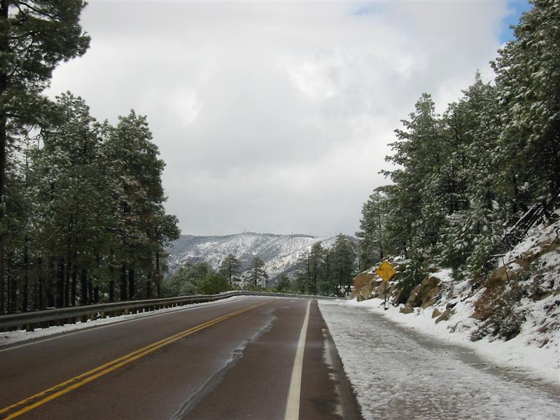
We set off in complete New England
winter riding gear: AmFib tights, neoprene booties,
“lobstah” mitts, balaclava, and three layers up
top. With the sun out beginning the
climb, we had to shed some layers. The
roads were still wet though.
The climb went well, having
reasonably fresh legs. The 1.6” slicks
rolled almost as well as Michelin Pro 2 Race tires. We stayed dry until reaching the snow line
where snow melt made the road wet and messy.
It was plowed. I reached Summerhaven before Dave and took the right to Ski Valley
at the summit. This was not setup the
way we expected and Dave did not take the turn. But after climbing several hundred feet of
steep vertical, the road was closed and unplowed beyond the ski area. This meant the last several hundred feet to
the summit was not going to happen this trip. It was utterly unrideable. I turned around and bombed back down to
town, which was being rebuilt after the fire a couple years ago. I read only two out of over three hundred
buildings and homes survived.
Arson. The Mt Lemmon Café with
world famous pie was closed. I was not
happy about that. Bike uphill for 40
miles and no pie in the sky? We had to
make do with snacks from the general store, which was open.
We kitted up with every bit of
clothing we brought up with us. Just
after beginning descent, the dark clouds gathering around the summit blasted
out a thunderclap. We boogied. There’s an initial descent from the
village, but then a long 500ft climb before beginning the real descent. As we began the real descent, it started to
snow. It snowed pretty hard and it was
icy stuff. Hurt like crazy in the face
at 40mph. We encountered several other
riders coming up during our descent, including two guys who didn’t have much
layers with them when it started to snow.
It looked like another guy we saw come up on our initial descent
hitched a ride back down. We quickly
got out from under the snow however, and the rest of the descent was dry and
pure bliss. We could hardly believe we
pedaled up all that, 20 miles of nearly monotonic descent at 40mph. The summit area stayed socked in with dark
clouds for much of the rest of the day.
As we came back into Tucson
(where Dave caught me off-guard and took the town-line), it started to rain
again. At least it was warm now, and
with all our winter crap on we were over heating. We didn’t want to stop to shed layers, so
I’m sure we looked like freaks riding through about 10 miles of Tucson in full winter
gear when many people were in short sleeves.
They had no idea.
I have now done all the great
climbs in southern Arizona, including Mt
Graham, Mt Hopkins, Kit
Peak, and Mt
Lemmon. That evening we had dinner
with Chris from Raytheon at the Contessa Italian
Café in Oro
Valley. Dinner is served buffet style, all you can
eat. Perfect after a five hour
hillclimb ride.
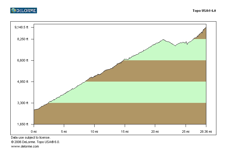
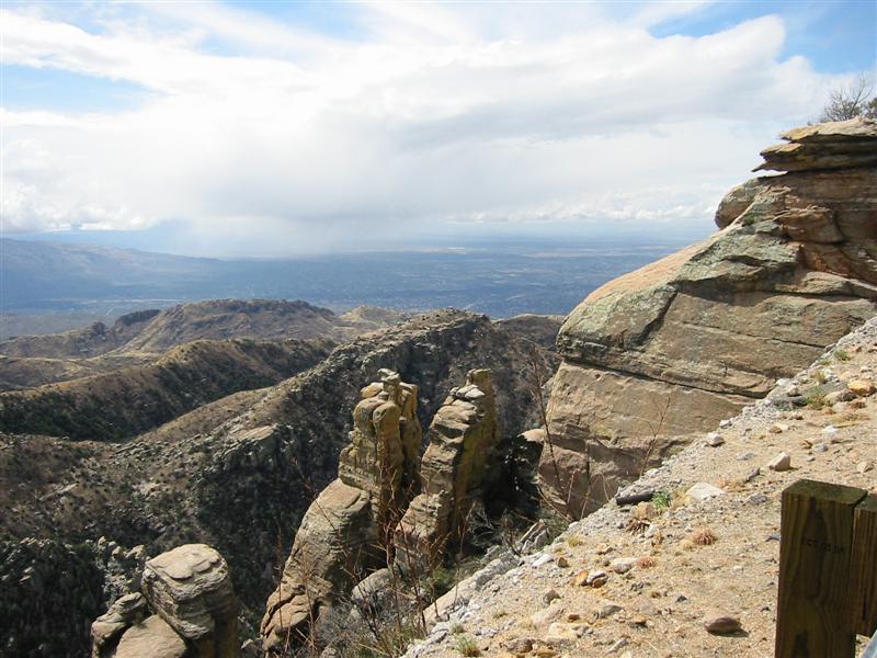
Mt Lemmon Profile from edge of Tucson. Summerhaven sits
at 25 mile mark, ski area at 27 miles.
Mt Lemmon shrouded in clouds, hints of
snow just visible at cloud line.

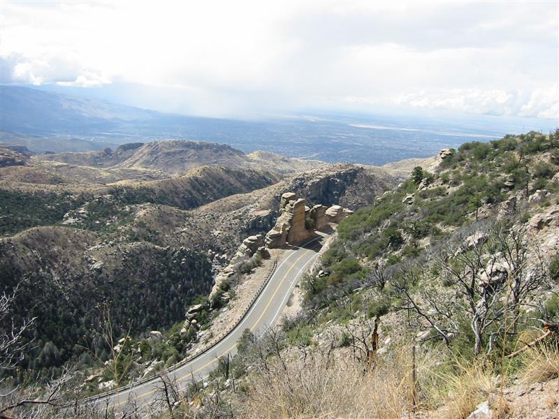
Lower portion of Catalina Highway with Tucson in distance
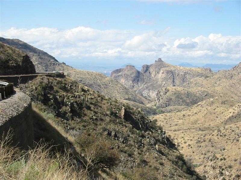
Catalina
Highway
benchcut into mountains
Interesting rock formations with rain
cell just south of Tucson
Rocks we’ll pass by shortly on climb
Dave climbing with a “Share the Road”
sign on right
Curve below, city in distance, and rain moving
into the city
Snow approaching 8000 foot level
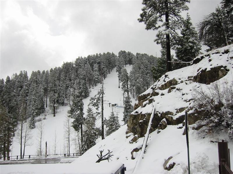
Ski Valley
ski area, a bunny hill by New England
standards. About 6” new snow here.
The reason the summit was not going to happen this trip.
Completely unrideable
with skinny slicks. About 2 miles to summit from here.
Fantasy Island and
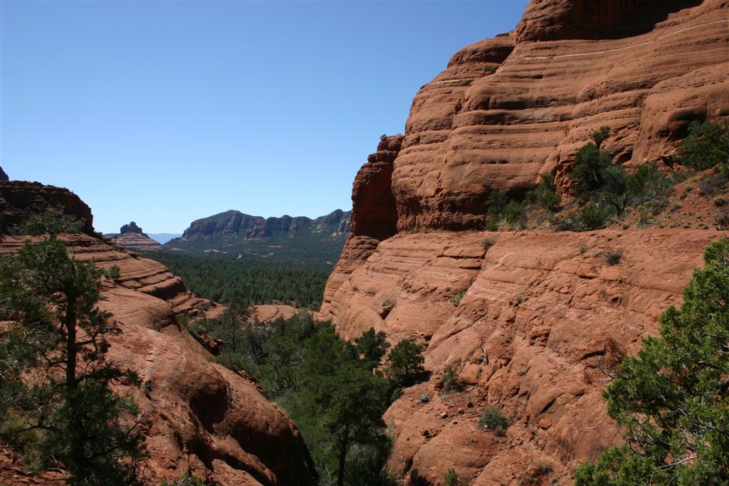
50-Year/Charouleau Gap, 24-MAR-07
Tucson Area
16.8/28.5 miles
1:27/3:25 riding time (approx. 6.3 hrs total time)
3500 feet climbing
2700-4200 feet elevation range
Finally the weather was
looking positive. The low pressure
system that was spinning Pacific moisture up from the south had moved
north. Last of rain moved out early
Saturday morning. Our only time
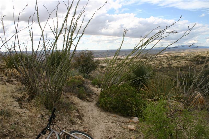
constraint was to ride Fantasy
Island first, then get
stuff and check out. The parking at Fantasy Island looks a little sketchy, so we
didn’t want to leave all our gear in car while riding.
The trails were mostly dry,
really nearly perfect with that just right amount of tackiness. Just a couple of wet patches on the Valencia
loop. We rode all the loops there at
pretty fast speed, enough to scare myself most of the time. The whole place is a playground of sorts
with drops into washes, table-tops, a half-pipe, and other fun features. I had ridden these trails on two prior
visits, but never the Valencia
loop.
After checking out, we headed
over the Catalina
State Park for the main
feature of the day, the 50-Year/Charouleau Gap loop. We decided to park in the state park and pay
the fee with all our gear in the car. It’s
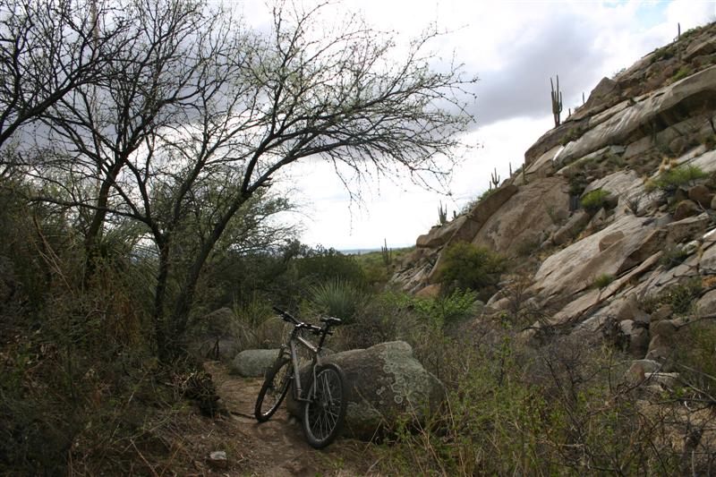
safe there. This starts off on the
southern terminus of the 50-Year trail, a several mile portion I’ve never
ridden. I’ve ridden parts of 50-Year on each of my three prior visits to Tucson. It is that good. But this time we were going to ride beyond
“The Chutes” and pick up Charouleau Gap Road, a 4WD
road over the gap. Char Gap is very
steep. Few riders can clear the whole
thing. Our legs were cooked by this
point, so we got off bikes a couple times during the climb.
When we reached the turn-off
for Cherry Tank and the singletrack trail back down, we decided to skip the
out and back to the gap itself. This
would have entailed hundreds of additional feet climbing, and daylight could
become an issue. Arizona does not do daylight savings
time. So we continued to climb instead
to Cherry Tank (anything that holds water in the desert is called a tank,
including natural ponds).
After reaching the tank,
singletrack back down would finish the ride.
I had GPS with me, and this was going to be the first time I used one
to actually navigate by. I plotted a
track file from Google satellite imagery and other map info posted by
mountain bikers. You see, this area is
open range land. Cow trails went
everywhere, and the singletrack we started to follow kept forking. This route may in fact have been created by
cows in the first place. No matter. It was wicked skinny, steep in spots,
barely squeezing through all sorts of prickly traps, and scenic. It entered a narrow, deep wash which made
things interesting. We got off track a
couple times, and with GPS, we quickly made corrections. Would have been nice to have handlebar
mount.
We finally meet back up with
50-Year trail and now could relax the rest of the way back, except there were
about two miles of baby head rocks and two moderate climbs. Both of us had major saddle sores going on
by this point, partly due to riding in rain on Thursday, then putting in so
many miles on bikes we hadn’t ridden all winter. None-the-less, it was a great day of
riding.
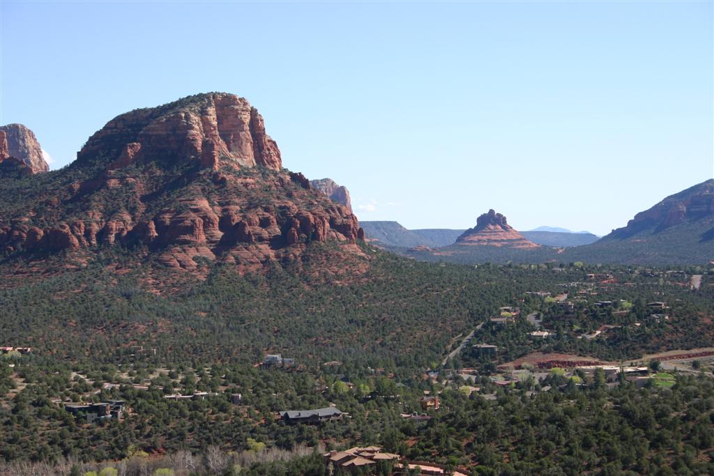
Snow capped Mt Lemmon from Fantasy Island
Dave at Fantasy Island
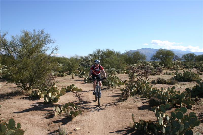
Doug riding through prickly pear patch
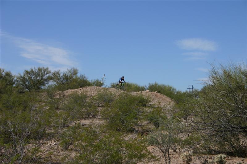
Dave cresting one of the table-top jumps
Many of the thorny desert traps are
represented in this photo
Road to Charouleau
Gap in distance
Dave in Canada
Del Oro Wash
A steep slickrock
area
And yes, Dave cleaned it
Another challenging pitch coming up Charouleau Gap Rd
An off-camber slickrock
wall to climb
Near turn-off to Cherry Tank. Oro Valley
in background.
Cherry Tank. It was natural pond, but it looks like
heavy equipment recently
dredged and reinforced it to hold more water.
Beginning of singletrack descent. Very narrow, steep, and thorny. The skinny
stalk-like plants are covered in razor sharp thorns
that shred anything brushing by.
Farther down descent in narrow rocky
wash.
Wrapping up ride on 50-Year Trail. Note there is still snow at tops of Santa Catalina’s
in background.
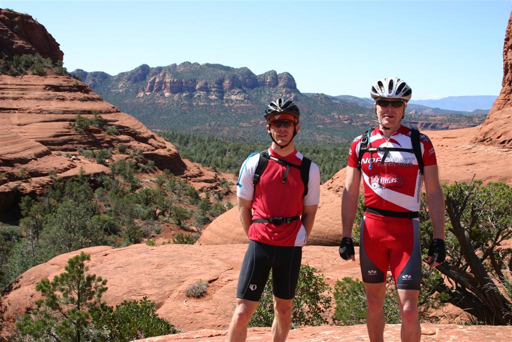
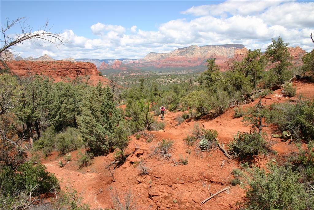
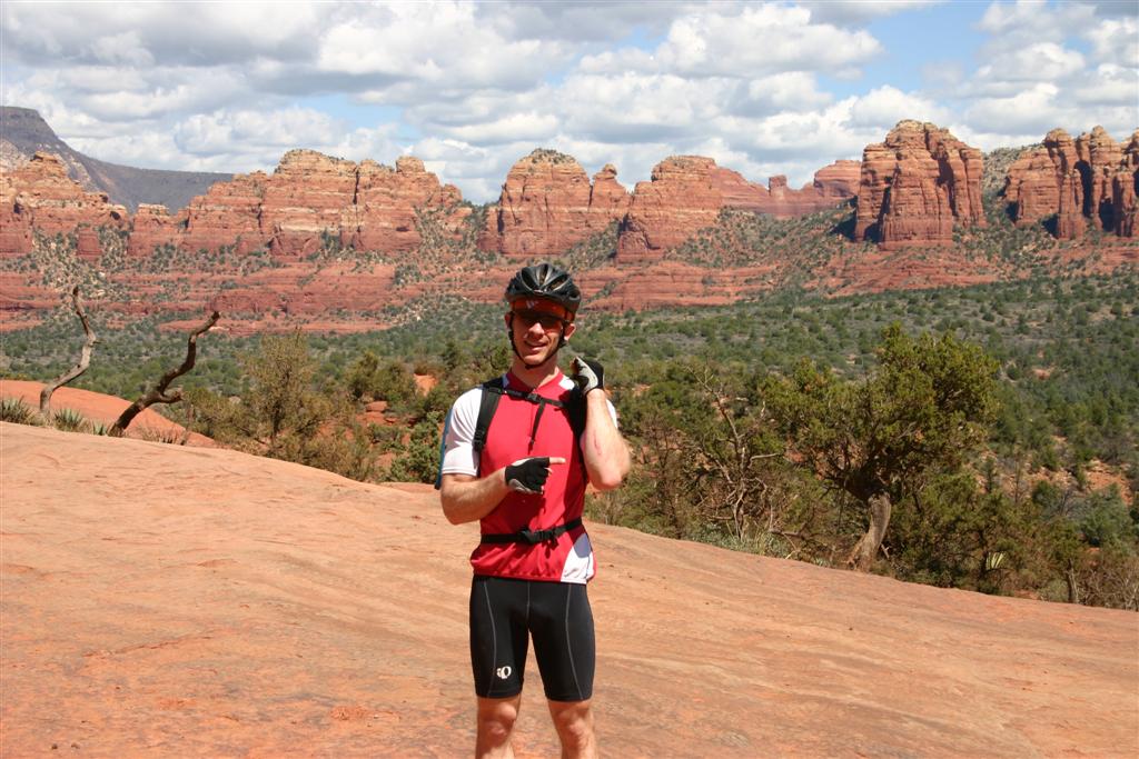
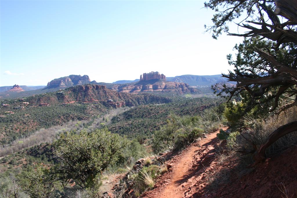
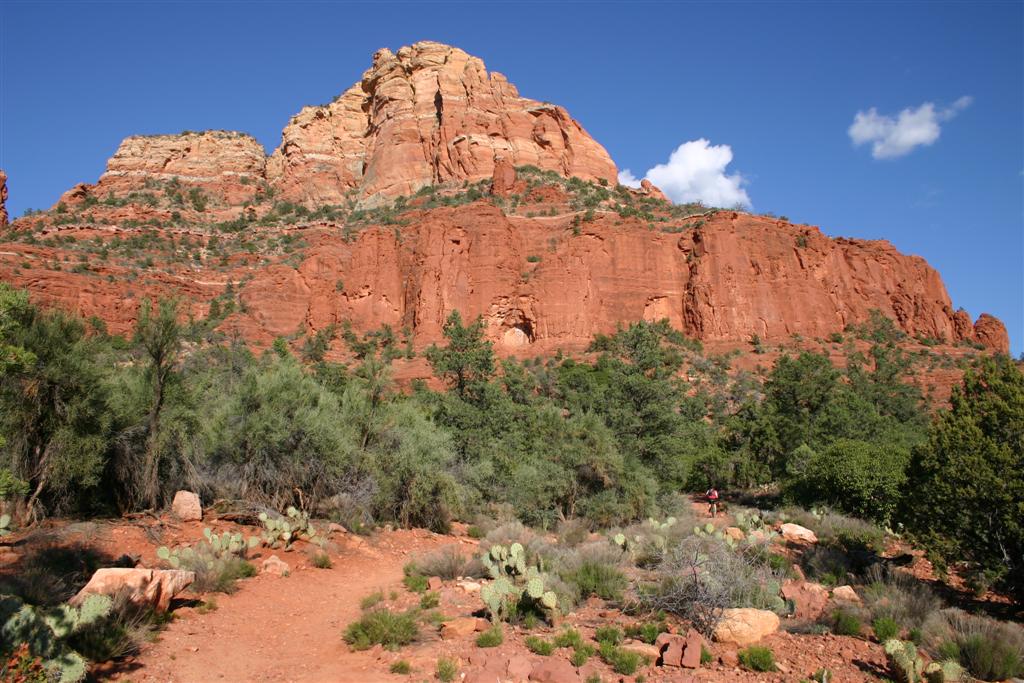
Sedona Trails, 25-MAR-07
Sedona
40.5 miles
5:12 riding time (approx. 7.5 hrs total time)
5000 feet climbing
4000-6000 feet elevation range
The forecast for what turned out
to be the epic ride of the trip was perfect: sunny in the 70’s. We drove up to Camp
Verde from Tucson
the night before, so we only had short drive to reach the village of Oak Creek
where we began our ride. The Comfort
Inn in Camp Verde was the cleanest, best
breakfast, nicest place we stayed. It
was also fairly cheap. Plan was to
ride as much of Sedona area trails as we could in one day. The system is vast, we could not possible
ride all of even the good stuff. I
believe we hit much of the best stuff though.
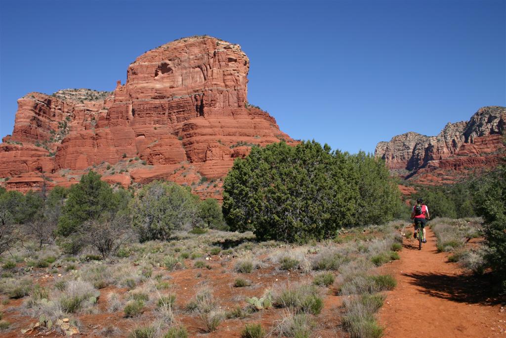
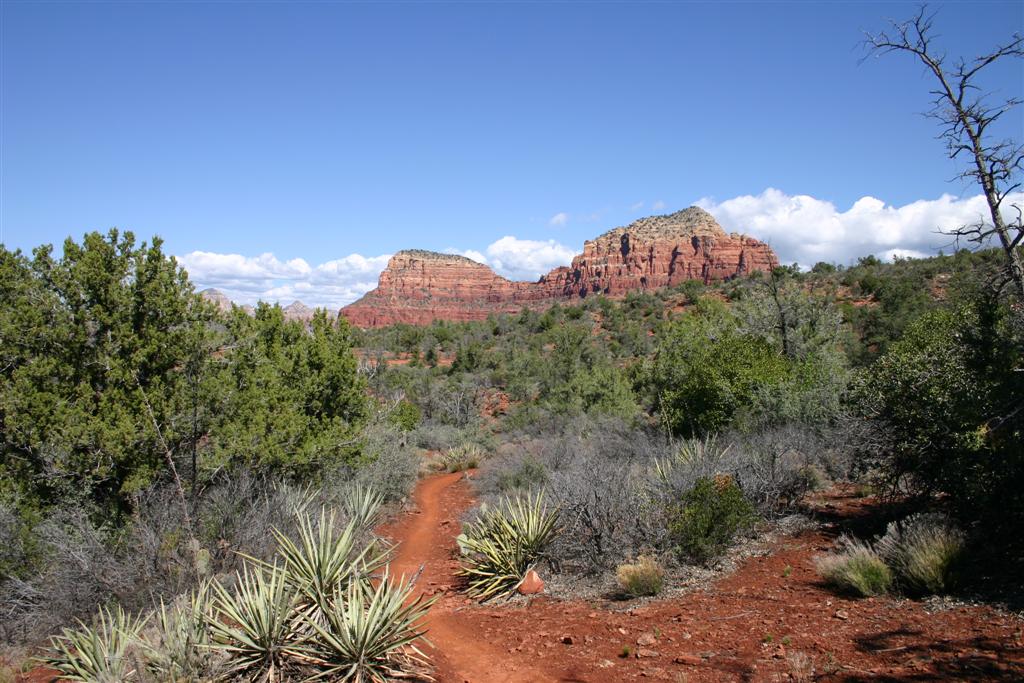
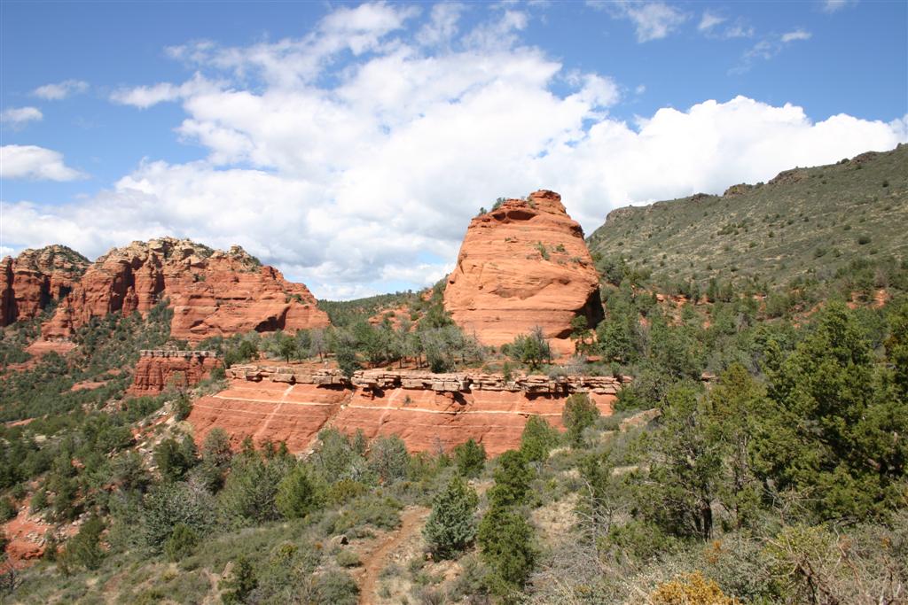
We started with the Big Park
loop at the bases of Bell Rock and Courthouse Butte. Then we wrapped around to pick up Llama
Trail, across on Little Horse, then the famed Broken Arrow Tail. Broken
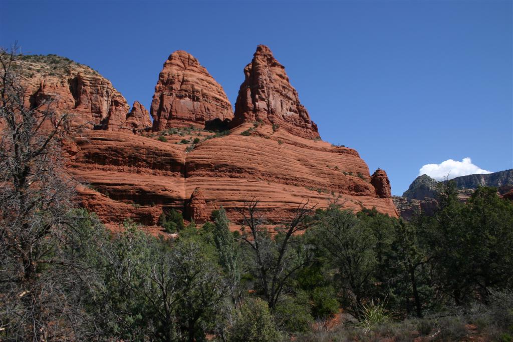
Arrow was nice, offering fantastic scenery, technical
challenges, slickrock riding, and lots of tourists
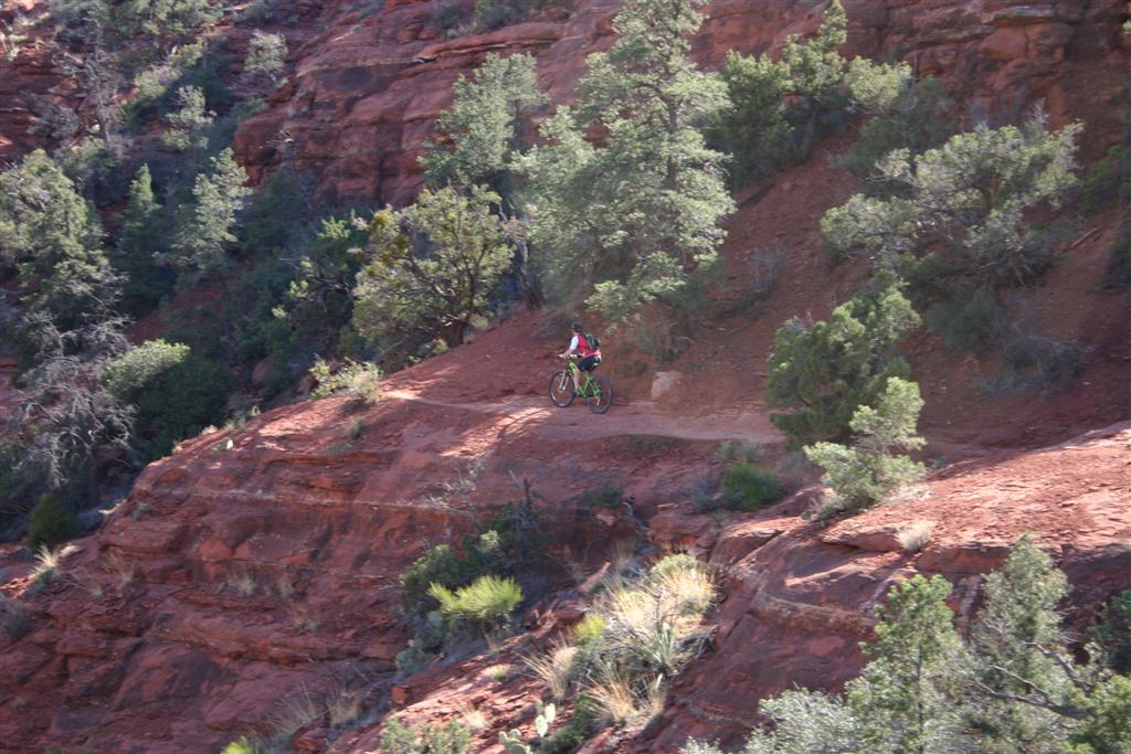
since Jeeps can cart them in and out of this area. Dave took a header on initial descent from
Chicken Point, scuffing up his arm.
We had to cut off Broken Arrow where it ran into wilderness area and take
road to next major riding spot, Bear
Wallow Canyon. We stopped at the Circle K to refuel along
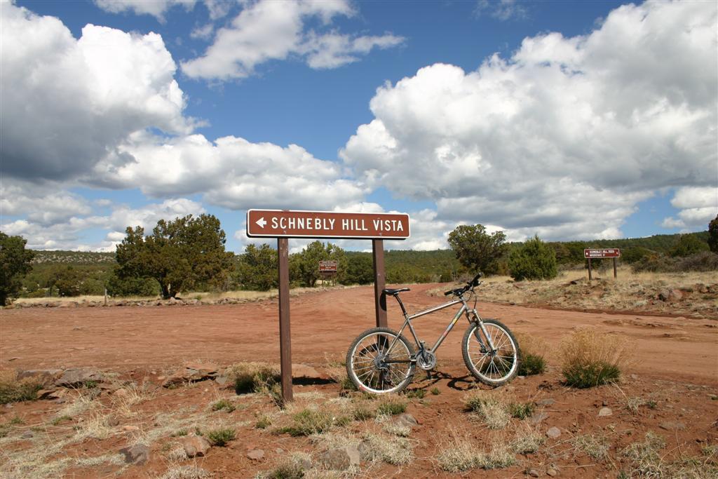
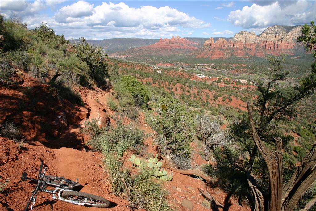
the way. We rode up rocky Schnebly Hill Road
to the vista point, a ledge overlooking Sedona at 6000ft. There were great views all the way up
actually. The climb from Rt 179 was about 1800ft, pretty near monotonic. Just down from the top, we picked up Munds
Wagon trail for the descent. This was
a wild, rock strewn, butt behind saddle blast
down. Several dismounts were required.
Upon reaching the junction
with Huckaby Trail, we made a decision to scrap
riding the northern Sedona stuff since the ride had already taken so much
time. Jim Thompson and other trails
will have to wait until another visit.
We decided to loop back to Oak
Creek via Brewer and Airport Loop trails. This turned out to be a big mistake. Our legs were in no shape for the climbing
that ensued, and the Airport Loop turned into a monster hike-a-bike in the
direction we went. But there was some
tantalizing ledge riding along the way.
When we got to what looked like the top of the mesa the airport sits
on, we could not tell where the trail went.
It look like it just dead-ended, leading me to believe we were in fact
on Table Top. Maybe, but we could not
find any other trail junctions on the way there. It was getting late and we were tired, so
we abandoned planned route, hiked back down to Overlook Point just off Airport Road,
then took road back down into Sedona.
We took mix of roads and
trails from Sedona back to Oak Creek. This included the easy Mystic and Bell Rock
Pathway trails. Unfortunately, this
meant we missed the Templeton Trail past Cathedral Rock. This too will have to wait until another
visit. So basically, we rode almost
everything east of Rt 179. Two other large areas close to town remain
to be explored, the area just north of Sedona nestled against the Red Rock
Wilderness, and the area south of Sedona by the airport and Cathedral
Rock. There are many other trails
further out too. Overall, riding in
Sedona easily ranks in my top ten. I
will definitely go back when I can stay there several days to explore many
more trails.
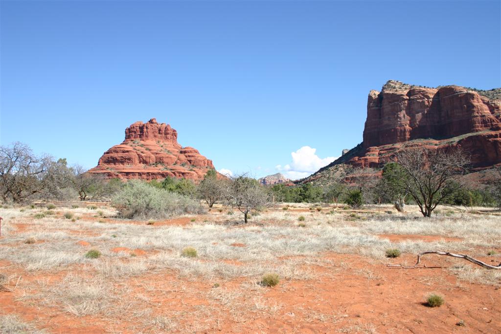
Bell Rock with Courthouse Butte on right
Courthouse Butte
Heading northerly on Llama Trail
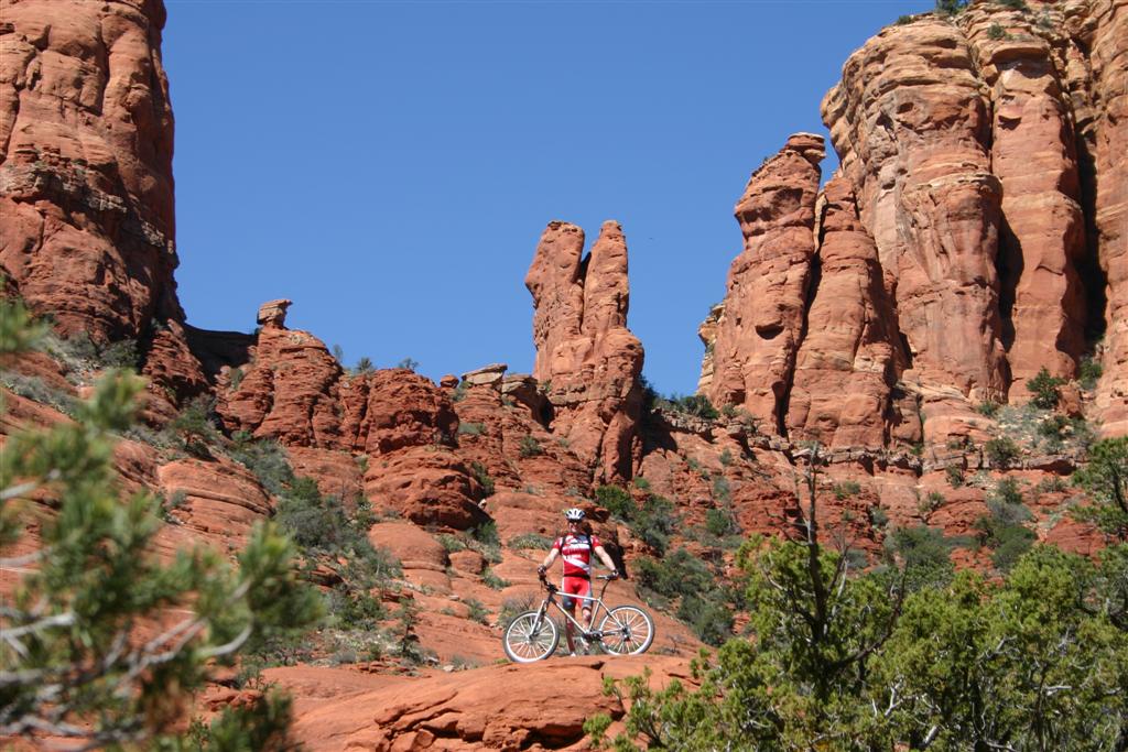
Doug at Chicken Point on Broken Arrow
Trail
Dave and Doug on Chicken Point
Deep gorge at Chicken Point
Descending Broken Arrow Trail
Dave a little further down Broken Arrow after
going over the bars. Lots of red slickrock to ride on here.
The “Merry Go Round” on Schenbly Hill Road. You can walk around this in a spiral until
reaching the top. Bad
idea in steel cleated
cycling shoes. The Munds Wagon
singletrack is visible just below the merry go round. We take
this back down after reaching the ridge line.
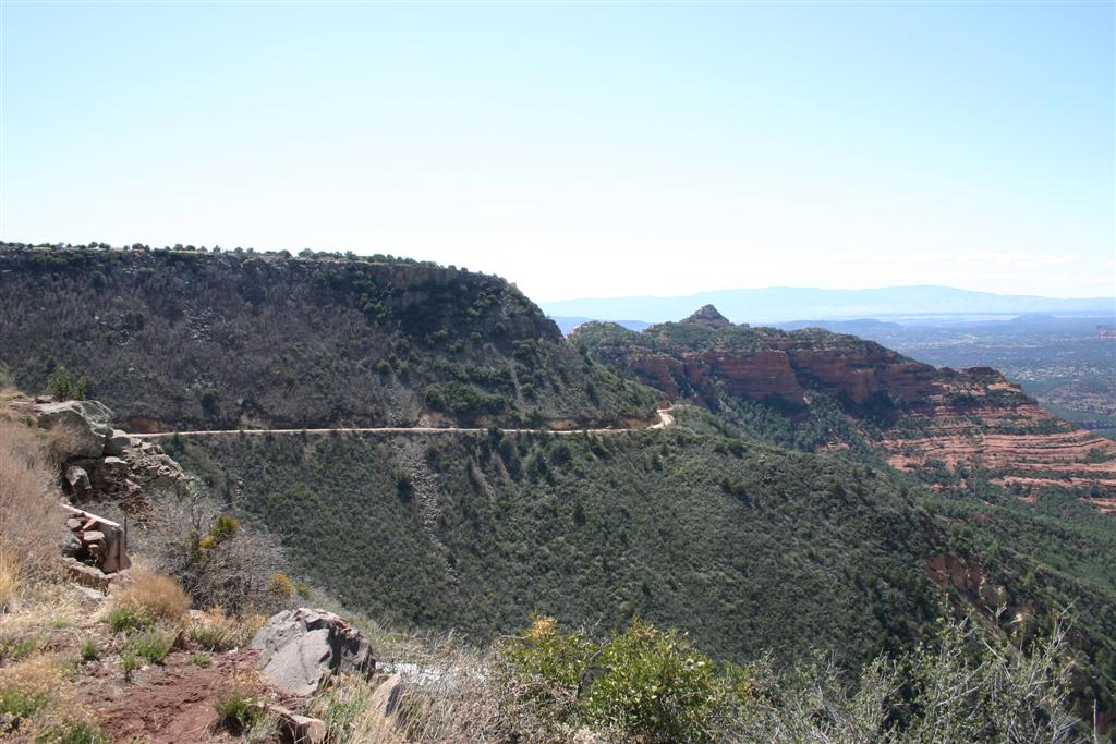
From top of Schnebly Hill Road,
which climbs nearly 2000ft out of the Sedona/Oak Creak
valley.
The vegetation up here was noticeably
different. Just a tad cooler too, at
6000ft.
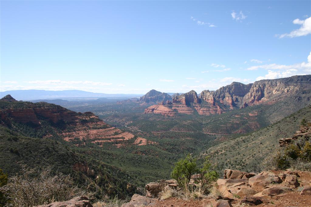
View from Schnebly Hill overlook. Sedona is in distant
background center left of image.
Climb up Brewer Trail to the airport mesa
was wicked steep, full of loose rocks, and you could not afford
to fall anywhere unless you wanted to go to
hospital for thorn extraction. Dave
did topple over along this
segment, but fortunately he did not directly
fall on any cacti.
Bell Rock from Brewer Trail looking over
Sedona We are parked a couple miles
beyond Bell Rock,
and the day was getting late.
Dave on initial part of Airport Loop trail. You
don’t look down in spots like this.
Airport Loop
trail looking northeast towards Schenbly Hill
ridgeline in far distance. With sun
getting low
in sky, west facing rocks are brilliantly
illuminated.
From Airport Loop
trail looking south. Bell Rock on far
left, Cathedral Rock in center of image.
Dave finishing up ride on Mystic
Trail. I think this is part of Twin
Buttes here.
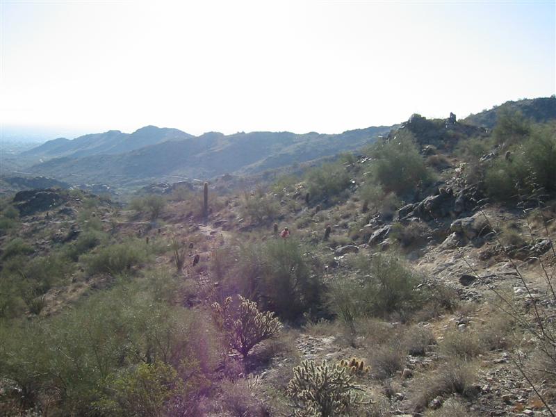
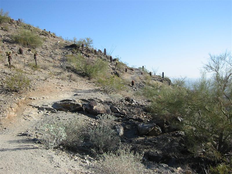
National Trail/Desert Classic,
26-MAR-07
Phoenix
34.8 miles
5:28 riding time (approx. 7 hrs total time)
6430 feet climbing
8860-11,420 feet elevation range
The drive back to Phoenix was supposed to be 1.5hrs, but traffic in Tucson and Phoenix
sucks. Sunday night, bumper to bumper
for miles at a time. Why?? We hit
traffic like this all weekend. It’s
worse during the week. The Sonic
malted shake did hit the spot though, holding us over for more food later in Phoenix. When we checked in to Ramada Inn, the place
had no water! Just a dribble came
out. I was irate and called the desk
for another room. Manager said a pipe
broke for whole hotel, and water would be back on shortly. The place overall was a dump for over $100
per night. Water eventually came on.
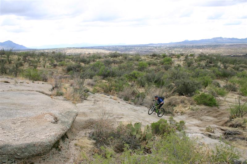
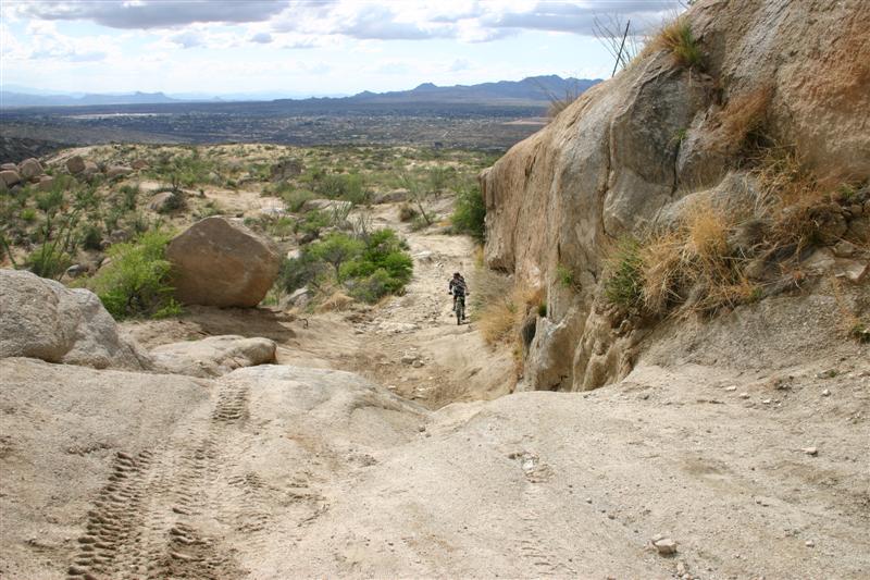
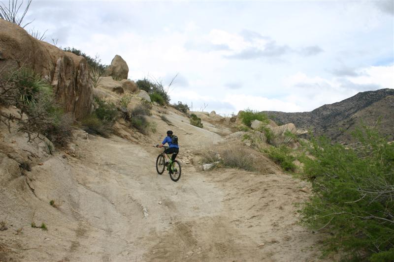
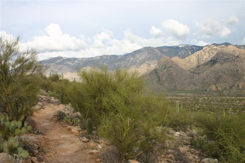
Plan was to ride the
National/Classic loop just two miles away in South Mountain
Park, where we did
first ride of trip, before checking out.
We drove there to avoid mingling with rush hour traffic. Our legs were too cooked to ride the trials
type terrain of the National Trail up on mountain ridgeline. We came back down from National and biked an out-and-back on Desert Classic Trail
instead. This was mostly buff, much
flatter terrain that could be ridden very fast. Classic gradually climbs from
trailhead. We rode out until we had
just enough time to get back, shower, pack bikes, and check out at 11am. On way back on Desert Classic, I lit it up,
hammering big ring all the way back, often at speeds around 25mph. Came close to sliding out around corners
many times. Was wicked fun, and it’s the
way that trail is meant to be ridden.
The bike pack, checkout, bike
drop-off, and rental car return all went smoothly. We even had time to get another Sonic
malted shake (only 950 calories)! The
direct flight back to Boston
was even slightly ahead of schedule.
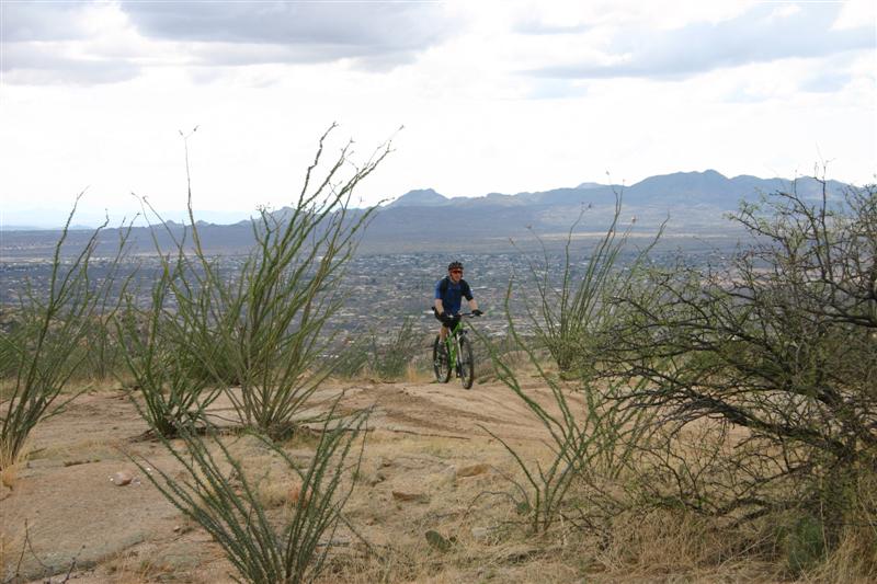
Looking southeast into sun with Dave
coming up National Trail
Looking up one of the rare easy patches
of National Trail
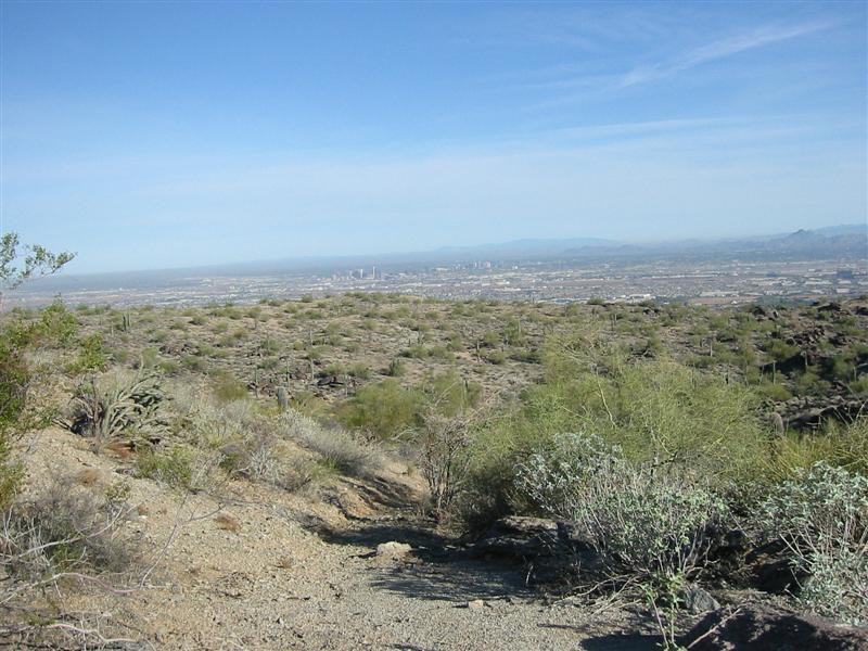
Phoenix from ridgeline of National Trail
Summary
Having come close to canceling
this trip due to abysmal forecast, it turned out quite well. We got poured on the first day and cut
short by factor of two the riding I hoped to do. We never made it to the McDowell Mountain
Park where we planned
to ride Thursday. We did not get to do
the planned Squeeze-the-Lemmon epic either, but still got 75% of the planned
riding in that day anyway. Saturday
went almost as planed, riding all of the Fantasy Island
trails and riding a variant of the planned 50-Year/Charouleau Gap loop. Riding in Sedona on Sunday exceeded my expectations,
both in scenery and riding fun factor.
We didn’t nearly cover all of the trails on my wish list, but I knew
that would be the case. We stopped a
little more often on this ride and some of the terrain was extremely
technical. Sedona was thoroughly
satisfying however, easily making the trip worth while in itself. The last day didn’t quite go to plan
either, but this was not a bad thing.
We were so wiped out from getting in great rides the prior three
days. We played it safe to not be
rushed wrapping up another great cycling trip.
Report
compiled on 29-MAR-2007 by Doug Jansen.
Permission
to use any image is granted.
|
